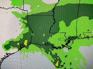
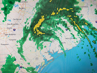
It's better for us the farther west & north Beta's center goes, but right now it has come to a halt. So let's go over what I feel has kept most of the rain away from us so far.
We continue to be in lower dew points, but the tropical feel is just hovering along our coast. Hurricane teddy's circulation has forced a cold front way down through Florida and you can see the cold air clouds over the Atlantic and eastern Gulf. Once Teddy head farther to the north, that will allow the blocking high to drift off the east coast resulting in Beta finally making the move to the NE later today and tonight. This surge of dry air around Beta has reduced the rain forecast for us even further. Now most of SE LA/MS is only 1-2".
Some suburbs south of Houston have received over a foot of rain. the question for us is what to do with the glob south of our coast?
We remain under a Flood Watch just because of the slight possibility this could head over us. RIGHT NOW, it is staying offshore.


1 comment:
Well ... post your name then.
Post a Comment