
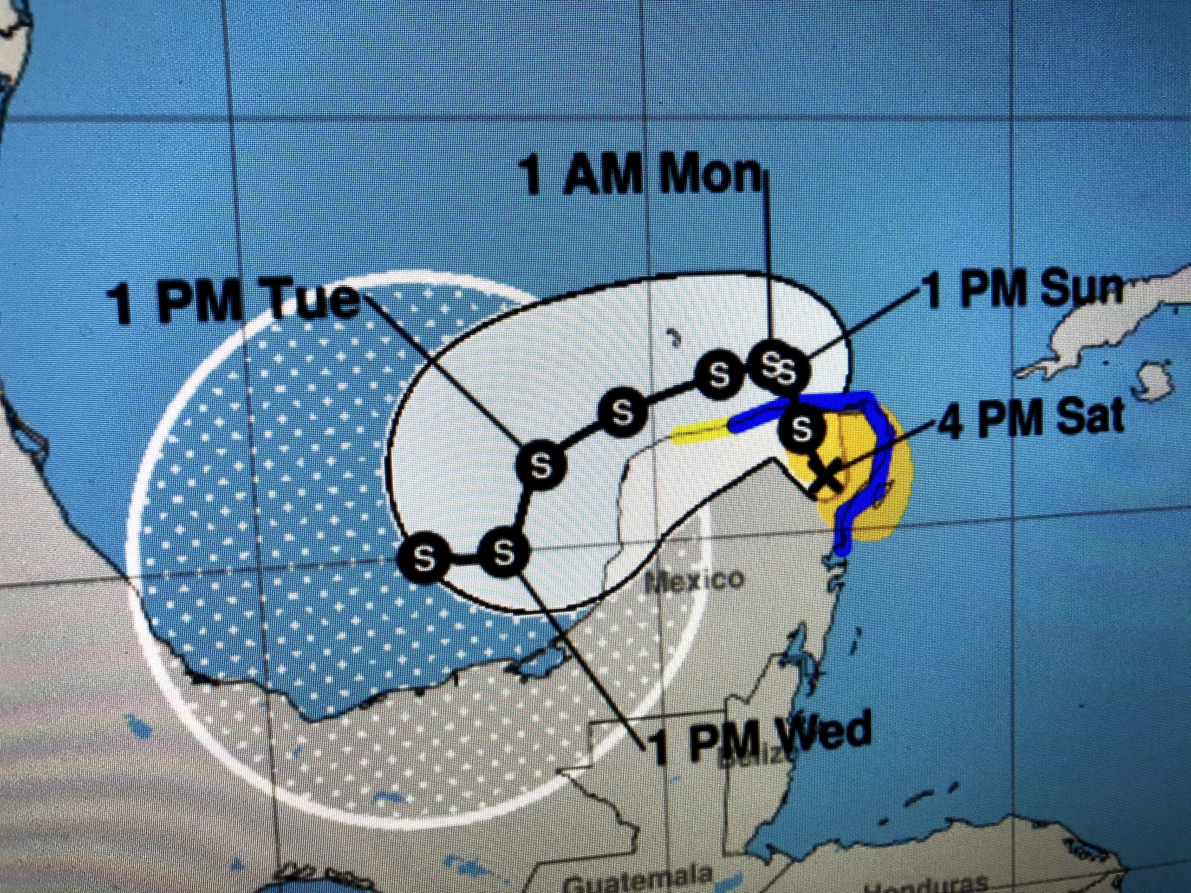


We will have many days to follow 92L (Delta?). IF we were still in mid September before Laura & Sally & 3 cold fronts have cooled the northern Gulf., then I'd really be nervous. But hurricanes REQUIRE warm water for their fuel. They have that right now, but the Gulf is much different than 2 weeks ago.


We still have the large surface high bringing us dry, cooler weather with yet another front coming for late Sunday night. Don't get overly excited by computer models spewing out intensity forecasts when we don't even have a surface rotation yet. I'll update a couple of times this weekend, but let's get out and enjoy this great taste of Fall! Stay tuned!

No comments:
Post a Comment