


As you can see, it is chill north of a retreating warm front with a real snow storm happening over the upper Midwest.


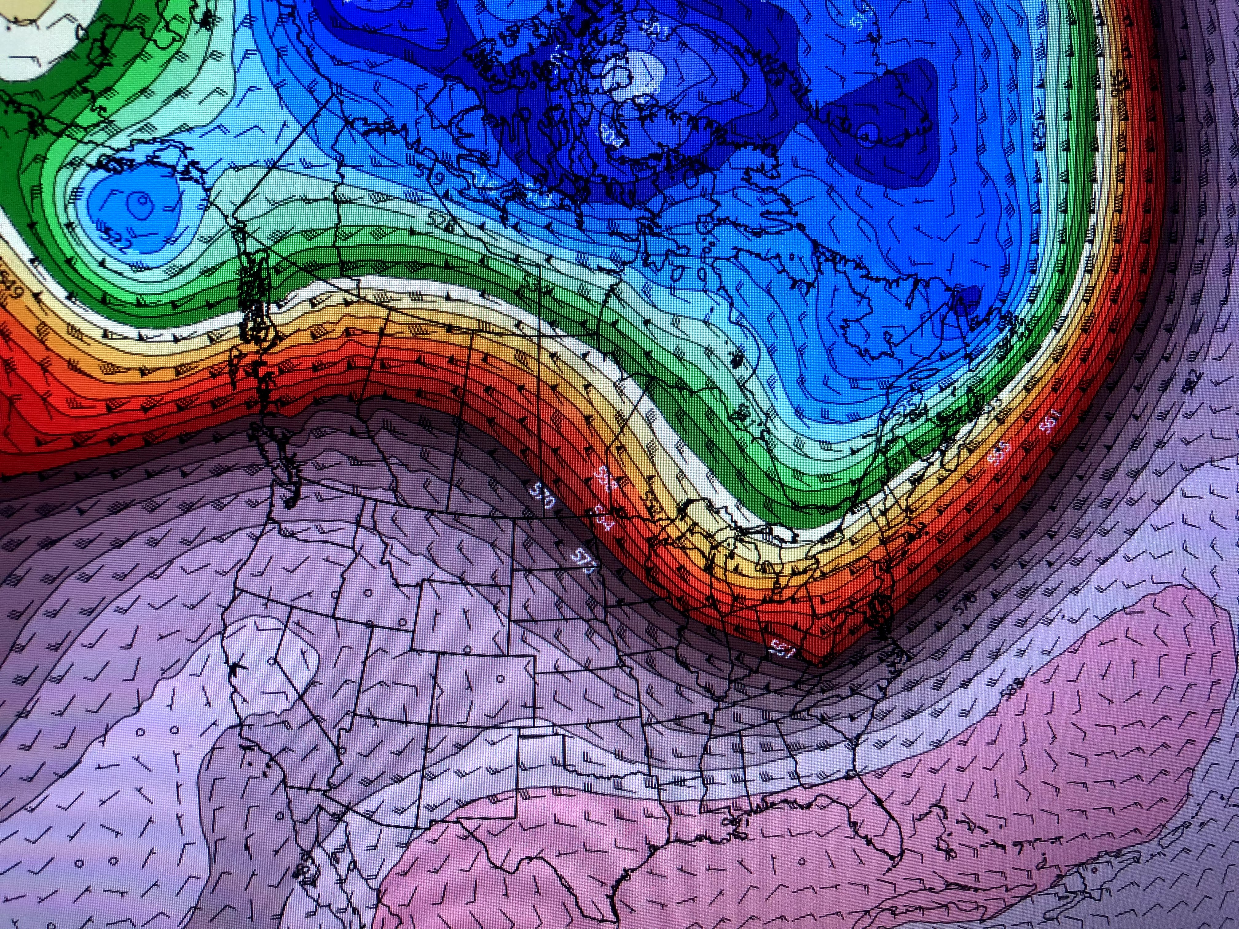
The top graphic is the upper level winds currently with the middle pic being for this Friday morning. Notice the upper dip shifts more over the Rockies for this weekend not allowing the cold air to head towards us. the bottom graphic is for NEXT Friday, 10 days away that does have a "slight" dip over the Great Lakes. That's certainly not a deep East Coast trough that will bring back sweaters and jackets. So get use to the warmth as it looks to linger.


NHC is still following Epsilon, expected to become a hurricane as it turns east of Bermuda. The other area over the western Caribbean now has a ZERO chance to develop due to strong upper westerly wind shear. 

There is a broad low level circulation, but all of the T-Storms are blow off to the east. So while the rains and snow covers the upper Lakes into the NE, the West continues hot and dry.


There is a broad low level circulation, but all of the T-Storms are blow off to the east. So while the rains and snow covers the upper Lakes into the NE, the West continues hot and dry.


No comments:
Post a Comment