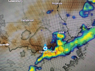
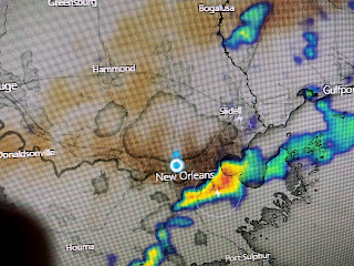
That kind of intensity will overwhelm the pumps and widespread street flooding followed.This was the view of the empty lot across the street from me. The main energy with this front is way north of us as the water vapor shows.
In fact, this line of storms was NOT the front which will stall out right over us. That should result in some dense fog of tomorrow morning. Several upper disturbances will trigger more rounds of rain mainly Friday through Sunday. Hopefully we'll not see the kind of intensity we saw today.


2 comments:
Happy Thanksgiving to everyone!
👍👍👍👍
Post a Comment