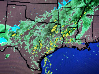
The set up is not quite ideal, but there is a lot of upper energy/vorticity racing out of a deep west coast trough. The top graphic is the SPC predictio with the next 4 maps being the upper air flow. The 1st upper map as this morning's flow with the next one being valid for 6 PM Thursday. Note the bright yellow spot over South Texas. That is the 1st upper low kicking out that will result in a split flow over us. That split will create strong lifting of the air across us and all of the Gulf South. I expect SPC will be issuing many Tornado Watches so keep up on the weather tomorrow afternoon and evening. The next Graphic is valid for 6 pm Friday with that upper low over Illinois with another, weaker one coming near El Paso. Finally the bottom graphic is valid for 6 PM Saturday with the axis of the upper trough now to our east.
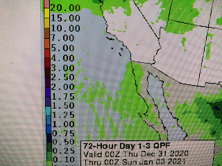
There will be a threat for some heavy rainfall (1-2"), but according to the Weather Prediction Center, the heaviest rains will be to our west and east during the next 3 days.
The airmass behind this next front is seasonally cold, but it is not a bitterly cold Arctic blast. Although Ch. 4 out of Denver had a story saying South Park (south of Breckenridge) reported minus 50 degrees this morning! Obviously that is a location high up in the Rockies.
Dew points have returned to 60+ and that indicates low level moisture is increasing. Let's tell our family and friends about the POTENTIAL for some strong to severe storms here tomorrow. I see 2 waves coming with the first around 2 PM and the second around 8 PM. The good news is our weekend will turn sunny, cooler and drier as we begin 2021. Stay tuned!


3 comments:
Thank you and Happy New Year. I have a great grandson eta Jan. 11. Hoping he stays put.
Thank you!
Bob, I always view your blog. It gives perspective to the talking heads on tv.
Post a Comment