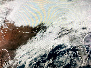
The top graphic is the radar view with the blue colors depicting snow. The middle view is the current surface map with a weak cold front approaching us from the west. As the upper support for the northern snowstorm tracks to the East coast tomorrow, there will not be enough push to get this weak cold front through us. It's likely to stall out and wait for a stronger front coming by midday on Wednesday.
You can see we are in the warm air sector with very high dew points approaching 70. As showers break out during daytime heating, we have seen several cells have lots of lightning with them. Most of this activity should stay north of Lake P, until later tonight with the South Shore seeing less activity.
The tricky forecast issue is how much shower activity lingers along the frontal boundary tomorrow? One thing for sure is we'll stay with lots of clouds for the next 2 days before colder & drier air brings back the sun for Thursday and Friday.
That storm along the West coast is giving them much needed rainfall. We'll see several periods of rain here over night through early Wednesday, but no excessive amount are expected. The other issue will be dense fog.
Current wind speeds would help limit the dense fog, but winds should decrease later tonight and tomorrow morning could be another slow drive into work. Allow extra drive time. Since it's warmer this week, I'm heading out tomorrow with Captain Hylton to see if the trout have returned to Shell Beach. My next post will be on Wednesday. Stay tuned!


No comments:
Post a Comment