What keeps Arctic air cold is extensive snow cover. Without it, the warming of the ground with the higher February sun angle usually prevents the core of the cold from reaching us.
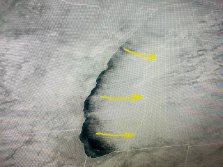
Satellite views confirm the extent of the snow cover (see the river outlines), but it doesn't extend over the southern states. There will be several "Alberta Clipper" type snows streak down over the Plains and Ohio Valley during the next 10-14 days, and that could bring the snow cover farther to the south.
What is really needed to bring the chill into the Deep South is a sharp East Coast upper trough. The top graphic is today's upper flow which has brought the chill into the U.S. The middle graphic is valid for Sunday with the bottom view valid next Saturday morning. Just based on the upper flow, you can see the current Arctic blast stalling well to our north with some warming coming for most of next week. However, that botom graphic does have a rather sharp dip in the flow over the Great Lakes and that might be enough to bring us a freeze threat NEXT weekend? On FOX 8 at noon, Zack Fradella showed computer models predicting mid to upper 20s on the South Shore for NEXT weekend.
You can see this weekend's cooldown with the warm up coming Monday through Wednesday. There's a lot that could change for next weekend, so those of you holding some snow cards, don't fold your hand just yet. Let's focus on the short term.
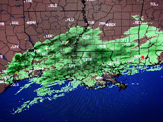
Satellite views have extensive clouds covering much of the South with a cold rain shield forming ahead of a wave moving off the Texas coast.
That wave could bring us a quarter to a half inch + rainfall before ending early on Saturday. Clouds should begin to leave us Saturday afternoon and sunshine might warm us back to near 60. Sunday looks Sunny and nice with the real warm up arriving on Monday.
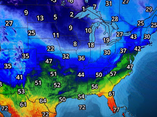
You can really see where it's been raining as temperatures are in the 40s. This is one of those afternoons where you want to light the fireplace, get a good book & a blanket and cuddle up.
Finally, since only 11% of the Great Lakes have ice cover, this Arctic Blast should make for tremendous snowfall amounts in the feet during the next 3-5 days. Sometimes I feel guilty knowing we'll be back in the 70s next week. Nah, really enjoyed playing golf yesterday afternoon in my Bermuda shorts! I was born in the North and had my snow fun in my youth. Now I'm just trying to keep my old bones warm! This might be one of those "glass of brandy afternoons" ? Stay tuned!


No comments:
Post a Comment