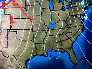
The top graphic is the European model's snow cover valid for 2 weeks from today. Humm...that southern band certainly gets very close to us. The middle graphic is today's upper flow with the big dip that brought the recent snow storm to the NE finally lifting out. The bottom is the upper flow valid 2 weeks from today. Notice the dip is broader and not as sharp. Unless that trough gets deeper, I'm thinking the real cold and snow stays farther north away from us. Plenty of time for things to change.
Temperatures in Alaska have reached 50-55 below zero with minus 35-40 common across Canada. This is the coldest this season so what we don't want to see is a deep East Coast trough developing that would drive that chill our way. Right now, that doesn't appear likely.
Higher cirrus clouds are flowing in from the NW while the return flow from the south over Texas is bringing back the lower clouds. Note the huge warm surge over west Texas ahead of our next front. It's warmer in Denver than here!
our next cold front doesn't arrive until Friday morning before stalling along our coast on Saturday. Tomorow will feel Spring-like as highs top 70 with reality returning for this weekend.
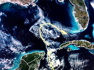
Finally, clouds cleared up north revealing their recent snow cover.(yellow line) Note how the iceless Great Lakes standout. Look what the cold air flowing down over the Gulf reveals.


1 comment:
I really hope it snows we can use some good ole southern snow. I hope it snows like back in December 11th 2008 and December 11th 2017. That was about of snow both times.
Post a Comment