Since our weather remains quiet, I'm starting out with where the action is. A strong upper disturbance is moving into California bring them much needed rain and snow, but the real action is expected to shift over the Rockies tomorrow and settle over the Front Range of Colorado for Friday & Saturday. Look at these totals from the GFS model.
It has Denver at 40 inches with Boulder 63" and Estes Park a whopping 67"! Hard to believe when you see the top current view in Denver showing sunny skies and 51 degrees. So what's going to happen to bring Winter back?
That upper low is predicted to move to the east and park itself over southern Colorado by Friday.
The top graphic is the model run from this morning showing the low just off the coast. The middle view is valid for Saturday evening while the bottom is valid for Monday evening. This system will slowly weaken as it moves out of the Rockies, but it will create an upslope situation that results in extreme snow totals. This same system will move far enough to our north to keep any severe threat away, but it could bring a cold front close to give us some rain for early next week.
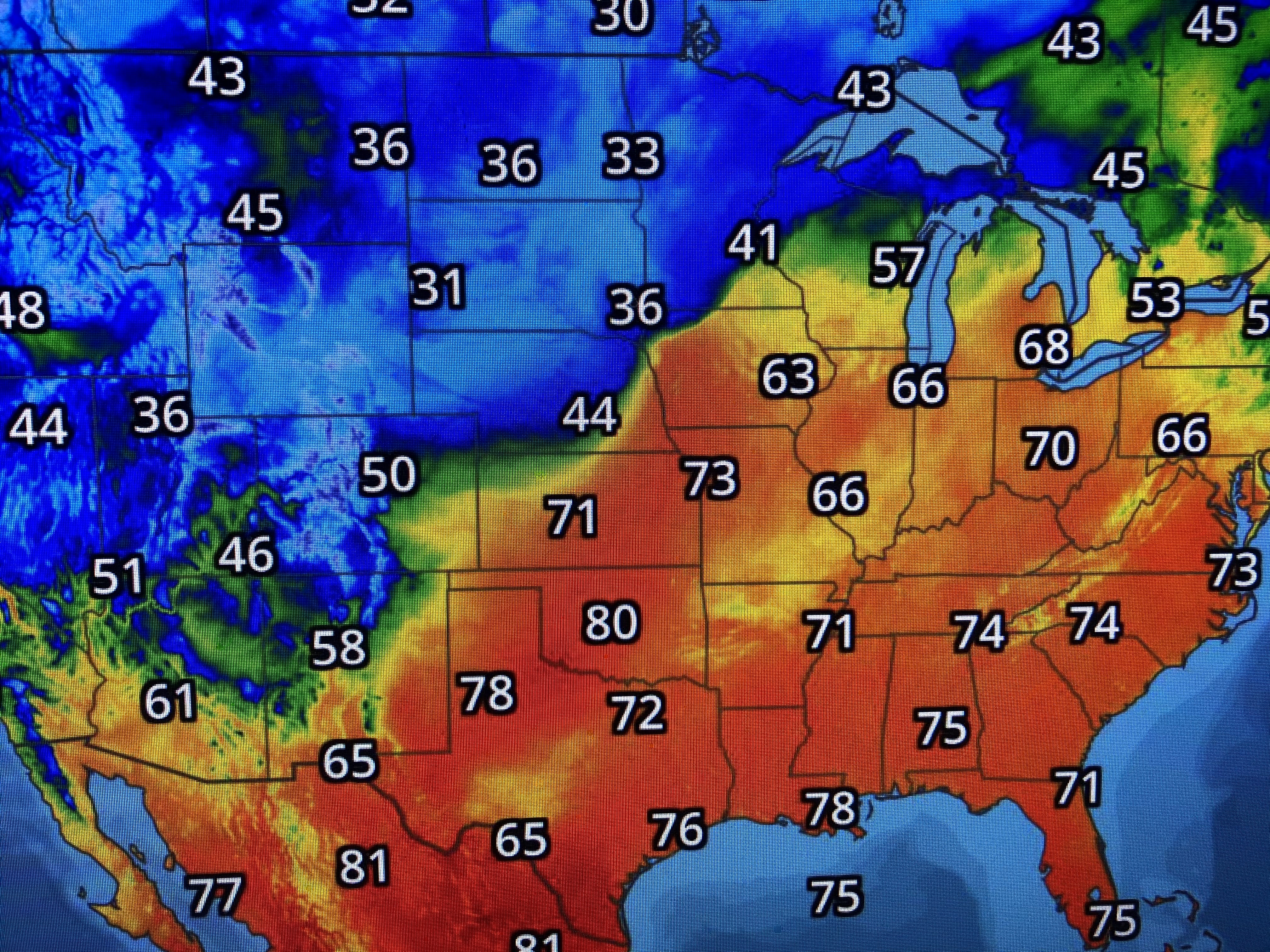
You can see the sharp temperature boundary setting up with heavy snow likely in the colder air and some severe storms firing off in the Spring like warmth.
Locally, the next 3-4 days will be warm (80+) and mostly dry. As long as the winds remain brisk, dense fog should not become widespread. It still looks likes cooler weather will return for next week. Finally, Weather Bell Analytics has issued their 1st 2021 Hurricane Outlook calling for 16-22 named storms (average is 12), with 9-13 becoming hurricanes and 3-6 of those being major. That's not surprising since we are still in a La Nina that typically enhances development due to the lack of upper wind shear. No reason to even think about that since it's only early March. Stay tuned!


No comments:
Post a Comment