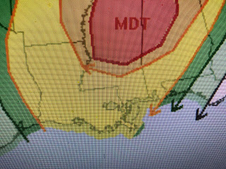
The MDT stands for moderate or level 4 out of 5 on the severe weather risk. The trigger for the next round of severe weather is another upper disturbance coming out of New Mexico.
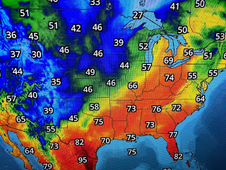
It isn't showing up on the surface map yet, but you can see where the Gulf moisture lingers across the southern states. The upper air flow for the past week has a trough positioned over the western states with a ridge over the East. Temperatures reflect that set up as the West is Chilly while the East is warm.
Until we see a shift in the upper air, it will be difficult to get a front through that would sweep away the rain & humidity. Tomorrow should be a mostly dry morning with the chance for a line of storms later in the day.
Friday may be somewhat drier, but I don't see the front pushing through to clear us out through the weekend. It will stay mild to warm so there is no threat for cooler weather anytime soon. Let's keep up on the severe threat for Thursday PM. FYI...my rain gage this morning recorded 6.23". We need time to dry out. Stay tuned!


No comments:
Post a Comment