


We drove back in heavy rains in Florida this morning, but once into Alabama, it was a dry track home. My rain gauge received 4.77" during the 4 days I was gone, and the small limbs & twigs that covered my yard & patio told me there were some storm winds too.


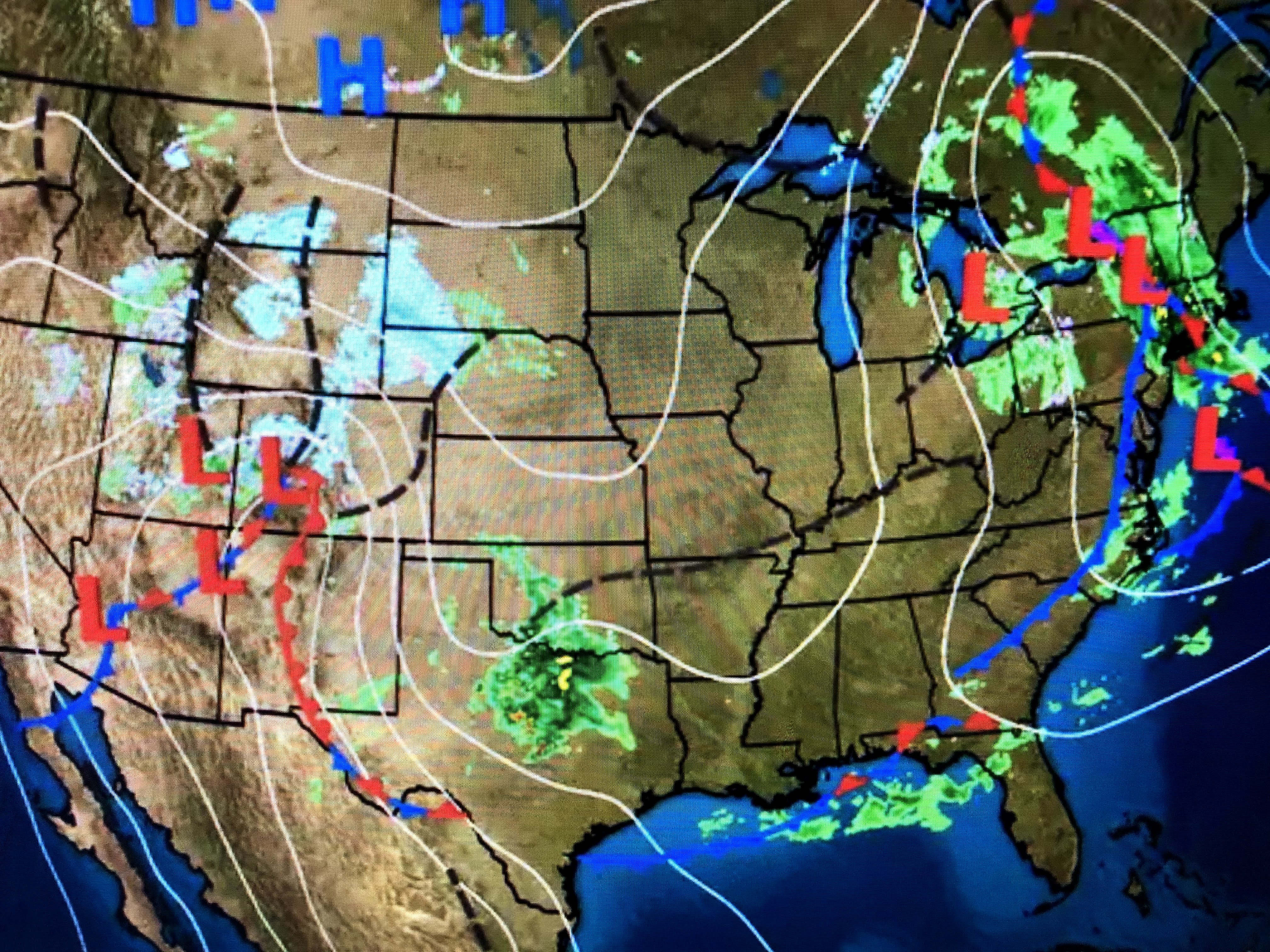
So what is happening that we keep getting storms day after day? Believe it or not, it's tied into the upper pattern along the West Coast that is keeping Seattle and Portland up into western Canada sunny & dry. There is a big large upper high with troughs aligned on both sides creating what is called an "Omega block", a pattern that usually is locked in for a week or more. I've tried to draw the upper flow over the satellite view. Note how clear it is along the west coast. Within the trough along the east side of the upper high we have a number of disturbances that trigger bad weather.


Until this pattern breaks down & moves, we're gonna see more rounds of storms at least through Saturday. A Flash Flood Watch has been extended into Saturday.


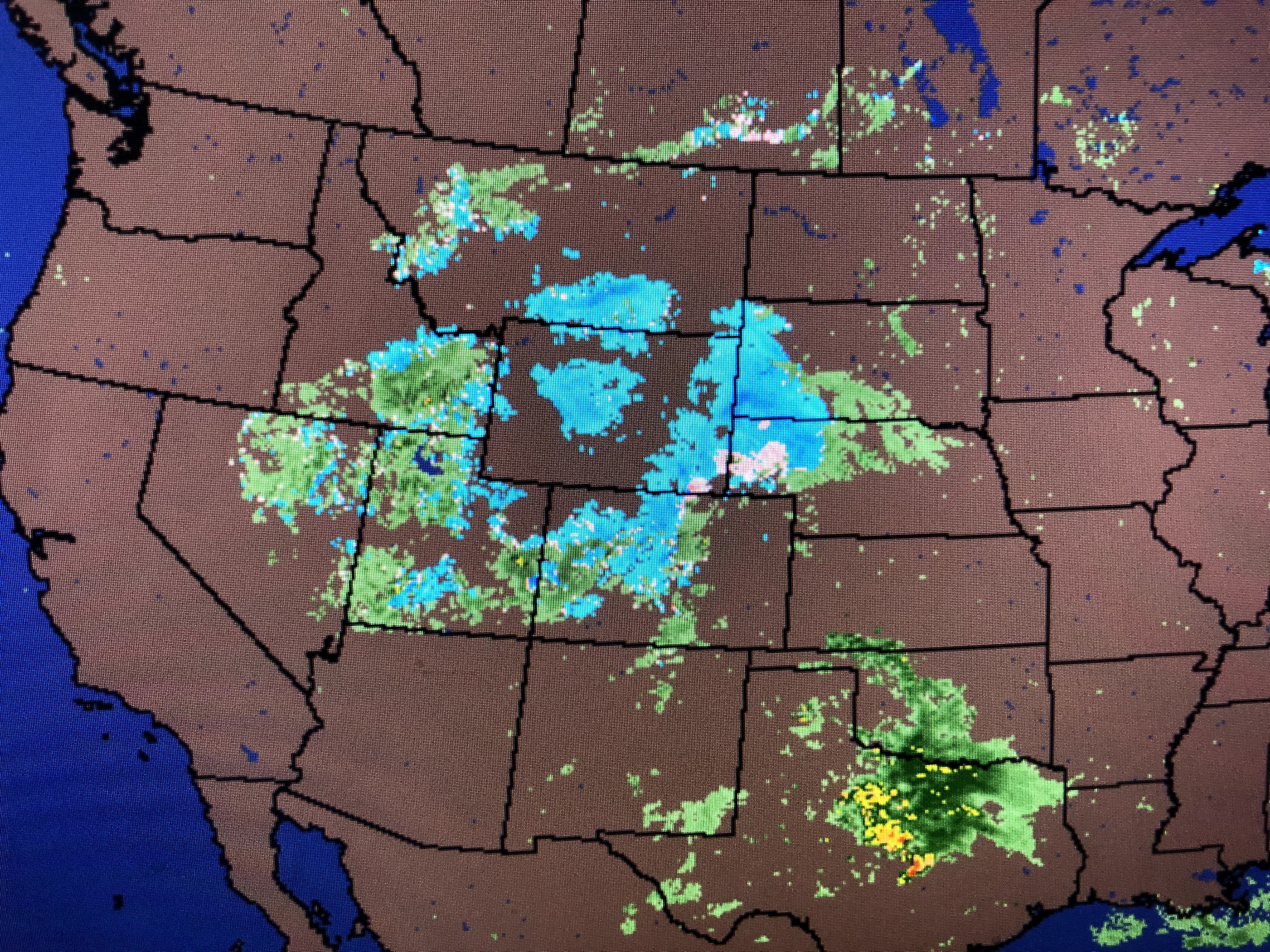
So we have a leftover surface frontal boundary along the northern Gulf coast with cooler air to the north with even more snow expected for Denver! Our next round is back over central Texas this afternoon and should race across us during the daylight hours on Friday.


The extended does have us drying out for Sunday into next week. That of course depends on this upper blocking pattern breaking down. We'll see. Get ready for another quick 1-2" on Friday. Good to be back (I think!). Stay tuned!

1 comment:
I’ve been waiting on your forecast. Run an hvac business and trying to establish a period of dry weather to run this crane for a rooftop unit. Was really hoping for a break in the rain sometime today to get this church ready for Sunday.
Post a Comment