


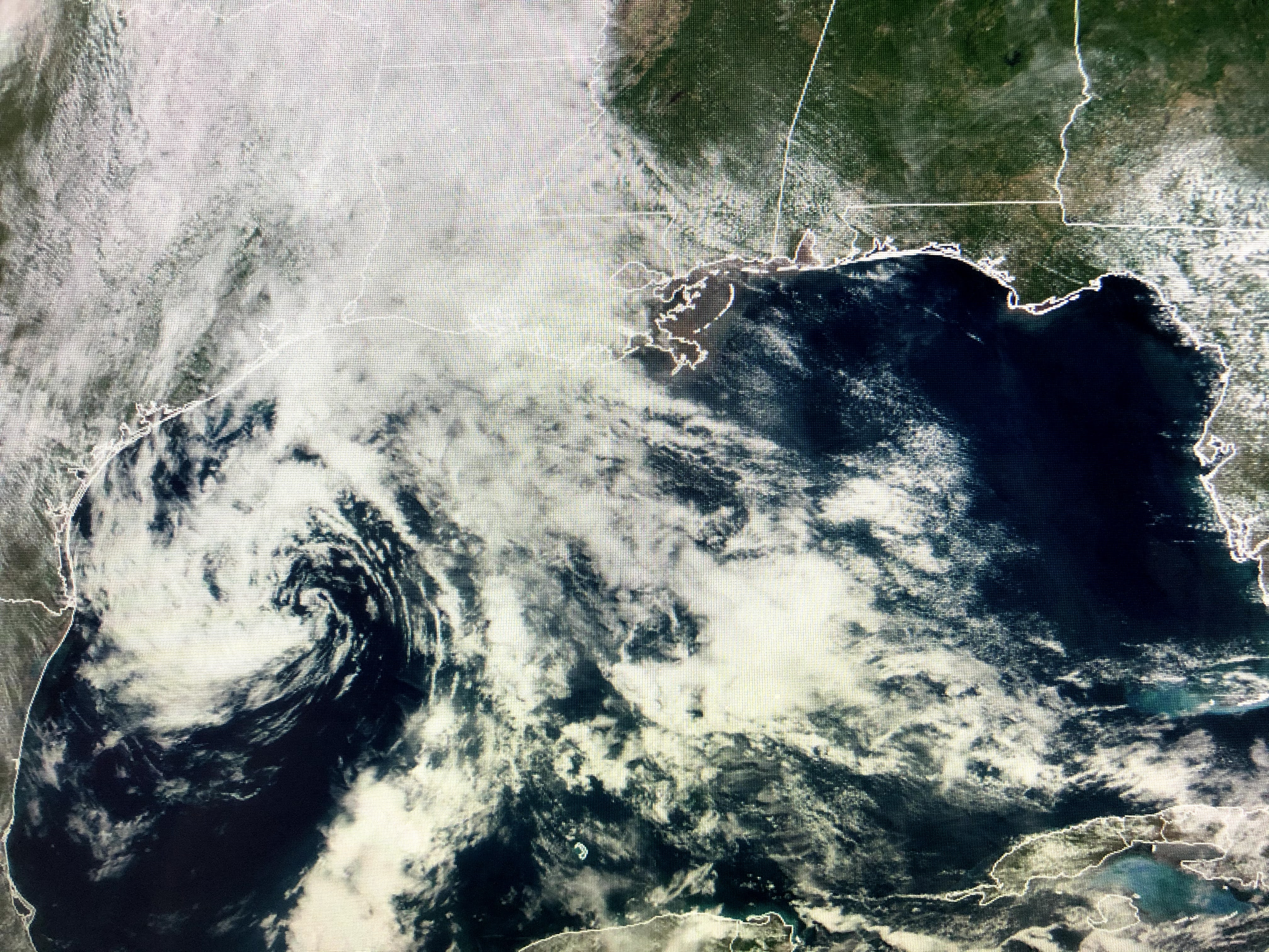


My gut tells me NHC will make the Gulf disturbance a Tropical Depression later today since it has such a well defined surface circulation. What is truly amazing is the impacts we're experiencing from such a weak system as winds sustained are 25-30 with gusts to 40+. That has piled water into Lake Pontchartrain and eastern exposure shorelines.


The unusually large surface high over the eastern states will build westward for this weekend drying us out. As the Gulf low moves inland tomorrow, the interaction between the high & low will weaken resulting in less winds, waves and high tides, but it will be a slow process. The high water levels in Lake P. have topped the sea wall and Lakefront Drive is closed due to high water. Remember, all roads outside the levee protection could see water over the road and extreme caution should be the rule. Stay safe.


The band of morning showers has drifted farther to the west and we should remain mostly dry into next week. Note the sunshine to our east that has temps 80+ while in the rain to our west it's in the low 70s. I plan to have my next update after 4 PM. Stay tuned!

1 comment:
I don't think so A.P. This season will be more influenced by the Saharan dust in June & July and hopefully by some upper wind shear that all the forecasters say won't happen during Aug-Oct.
Post a Comment