


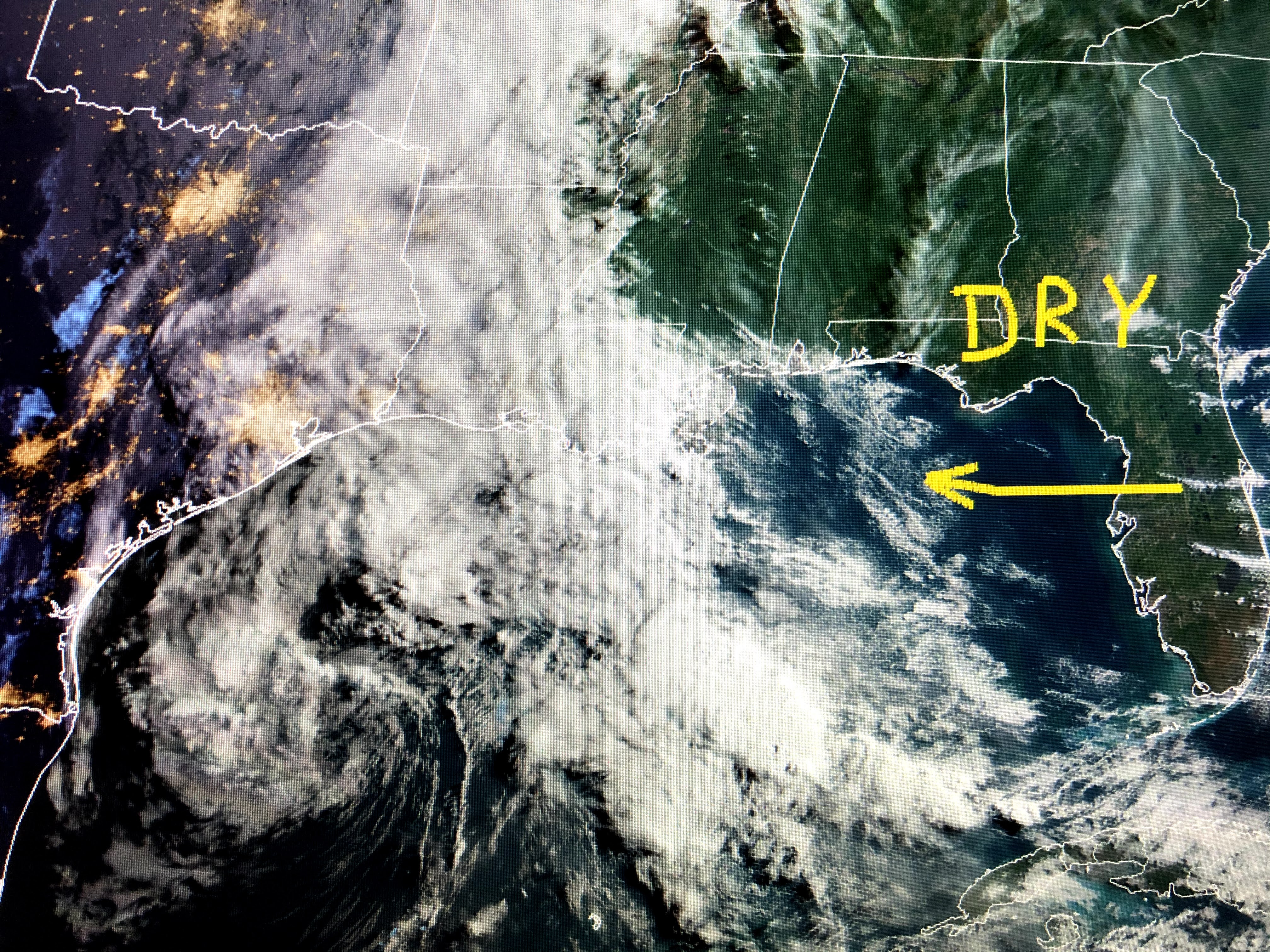
Notice how there seems to be a cluster of storms around the center of the Atlantic system while the Gulf disturbance doesn't have that.


So do we need to worry? Only if you live outside the levee protection system where high water levels have covered many roadways. The good news is things will start to improve for us later today as a strong surface high will steer the Gulf storm westward towards the central Texas coast.


Water temps in the Gulf are barely warm enough to support a Tropical (warm core) development, but there will be more heavy rains heading towards areas that don't need it. The showers over us will pull farther to the west today with some afternoon sunshine making for a brighter PM.


Bottom line, our weekend will not have any rain as high pressure to our east builds westward.. That will result in temperatures getting almost hot by Sunday into next week when we could see our first 90+ for this year. I will update later this afternoon when we might have Sub-tropical Storm Ana out in the Atlantic or TS Bill in the Gulf. Stay tuned!

2 comments:
I have wanted to ask this for a long time. Seems that tornados are less prevalent in New Orleans as compared to North Shore, central Louisiana, Mississippi, etc. Does the lake or proximity to water have any effect?
I always felt Lake Pontchartrain did have some effect though I'm not sure why. I called it the "Pontchartrain Split" where storms coming from the west would split with some going to the north and some going to our south. Tornado frequency increases the farther north you go due to the increased upper winds that ventilate (chimney effect) the storms allowing them to get stronger.
Post a Comment