


Neither system has been able to get storms to develop around their well defined centers. As you can see when I tighten in on satellite views, the usual clusters of storms are not there, hence NHC is not ready to name either right now.


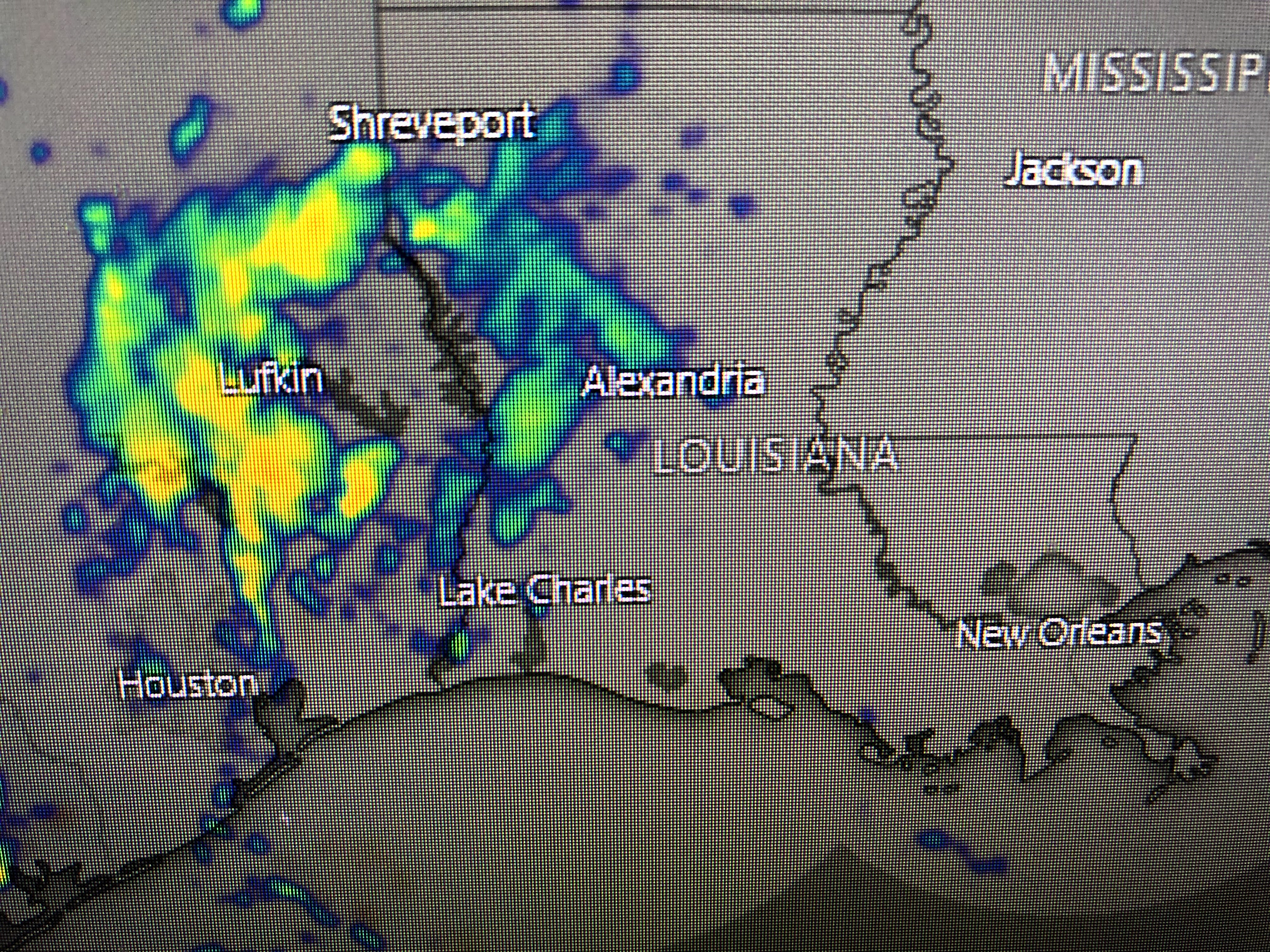


Radar views have very little activity around the Gulf system with the rain that was over us this monring now moving into east Texas. As the surface high builds over us, our rain chance go down and winds will too, but it will be a slow process. It'll take well into Sunday before we see a significant drop in tides.

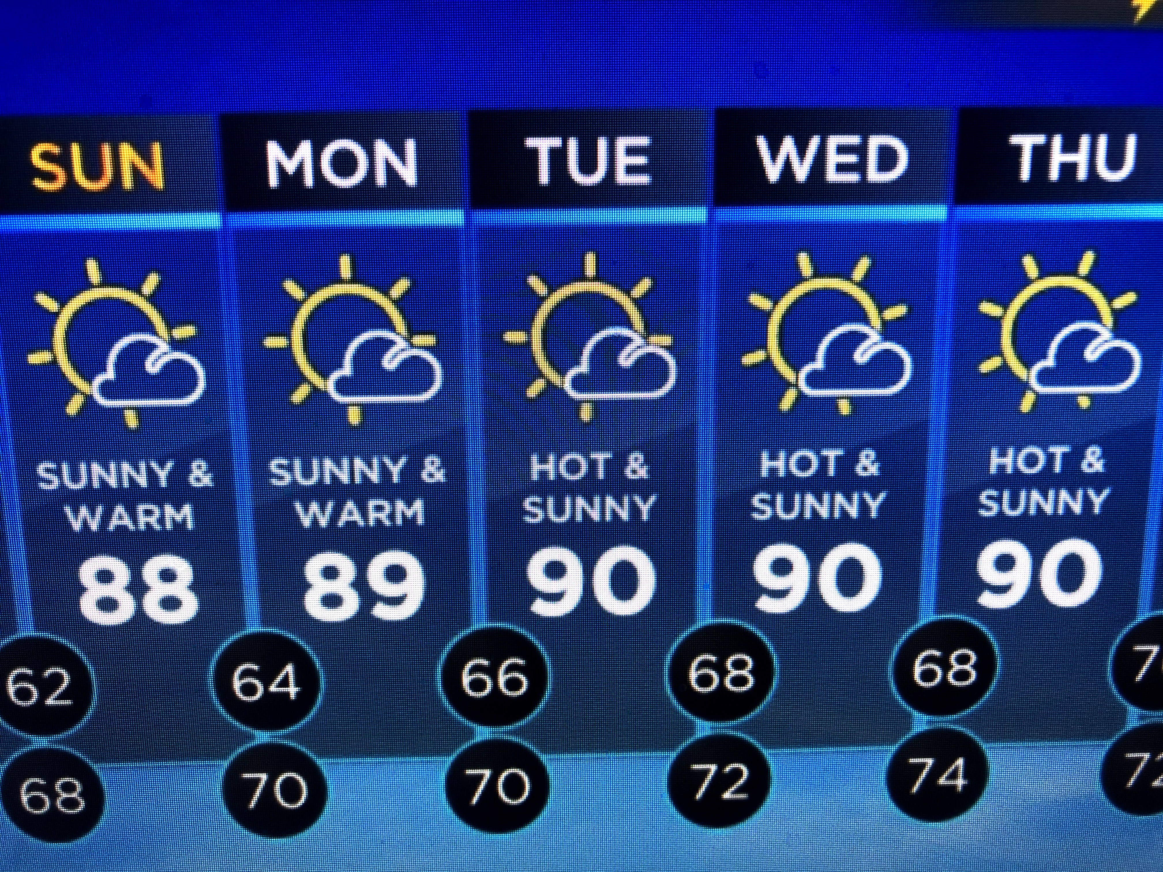
At this time of the year, take away the rain and temperatures will soar to 90+. Since we've been so wet, we need this time to dry out. Currently, the May rain total for MSY sits at 12.80" making this the 5th wettest May.

We only need another 1.54" to jump up to number 2 in the all time record books. The 1995 record appears to be way out of reach, thankfully!

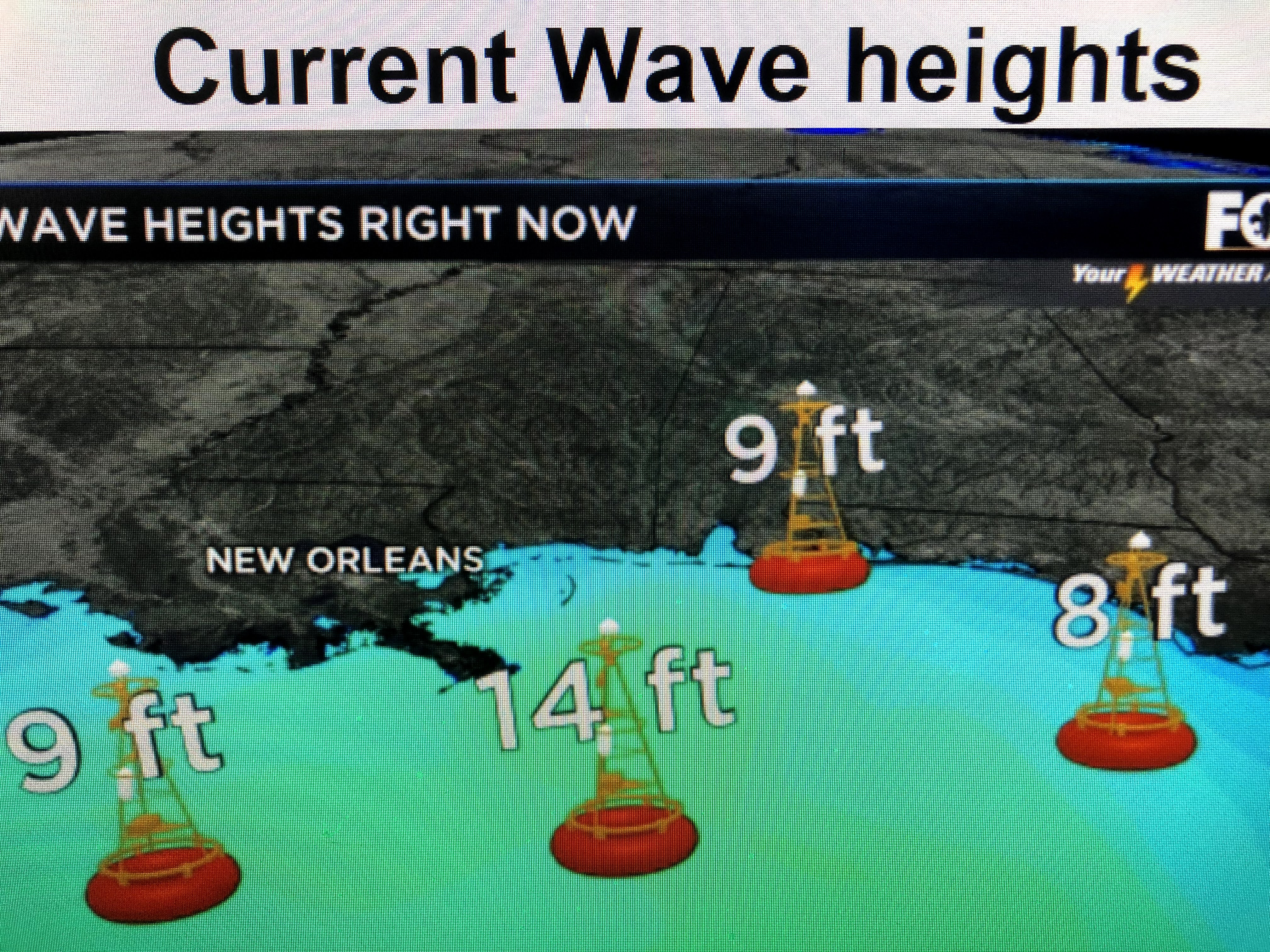
The biggest story locally is the high water levels caused by the persistent strong east winds. As mentioned above, water levels will slowly start falling as the center of the high gets closer. Don't be surprised to see NHC make the Gulf system a Tropical Depression later tonight or early tomorrow before it moves inland. Stay tuned!

2 comments:
I am getting married at a venue on the Bayou in Slidell Sunday evening. Do you feel it will be ok by then? The restaurant closed this evening due to water.
JS, Bob says "water levels should keep slowly falling as winds decrease. I’m thinking you’ll be ok, but that decision is not mine to make."
Post a Comment