


The area closest to the Islands is Invest 95 L while the one farther out is 97 L. Most models bring both systems into the Caribbean without much development, however, the GFS out 10-14 days is something we don't want to see.


The top graphic are models projecting 95 L with the middle being for 97 L, The bottom is the GFS wind field bringing whatever forms (Elsa?) into the Gulf then turning towards Louisiana. If that becomes reality, we will need to pay attention last NEXT week. For now it's something to follow as we have many days to watch.


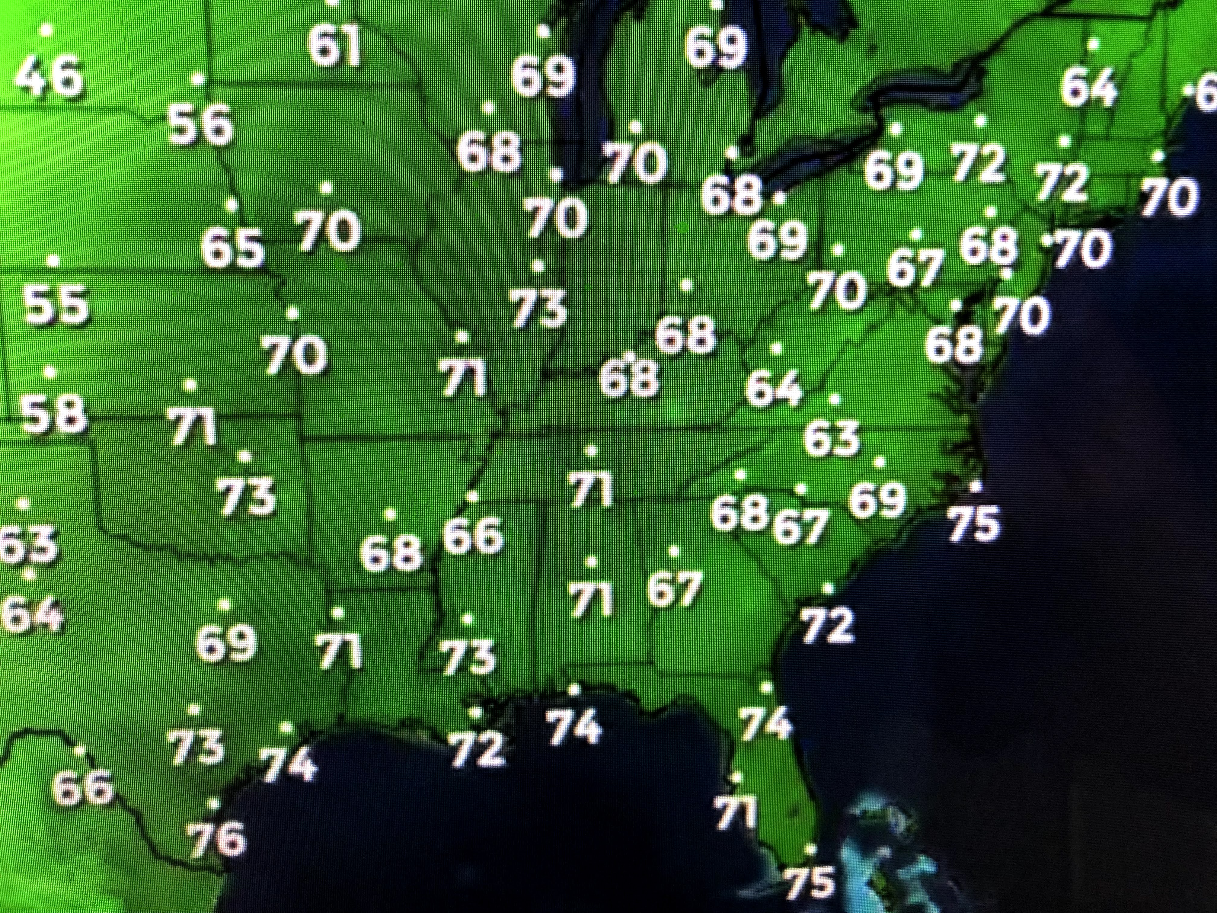
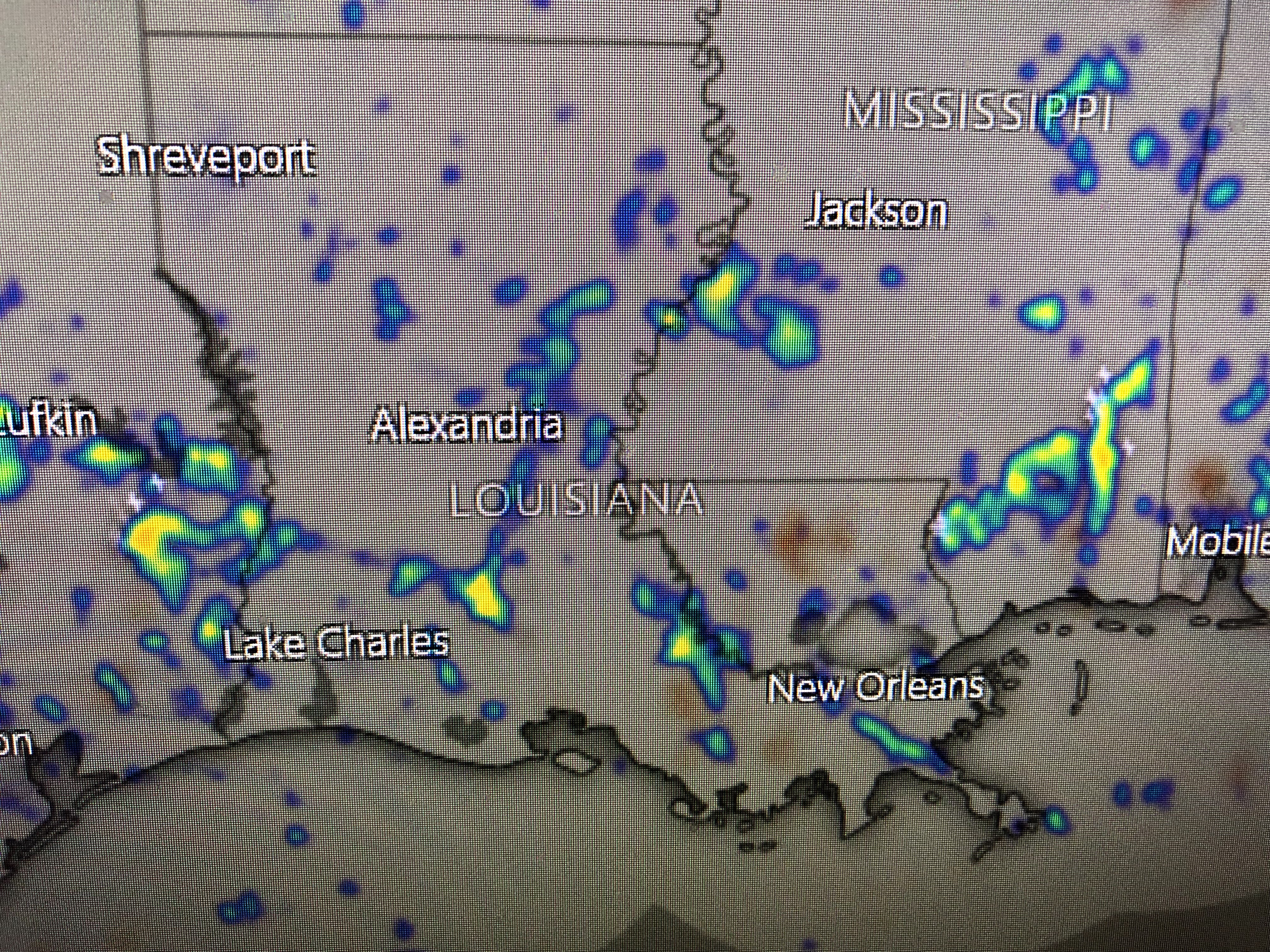
Closer to home, the remains of Danny can be seen as a cluster of clouds moving into northern Mississippi. Much of the eastern 2/3 of the nation is enduring heat & Louisiana humidity as dew points reach into the 70s as far north as Chicago, Pittsburgh, NYC & Boston. There will be a change later this week as a deep trough develops over the eastern states.


The top graphic is the upper wind flow valid for Saturday morning. IF the trough gets that deep, a cold front will get near us for this weekend. Right now, we are stalling it near us increasing our clouds and rain chances. However, there is still the chance it could push through bringing us some drier air for the 4th of July weekend. Don't bet your house on that happening.


In the short term, we'll likely see more scattered storms around tomorrow with brief tropical downpours. They do bring us some cooling relief keeping us below 90. FYI...NYC topped 100 today. Our focus for the next few days will be on the 2 systems out in the Atlantic. Watch and wait as usual. Stay tuned!
Oh, almost forgot to show you satellite views of what looks like a Tropical Storm east of Brazil & Paraguay.


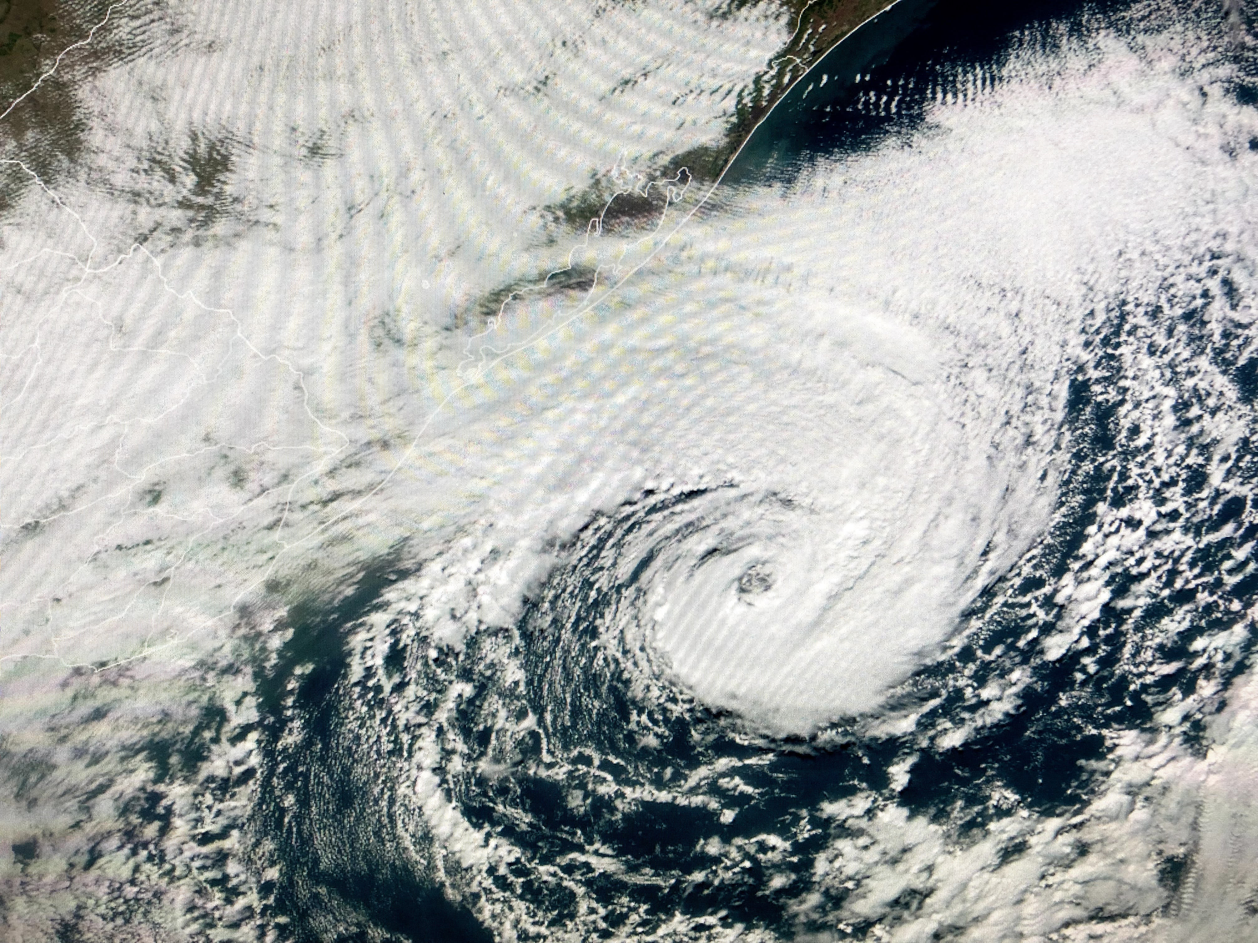
Thanks to my friend Ross Hays for bringing this to my attention. It appears to have banding features, but they are now in Winter. I think it's more like our East coast Winter Nor'easters. Just something different to see on our Mother Earth.

1 comment:
Bob, how concerned would you be to be in Negril Jamaica from 7/1-9?
Post a Comment