MSY picked up just ,35 today, but many spots got much more plus there was lots of lightning with these storms. Here are the records we are chasing.
The top graphic is the wettest Julys at MSY. We currently stand at 10.07" leaving us only .28" from cracking into the top ten with 2 weeks left in this month. The bottom graphic is the wettest years at MSY. Currently we are at 60.52" or only 14.66" from cracking into the top ten. Geez, such honors we don't need.
The only benefit I can see from the above normal clouds and showers is less hot resulting in lower energy costs. But I believe most of us are ready for a break from the rain even if it means hotter temps.
To make matters worse, the frontal boundary up north is expected to sag into the Deep South early next week resulting in even higher rain chances.
Oh well, let's focus on the positive. the Tropics are quiet in our part of the World and nothing is expected for the next 10-14 days. Dust is pouring off of Africa and that should keep things quiet out there.
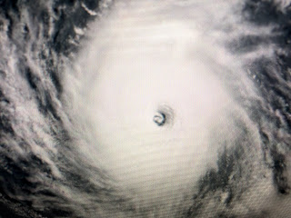
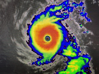
The Caribbean & Gulf have nothing going on as all the action has shifted into the eastern Pacific where Cat. 4 Felicia is cranking.
The bigger cloud mass is not Felicia *arrow). Felicia is a small, compact storm with the classic doughnut looking eye wall. This is what we don't want to see in our part of the World. Fortunately, none of the models have that happening.
Finally, next weekend (July 22-24th) is the Grand Isle Tarpon Rodeo with the opportunity to win a 21 foot fully outfitted Bay Boat & Trailer just by registering. Nope, you don't have to fish, just register to win. Google Tarponrodeo.org. Stay tuned!


No comments:
Post a Comment