


Last night David showed one model that kept the center of Nicholas east of Galveston over water making landfall in Louisiana. But the actual track ended up close to where NHC was predicting, well west of Galveston and just to the east of Houston this morning.
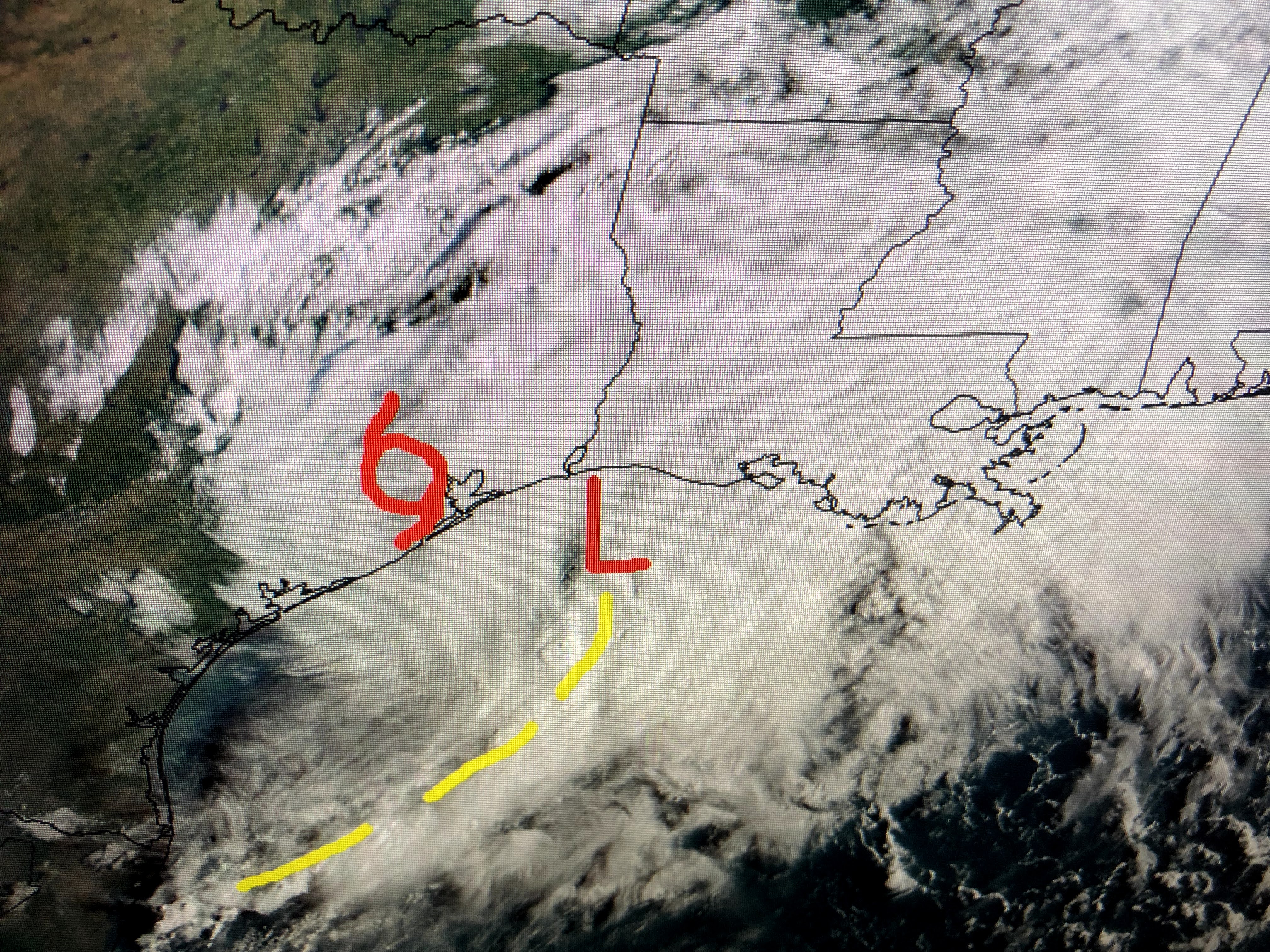

Nicholas did become a hurricane before landfall, but never did it have the rapid intensification like Ida. That's because it often had multiple centers competing against each other. In fact, that's still the case this morning as I placed an L where there is the mid to upper level spin that is pulling away from the low level center east of Houston.


All of the heavy rains/storms have pulled well east of the surface low that appears to be just east of Houston.


Even this morning, it's difficult to see a well defined center on the wind arrows/barbs. I'm guessing it's right over Baytown? Note the strongest winds are south of Lake Charles off the coast. So the main threat for the next 1-2 days will be heavy rainfall over south Louisiana and Mississippi.


NHC is painting a large swath of 6-10" from Lake Charles over NOLA to Gulfport. As long as it's stretched over many hours, it should not create any major flooding issues. Some have said this could be a "Harvey Scenario". Let me explain why that won't happen.


When Harvey reached the coast, he was a classic "doughnut hole" satellite presentation. His eyewall was well defined and took 3 days to finally dissipate leaving rain totals over 60+". Nicholas never did have that eyewall presentation and we have very little rain around his center. If the mid level circulation continues to pull to the east away from Nicholas' surface center, we could see our rain totals less that what is predicted.

The best thing that could happen today and tomorrow is the upper disturbance moving over the Great Lakes picks up Nicholas and pulls it north and east away from us. That is not the current thinking and it's why we'll probably have 2 days of rainy weather before we see a drying trend later this week. This is not what is needed as workers try to restore power and repair homes. Next post after 4 PM. Stay tuned!

No comments:
Post a Comment