west of the front, it's a beautiful day with bright sunshine. East of the front, it's summer-like with lots of clouds & humidity with spotty showers.
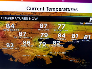
Looking at temperatures, it's hard to find he front as it's in the 80s behind it. But check out the dew points and you'll see 40s & 50s in OK & TX while we're stuck in the 70s.
As this weak front staggers through by Tuesday, it will be less humid, but there will not be any cooler air with it. We'll have to wait until after the 15th to get our next real cold front.
As the Tropical Atlantic shuts down, we look closer in for development as we head into October & November. As satellite views confirm, there is nothing there. Computer models are not showing any development and normally, I would have the "Fat Lady" singing this week. But because Zeta burned me last year, I will wait another 10-14 days before declaring "the party is over". Stay tuned!


No comments:
Post a Comment