
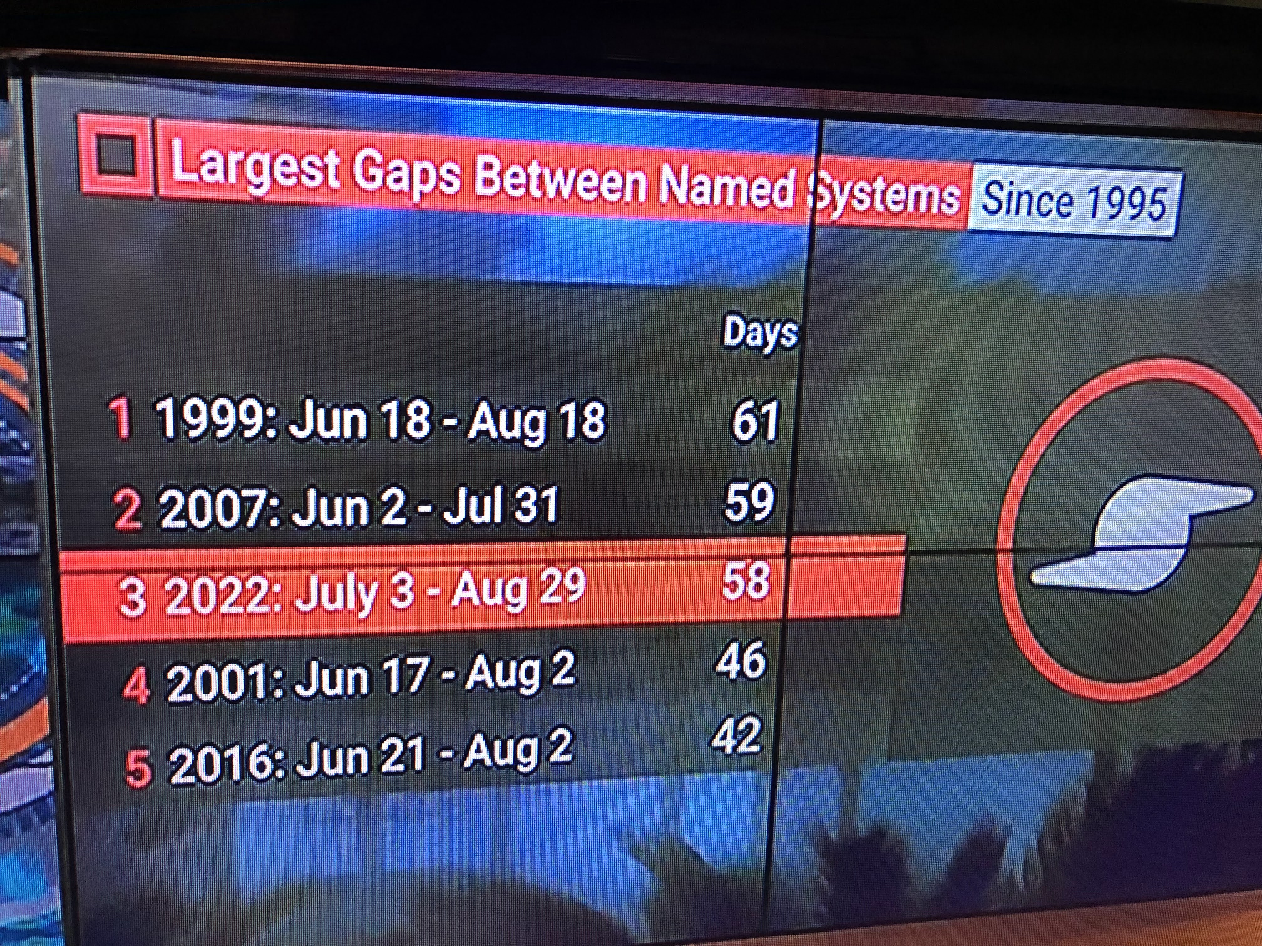


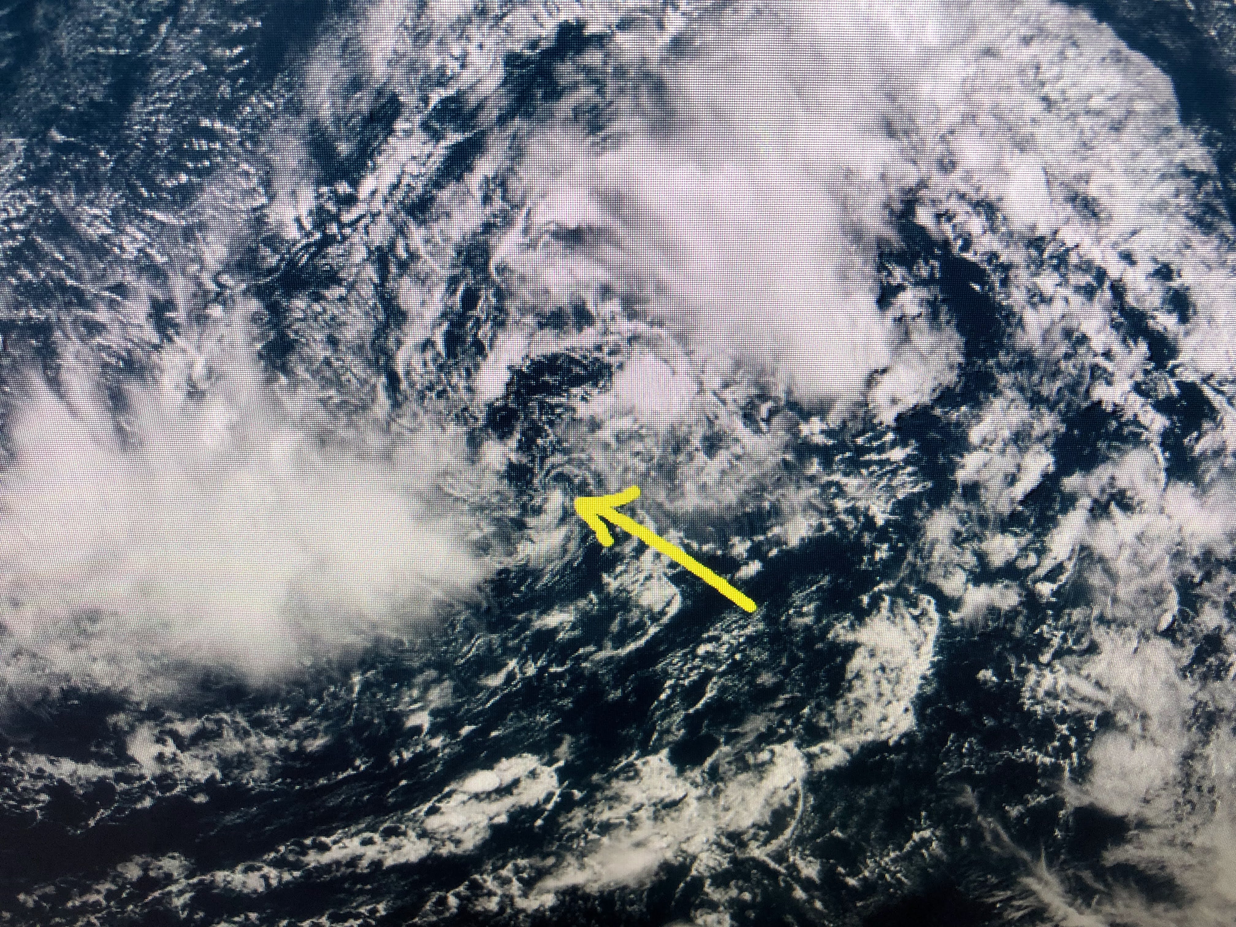
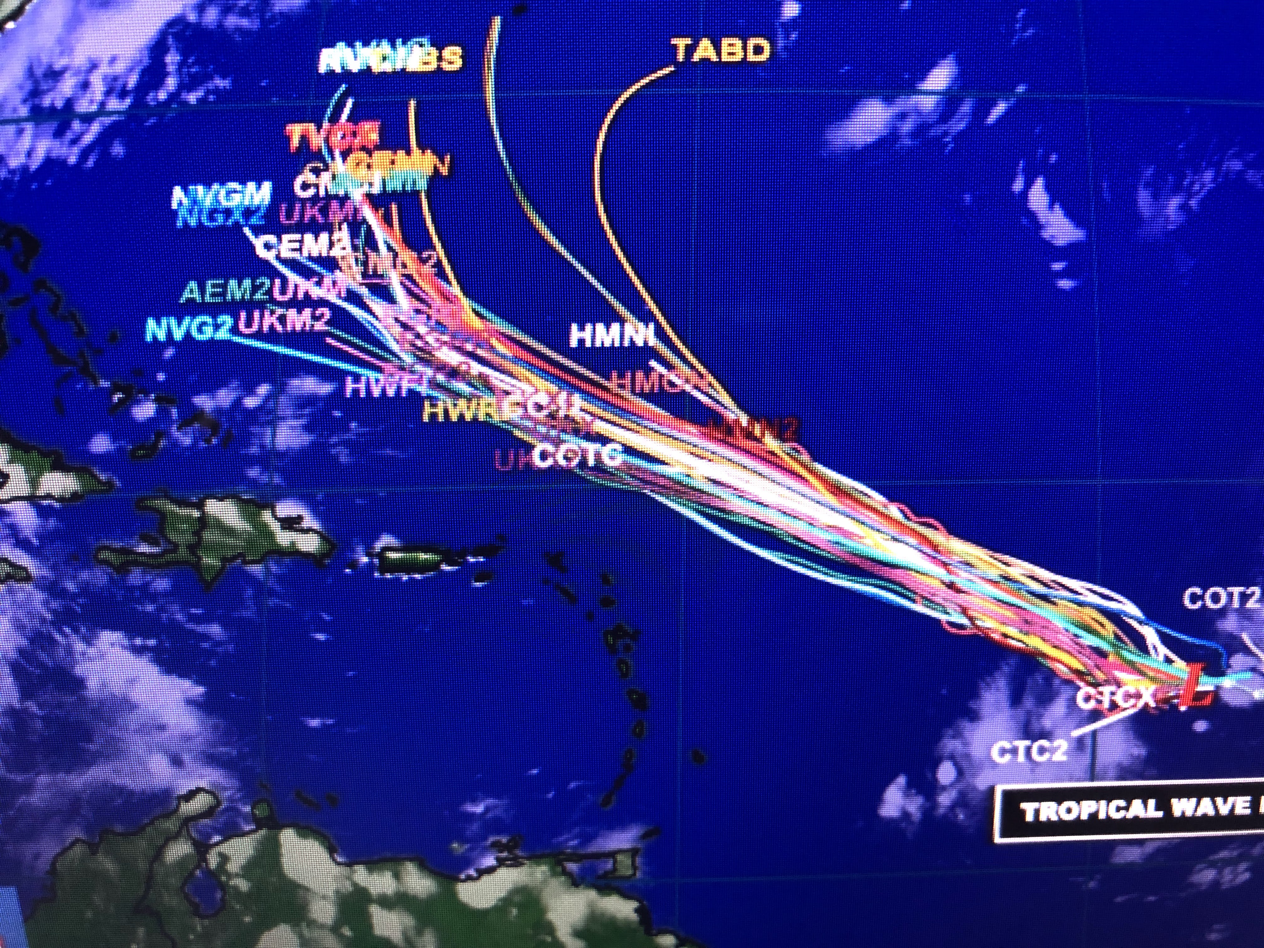
Computer models bring 91-L north of the Islands & Puerto Rico when strengthening should occur. Not only will it be our next named storm (Danielle), but some models increase it to the season's 1st hurricane. Of note, the average date for the 1st hurricane happens by August 12th. Compared to last year, we already had 9 named storms & 4 hurricanes, 2 that were major. But something is different this year, but nobody seems to know what that difference is.


Skies are clear where the storms were yesterday. There is a surge of moisture heading into Texas that still could use more rain.

The surface weather map doesn't have much going on, which is typical for August.


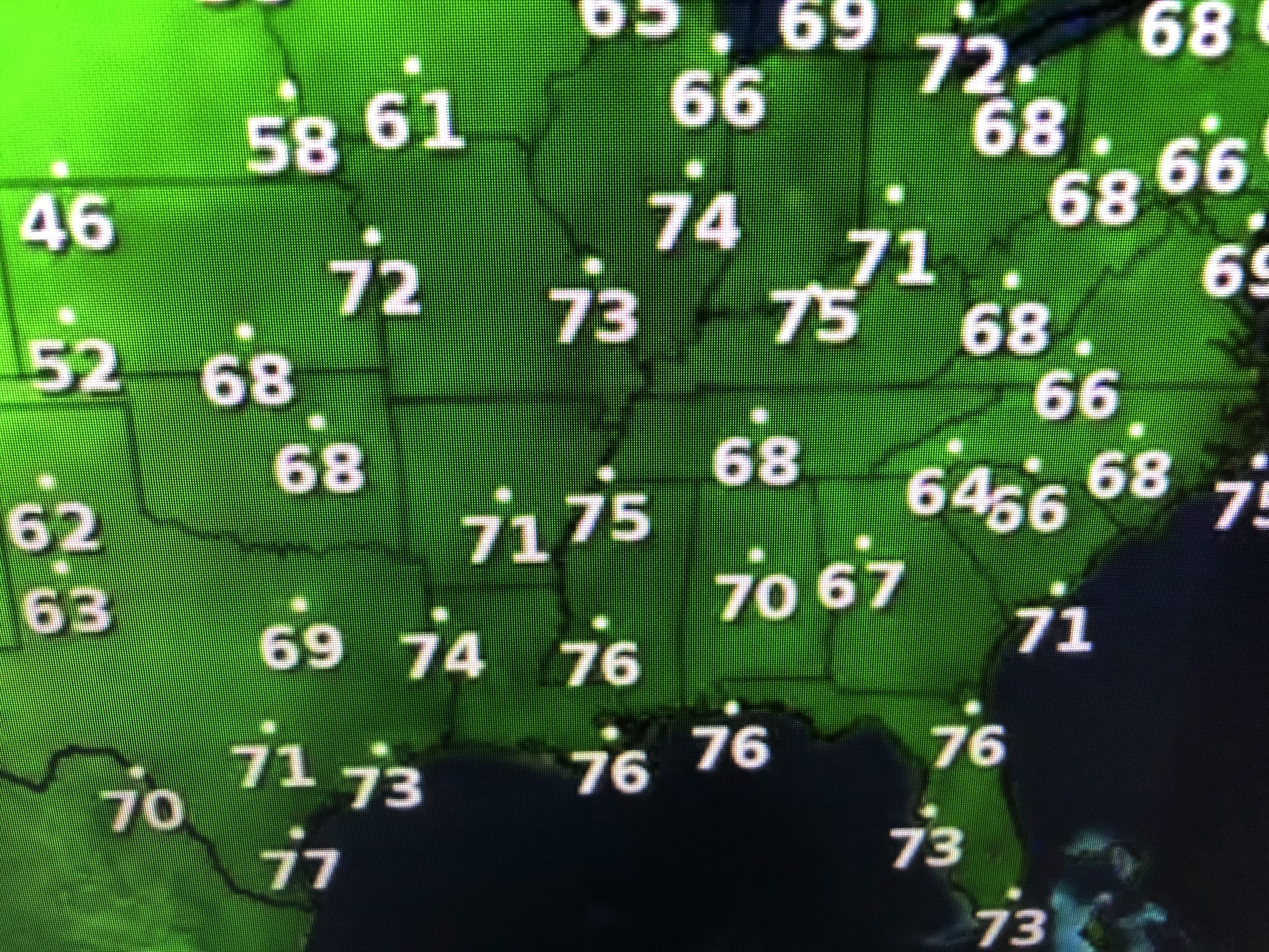
Of note, look at the 70+ dew points up to St. Louis & even Detroit. They feel as bad as we do. Some drier air may sneak in from the northeast by Thursday, before a new surge of Gulf moisture comes back for the holiday weekend.


Best weather in the country? Head west young man or woman.


No comments:
Post a Comment