


Back on our side of the world, nothing has chanced. No named storms for 59 days and let me give you my 2 cents as to why no storms.


I've circled many clusters of storms, but none are developing during a La Nina year that IS SUPPOSED TO have less wind shear. But what I see is a very hostile upper environment that has been with us since early July. Let's begin out in the Atlantic where NHC has 2 areas for development.


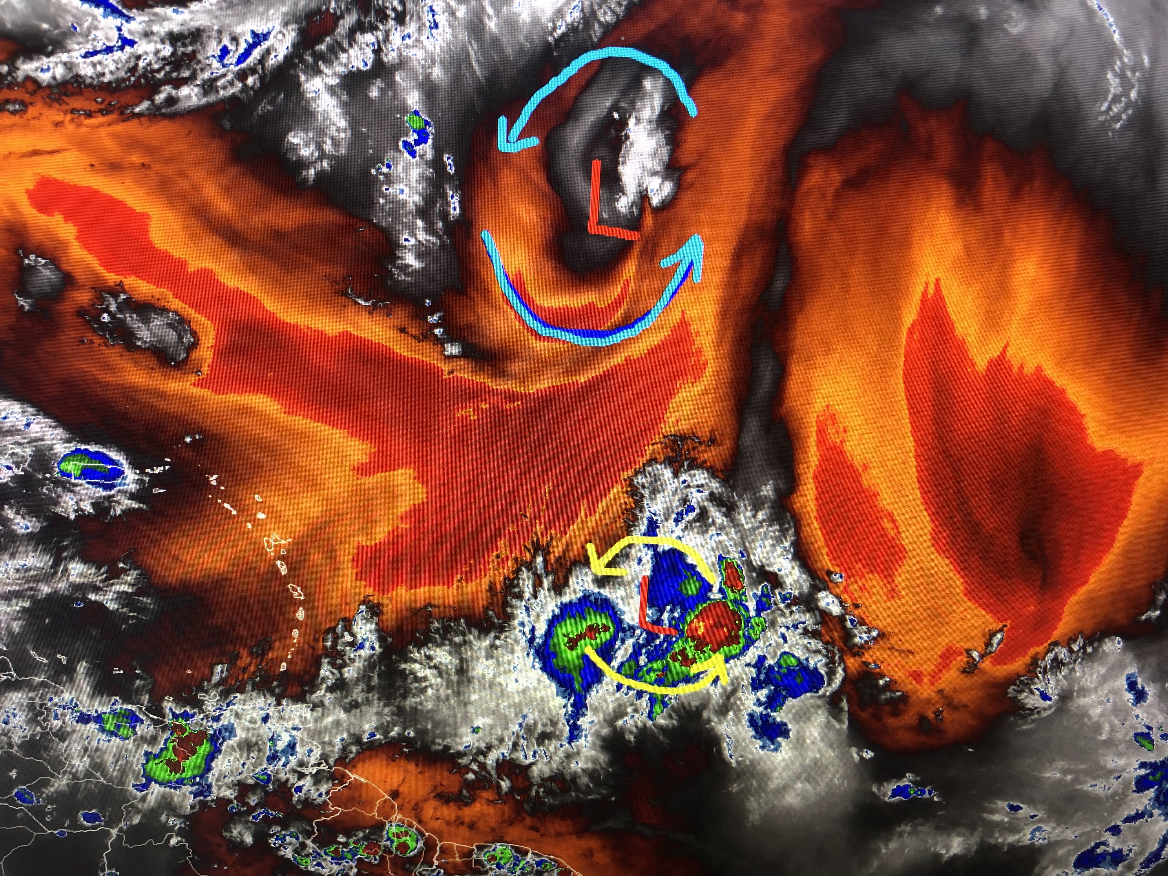
The on near Africa is so far out and already on a higher latitude that we need not worry about it. To the west is Invest 91 L that has a weak surface circulation, but lacks any upper storms. Why? Look at the bottom water vapor view. We have an upper low to the north creating wind shear plus it's sandwiched/ trapped between dry air on both sides. HOSTILE ENVIRONMENT! But look at the tropics as a whole.


David Bernard showed it on his program last night at 10 pm. The tropics have all these upper TUTT ( Tropical Upper Tropospheric Trough ) Lows and dry air making/limiting development of any disturbance. The Upper Low over eastern Cuba has a split in the flow over the Caribbean allowing T-Storms to fire off but not organize. Even in the Gulf, we have an upper low with a trough over Florida. What is interesting is how will the trough to our north interact with the upper low later this week? Bottom line...Storms will have difficulty developing as long as the TUTT stays strong. It sure looks like we will finish 2022 zero for August. Still have a ways to go before the "Fat Lady" sings.


Look how a cold front has cleared out much of America. The air behind it is only slightly less hot, but the dew points fall into the 50s & 60s bringing that dry feel. We might briefly get into drier air on Thursday before Gulf moisture surges back for the holiday weekend.


There is an upper low over west Texas bringing some relief to their severe drought. Not sure if that will slide our way enhancing our weekend rain chances.


Today's storms are arriving late and sunny skies allowed for temps to reach the low to mid 90s. Note how it cools down in the rain on the North Shore.

Pay attention to these PM storms today & tomorrow as daytime heating might bubble several up to severe levels. For now, Yea HOSTILE ENVIRONMENT! Don't care about the reason. Just last another 4-6 weeks! Stay tuned!

No comments:
Post a Comment