


For the latest NHC track, click on the storm tracking button on my web page. The rest of the Tropics look fairly tame. but there's much to watch.


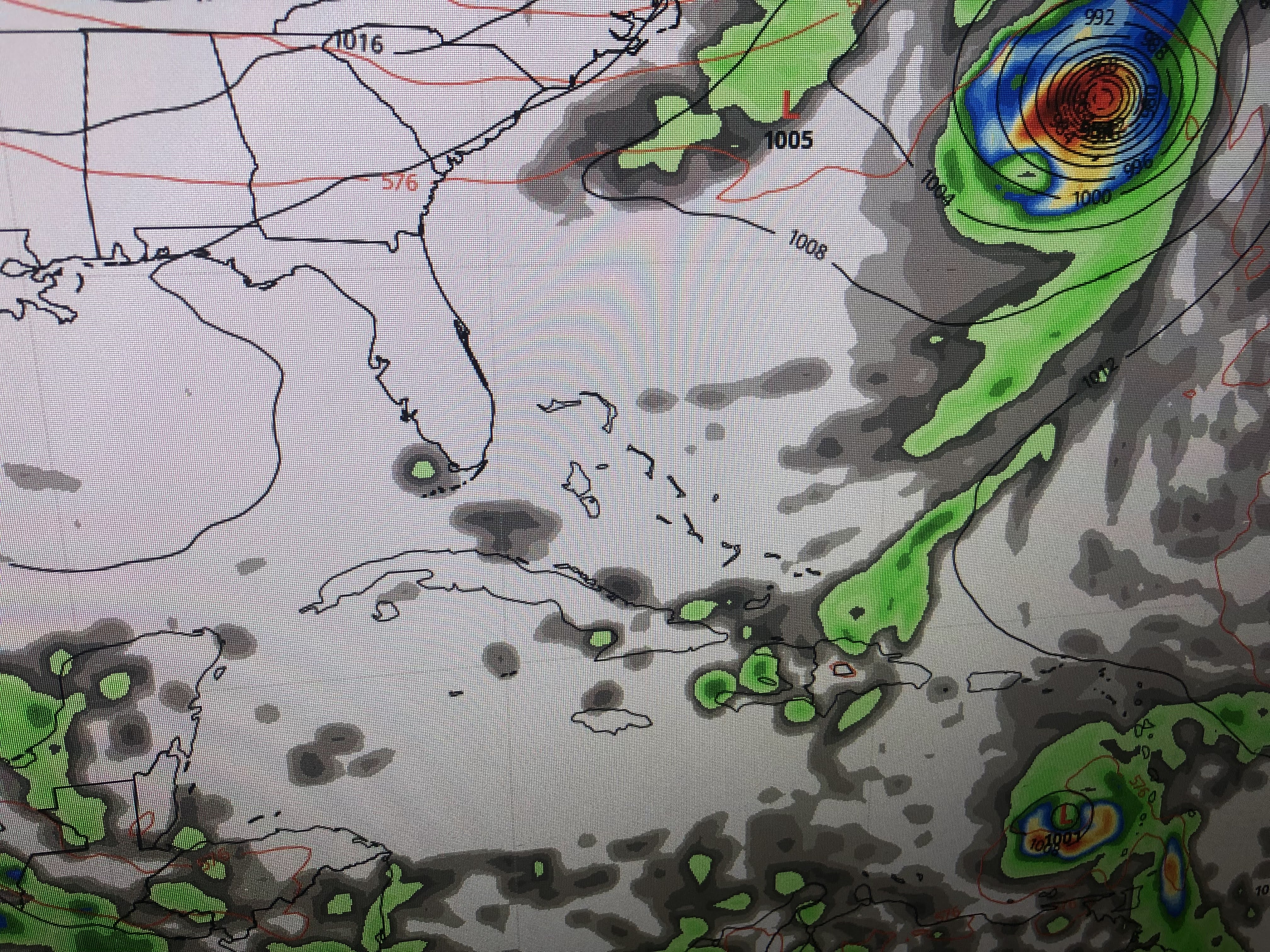
There is a long trough with several lows stretching from the Gulf across the Carolinas & into the Atlantic. Clearly, Hurricane Fiona stands out. However, there is something behind Fiona.


It's a tropical wave east of Barbados and looks innocent enough right now. However, both the GFS & Euro develop it once it reaches the Caribbean making it our next named storm (Gaston).


These graphics are from the GFS model and shows Fiona leaving this Friday in the top view. The middle has Gaston south of Cuba NEXT Tuesday with the bottom into the Gulf on Friday Sept. 30th. From there the GFS brings Gaston northward toward Lake Charles.


The bottom view is the Euro which takes it towards the Florida beaches. We all know these models have done this before several times this summer and northing ever formed. I don't get concerned about model "predictions/guesses" in the 10-14 day time frame. Let's pay attention to that wave and hope it follows the pattern so far this summer of not developing.


That heat dome keeps us safe from tropical activity right now, but it is not likely to be there in 2 weeks. I'd much rather see an East coast Upper trough develop bringing down cold fronts that would block the storms from coming our way. Not seeing that yet.


So in the absence of cold fronts, the heat is on this last week of Summer. The Fall equinox arrives Thursday at 8:03 PM. it certainly won't feel like it. In fact, I grabbed the bottom graphics from Hannah Gard's noon program on FOX 8. It may not be record heat, but we're gonna get very close.


We do have a couple of stray showers around, but most of us will stay dry. That pattern continues until Friday when a weak front will arrive with slightly drier/less humid air. No signs of a real cold front yet. Stay tuned!

No comments:
Post a Comment