


Invest 98 L is at a much lower latitude and its nearness to the coast of South America should limit development in the short term.


The yellow arrow is Barbados and most of the storms are already along the coast and disorganized compare to Fiona in the bottom pic. Just me, but the clouds & storms appear to be heading onto South America. So let's go through what the main models are doing with 98 L. We begin with the GFS model.


It beings with what looks like a hurricane entering the Gulf NEXT Wednesday heading towards the Florida Panhandle & inland by late Friday east of Apalachicola. The Euro is similar but farther to the east.


The Euro takes it NW of Tampa inland around Cedar Key. If either solution proves valid, we would see no major impacts. However, before you relax and not worry, these solutions are 7-10 days out, a time frame models are often NOT accurate. For instance, here's the Canadian model that takes 98 L on a far southern route.


Could that happen? Sure, especially if a cold front brings down a large blocking high forcing the system to stay south. Bottom Line, it's way too early to know. David said it best last night..." we are in the watch phase now, not the worry phase". Plenty of days to follow whatever forms.


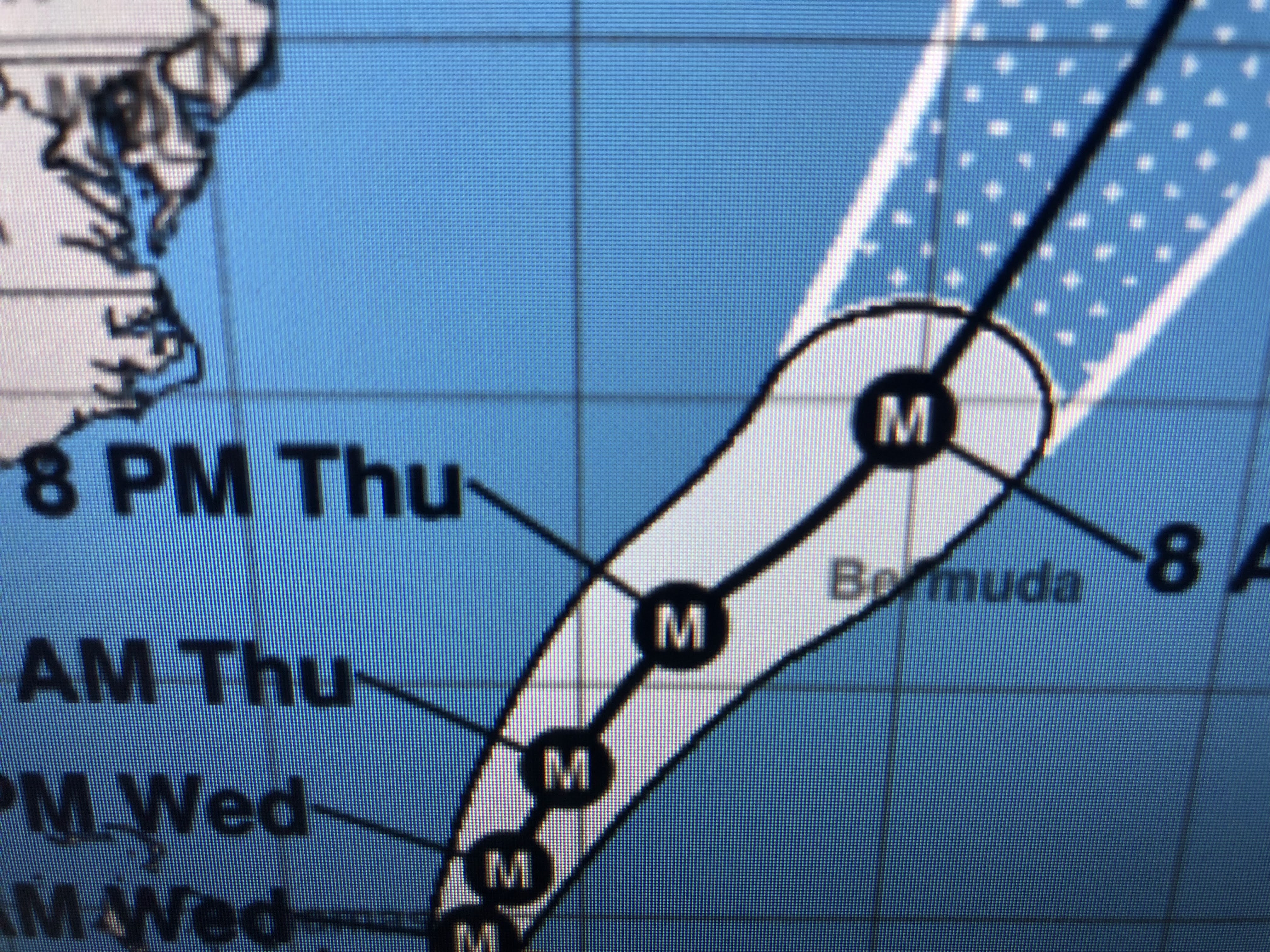
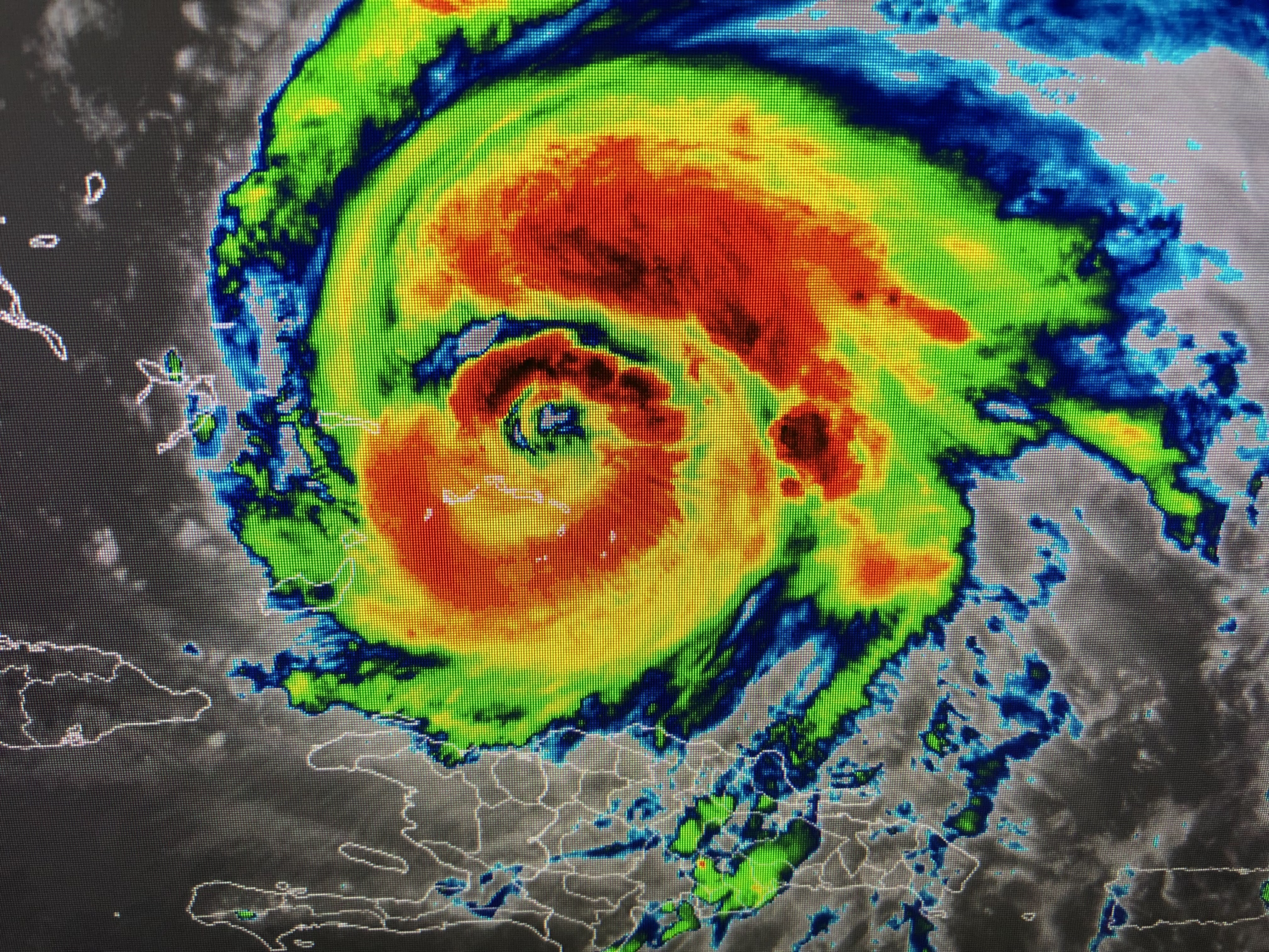
Hurricane Fiona has increased to a Cat. 3 with winds of 115 mph. She's expected to reach Cat. 4 later tonight and will brush by Bermuda on Thursday. Her structure is that classic donut look.


What is concerning is she's developing over moderately warm waters compared to what's in the Caribbean & Gulf. The bottom graphic is the Ocean heat content that has very warm water to great depths. 98 L (future Hermine) will travel over those hot waters. Plenty of time to follow it.


The Gulf is staying quiet and that heat dome is still locked in place for th rest of this week. Some drier air/lower dew points have rotated around the high. Dry air heats up quicker as you see triple digit heat at Memphis.


There is cooler air moving into the northern Rockies and it hopefully will reach us before any tropical threat gets close. A weak front will push through on Friday lowering humidity, but the real front arrives on Tuesday.


In the short term, we gonna fry! No rain, few clouds equal temps way above normal (87) as we'll threaten records the next 2 days. Astronomical Fall officially arrives on Thursday at 8:03 PM.


the western states are getting relief from a leftover tropical system and an upper low off the California coast. It's not a lot of relief, but it's helping dampen down the wild fires. Our relief is coming next week. Stay tuned!

No comments:
Post a Comment