


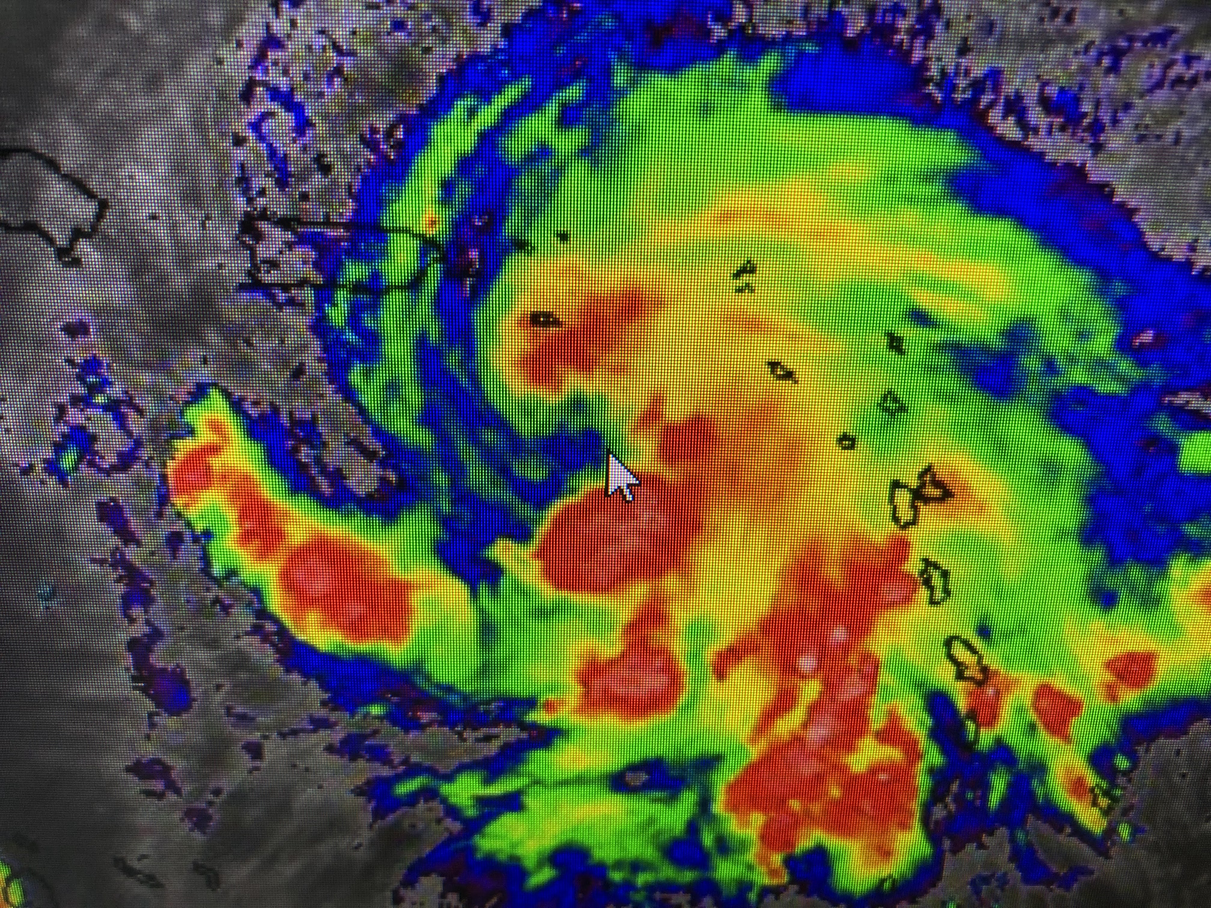


Satellite views are hinting an eye is trying to form. Tonight's Recon flight will determine if Fiona hits Puerto Rico as a strong Tropical Storm or a weak Hurricane. Regardless, heavy, flooding rainfall will threaten life & property.


There are a couple of swirls out over the Atlantic, but none of the models are bullish on development.

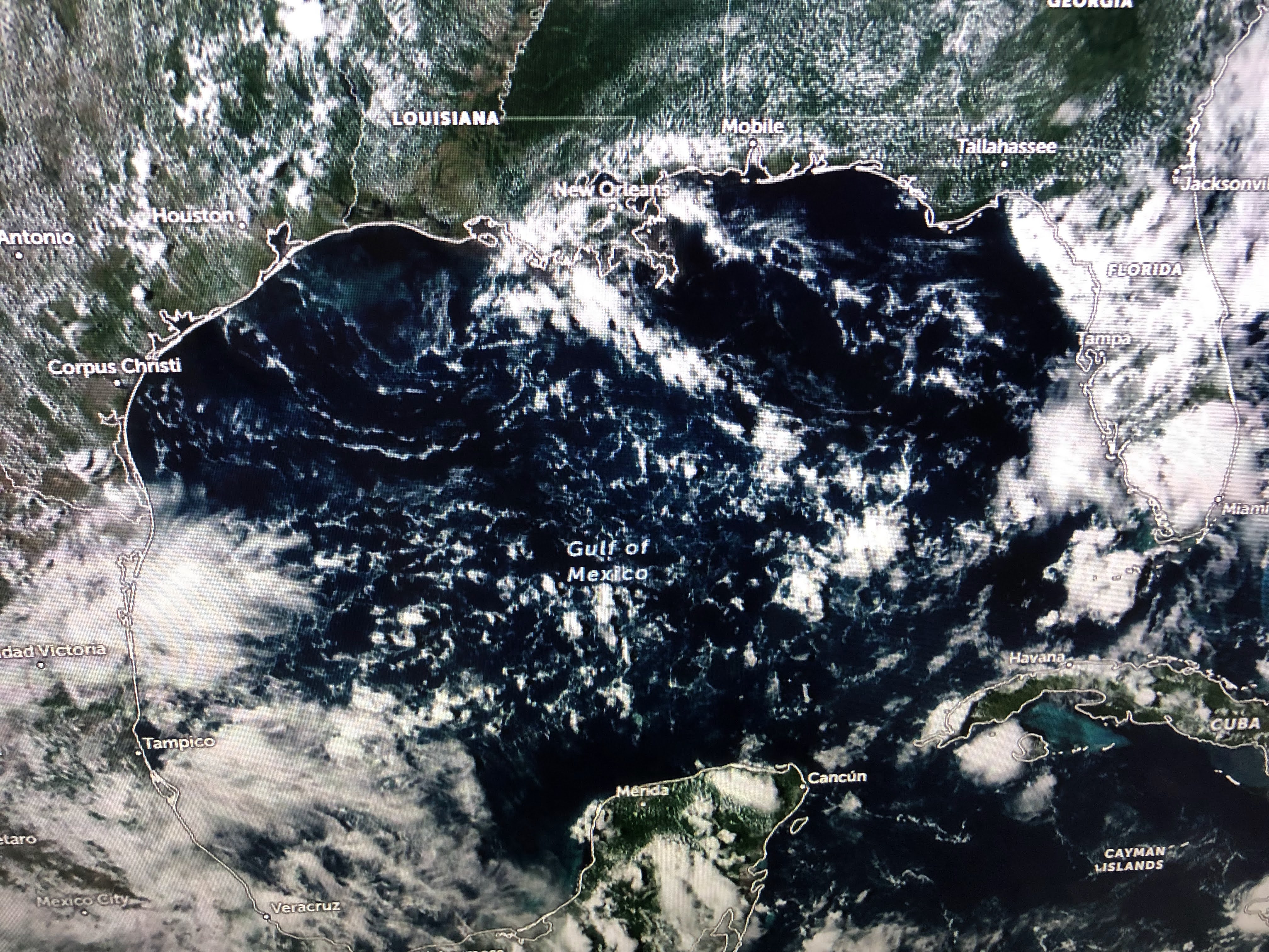
The Caribbean and Gulf continue to have clusters of storms, but none show organization. Models do not develop anything for the next 7-10 days after Fiona leaves. That gets us almost to October where chances for a major hurricane hit are significantly less. What a strange season so far.

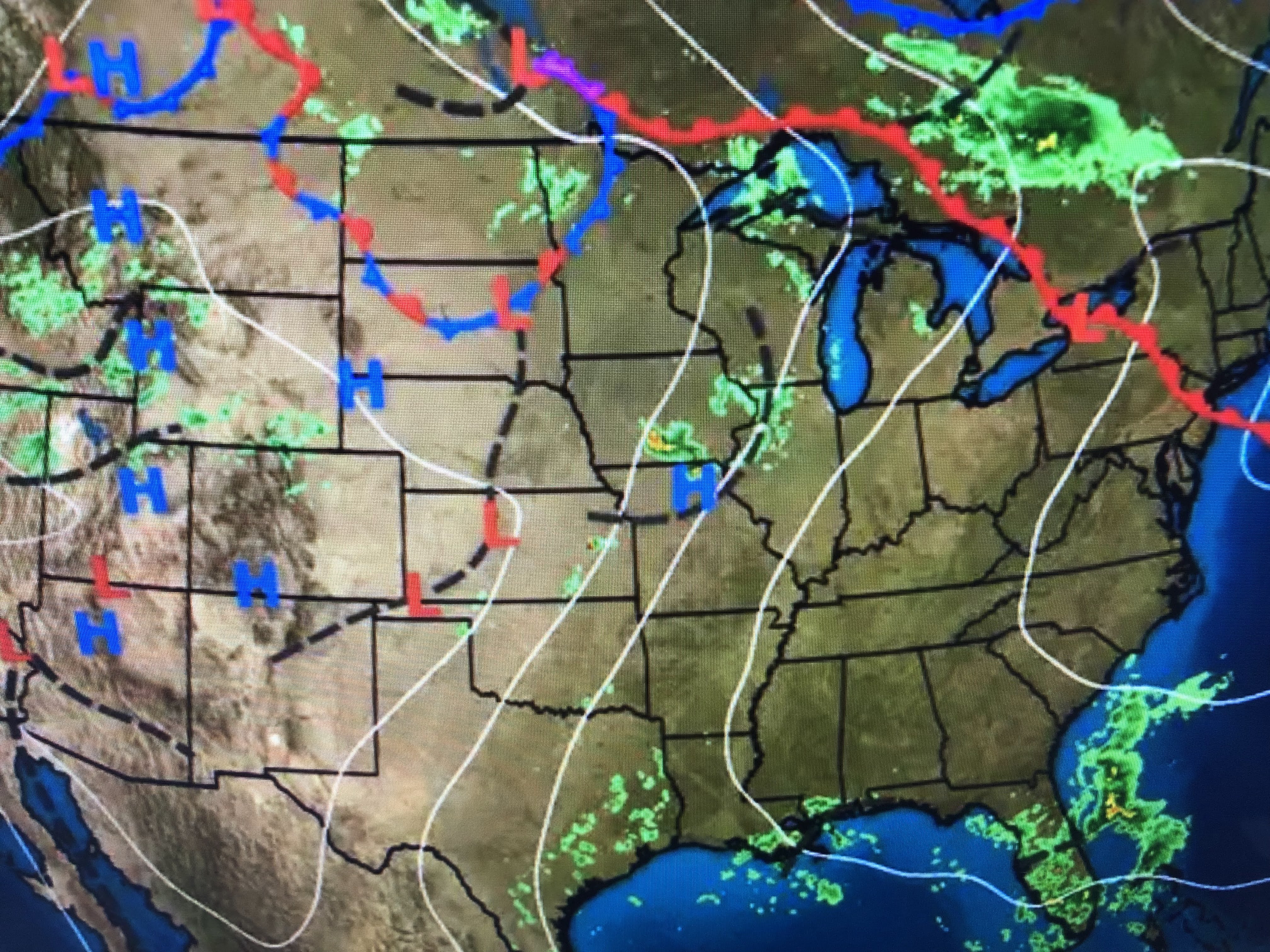

If you're waiting for our next cold front, not coming this week. In fact, the upper heat dome will allow highs to get into the 90s on this last week of summer.


With the surface high moving off the East coast, flow has resumed off the Gulf . Dew points are back 70+ and, coupled with daytime heating, some showers have developed.


This is welcomed rainfall since we have been dry for days. As the upper high builds over us next week, rain chances go away.


I like what one viewers said, "I'll take the heat if it means no hurricanes." Time to focus on the Saints. Who Dat! Stay tuned!

No comments:
Post a Comment