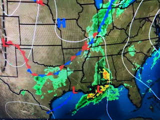
This upper splitting of the jet stream adds to low level lift creating upward motion that enhances rainfall/storms. As the upper system pulls to the NE, more systems are on the way for next week.
This is great news for the western states and should really knock down the lingering drought conditions. Snowfall at the higher elevations has been measured in many feet with the Rockies upper trough keeping them chilly.
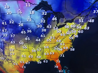
As the western trough pumps up the eastern upper ridge, temperatures have soared into the 50s & 60s as far north as Buffalo & Boston melting the recent snows. Without a surface front coming until next week, we'll stay in the mild, muggy air into next week.
You can see there is no cooler and drier air to our west so daily dense fog problems could be the issues each day.
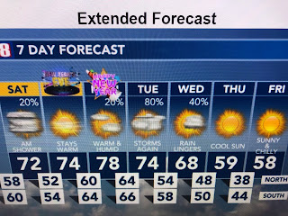
The dense fog that's likely to develop tomorrow night could put a crimp on fireworks viewing.
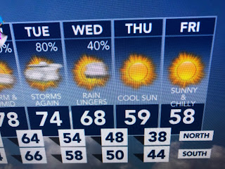
The next real rain threat will be Tuesday into early Wednesday when our next front moves through. It will not be an Arctic blast, but more like bringing back seasonal temps. Finally...
For the past 2 years I have met for lunch with the last meteorologists I hired. Kim Vaughn-Landry left FOX 8 to get her masters degree and now is a project manager for a local engineering firm. Chris Franklin was my high school intern while he was at Brother Martin and became our morning meteorologist after getting his degree from South Alabama. He now is the chief met. at Ch. 4. So proud of them! Stay tuned!


No comments:
Post a Comment