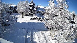
With beauty often comes the other (ugly) side. You have to shovel a path to get out of your driveway.
The snow clearly was visible on the daylight satellite view(arrows).
That snow storm is lifting out over the northern Plains into Canada as another one forms behind it. There is an "atmospheric river" of moisture that will keeps storms coming into the West Coast/Rockies well into early January.
As long as the upper trough remains over the west, the eastern states will not go back into the deep freeze like last week. In fact, warmer air has surged northward ahead of the slowly moving western system.
As the cold front & upper disturbance approaches Friday, we'll have a slight risk for severe storms & heavy rainfall.
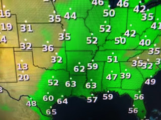
Note, Little Rock at 3 PM was 70 but the dew points have climbed back to 60+. As low level moisture increases, we'll see the potential for sea fog to develop later tonight. The timing on Friday's storms appear highest in the morning based on the model Hannah Gard used at 4 PM.
If all goes according to plan, New Years Eve should be dry for the fireworks.
Tomorrow's storms will be caused by the upper disturbance and not a cold front. We'll stay warm into next week when our next front plows through late Tuesday into Wednesday. It will turn colder, but not nearly as bad as last week. Stay safe & stay tuned this weekend.


No comments:
Post a Comment