


The Arctic air is so massive & dense that it is creating it's own momentum in pushing slowly to the south. The forecast challenge remains the upper SW flow that will eventually get the front moving back to the north as the main upper energy over the Baja finally lifts to the NE.


Most of the country is dealing with late January Winter weather. Overrunning of the frigid surface air is causing lots of icy conditions from Texas up into the Ohio valley.


Travel is a nightmare for many & local officials are asking folks to stay home if possible.

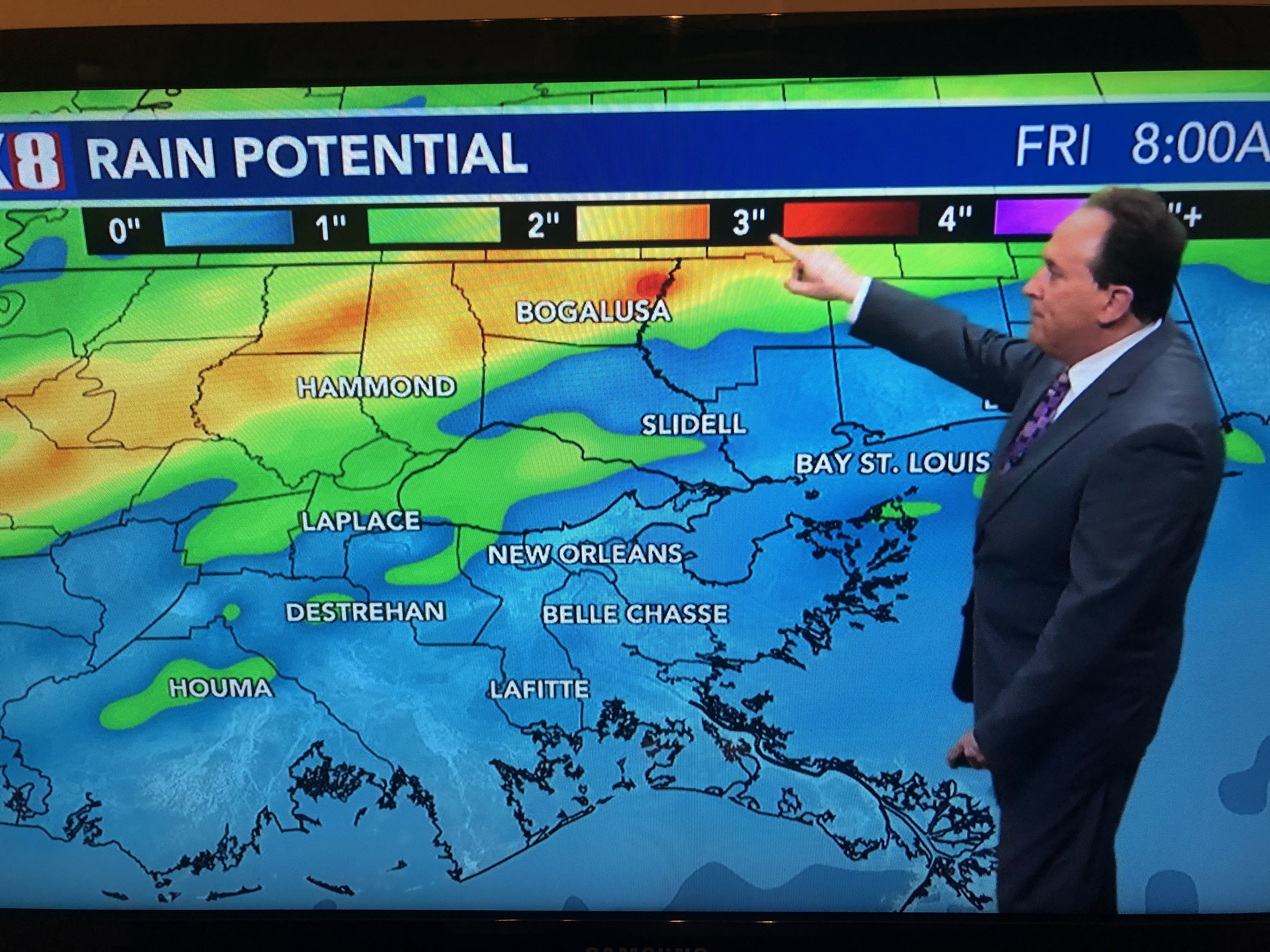
Locally, our issues will be more dense fog tonight with heavy rains possible, mainly north of Lake P. on Thursday PM.


Finally, January was very mild over most of the nation east of the Rockies. We only had a couple of days below average/normal, but when we were warm, we were very warm. January 2023 easily will be in the top five here.


Satellite pictures confirm the warmth farther north as all of the Great Lakes have little ice covering. There is plenty of snow on the ground as you can see the local topography shows up (rivers) on the visible satellite view. Usually when it's very mild/warm, the next month or two go the other way. With Mardi Gras coming, I hope not. Stay tuned!

No comments:
Post a Comment