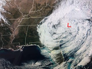
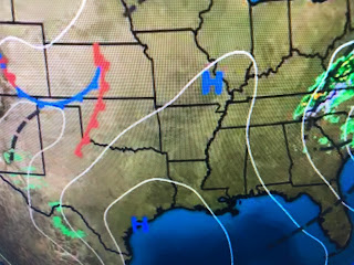
The upper low has aligned with the surface low over the Carolinas making their Sunday miserable. Despite being mid-February, there is very little snow falling with this system. Why? The supply of Arctic air has been cutoff over northern Canada with most cities well above freezing. Both Boston & Cleveland are above 50 with even Buffalo in the high 40s.
Northern Canada is still brutally cold (30-40 below), but the current upper air pattern (trough over Rockies) will not allow another Polar Vortex to plunge over the eastern states.
We'll see two storms come out of that western trough this week with the second being the stronger one for us. The potential for severe storms on Thursday is there and could affect the night parades. We'll update as we get closer.
Tomorrow may be the best day this coming week. As the surface high drifts over us, high thin clouds will give us filtered sunshine, but light winds & warmer temps should make for a near perfect day.
We will see a dramatic mid week warm up before next weekend goes back to cold 7 dry. Finally...


No comments:
Post a Comment