


Brownsville's dew point is nearing 70 and those south winds will keep the Gulf moisture flowing in.


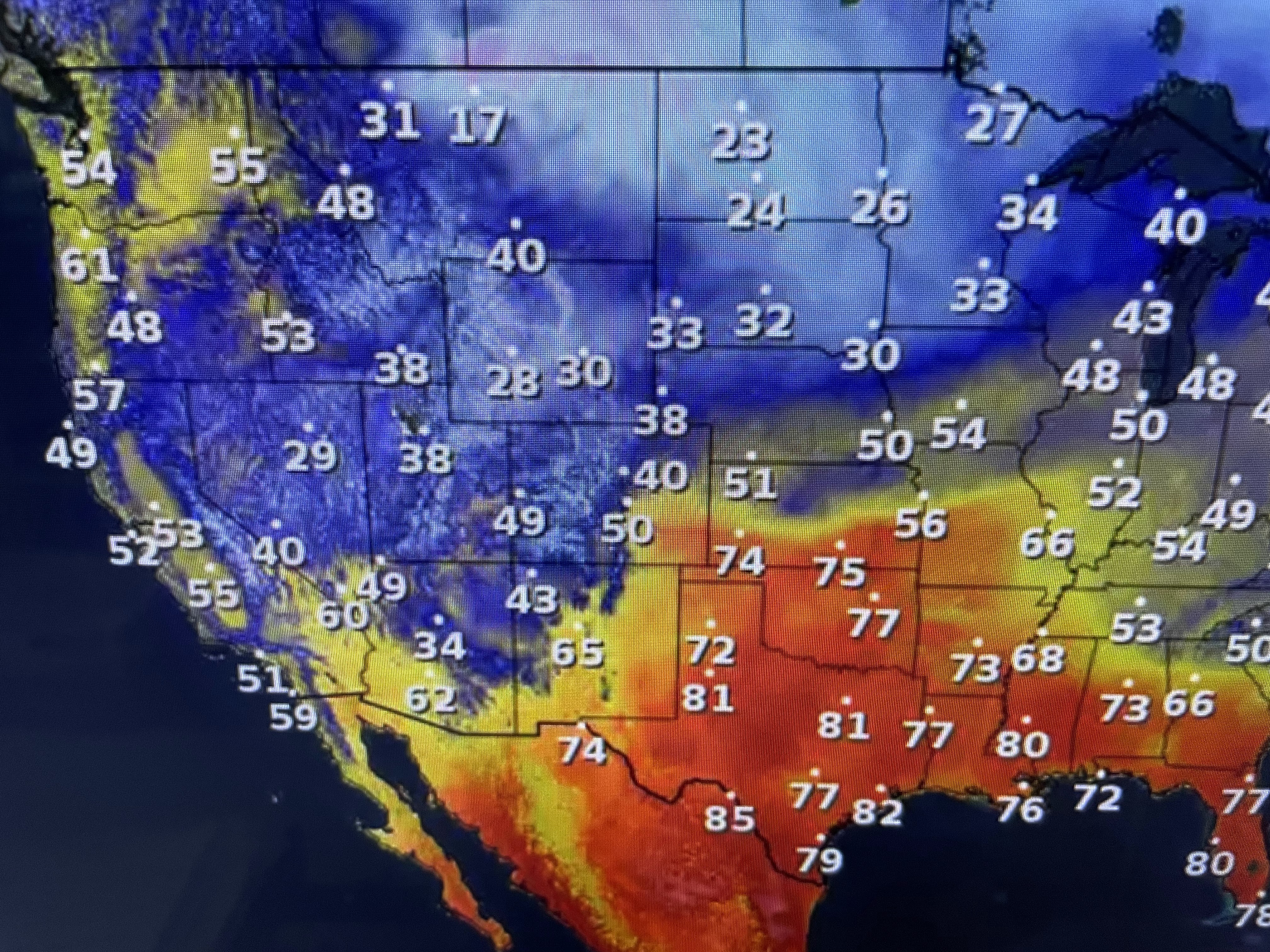
The 80+ warmth to our west in Texas will arrive tomorrow and last into next week. The reason for that cann be see in the upper pattern that has been in place for much of the Winter season. A West Coast upper trough results in a upper ridge over the Southeast. that clearly shows up in the temperatures.


As a cold front approaches us late Friday, SPC is indicating a severe weather risk will get near us.


Since we have lots of time to watch he western system head to the east, I'm not jumping on the bandwagon of anxiety when my gut tells me the severe threat will remain well to our north. We'll revisit this tomorrow.


For now it's back to shorts & t-shirts into early next week. Finally,


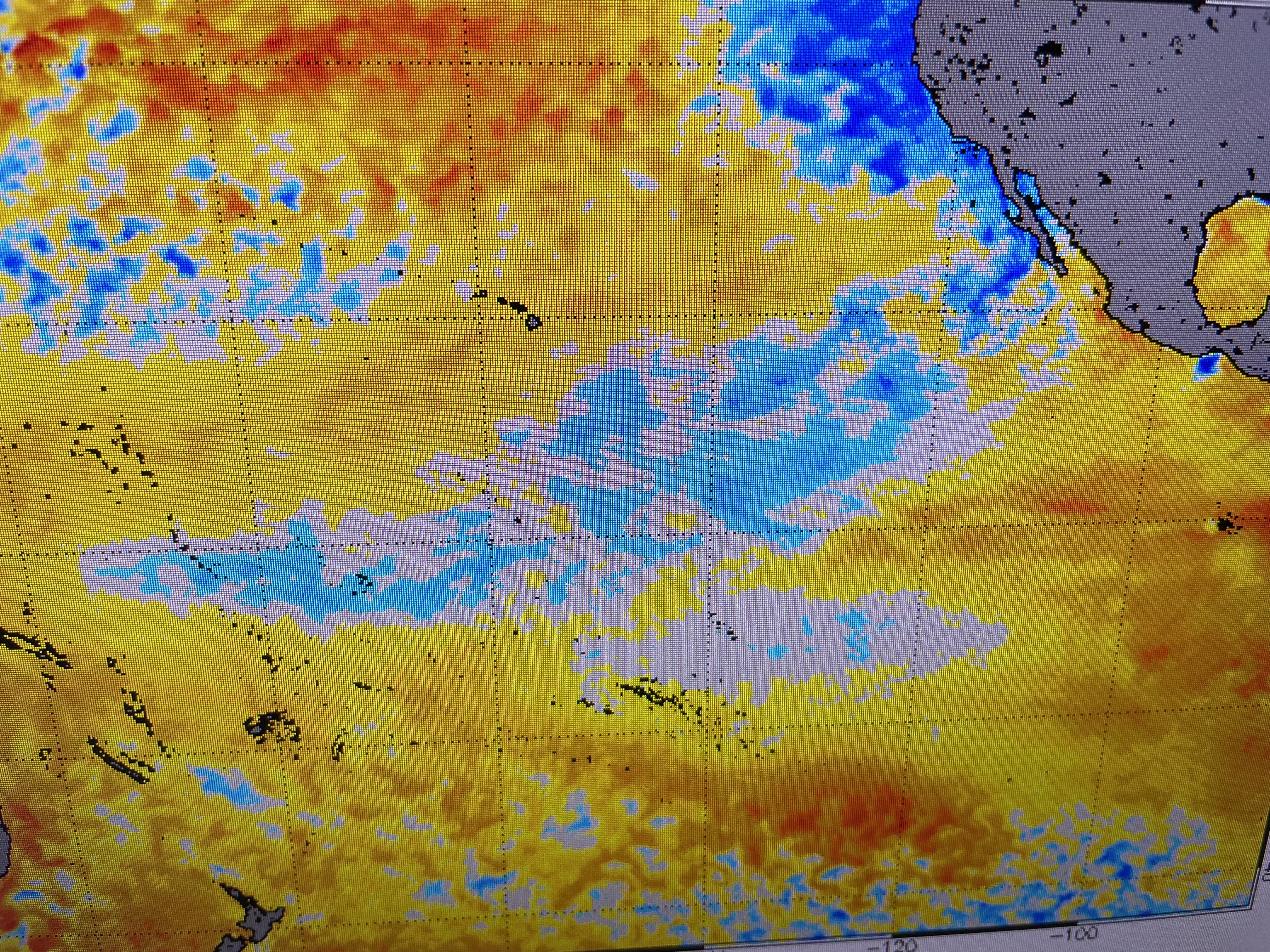
Saw this article over a week ago, but I didn't have a graphic to explain it. Thanks to my friend Ross Hays, here's the sea surface temps since mid December. The middle view is early December when the cold air (blue colors) indicates La Nina conditions persisted. The bottom view is from last week showing most of the blue colors (cold air) gone with the reddish colors blooming off the coast of South America. That signature is one of El Nino and would typically mean fewer storms this hurricane season. Stay tuned!

No comments:
Post a Comment