


It is a rare day in mid summer when we have few, if any showers along the northern Gulf Coast. That will last for much of this week, unless the frontal boundary draped over the northern Gulf gets active and starts drifting northward.


Note the extreme dry air (orange & red colors) on the water vapor view.
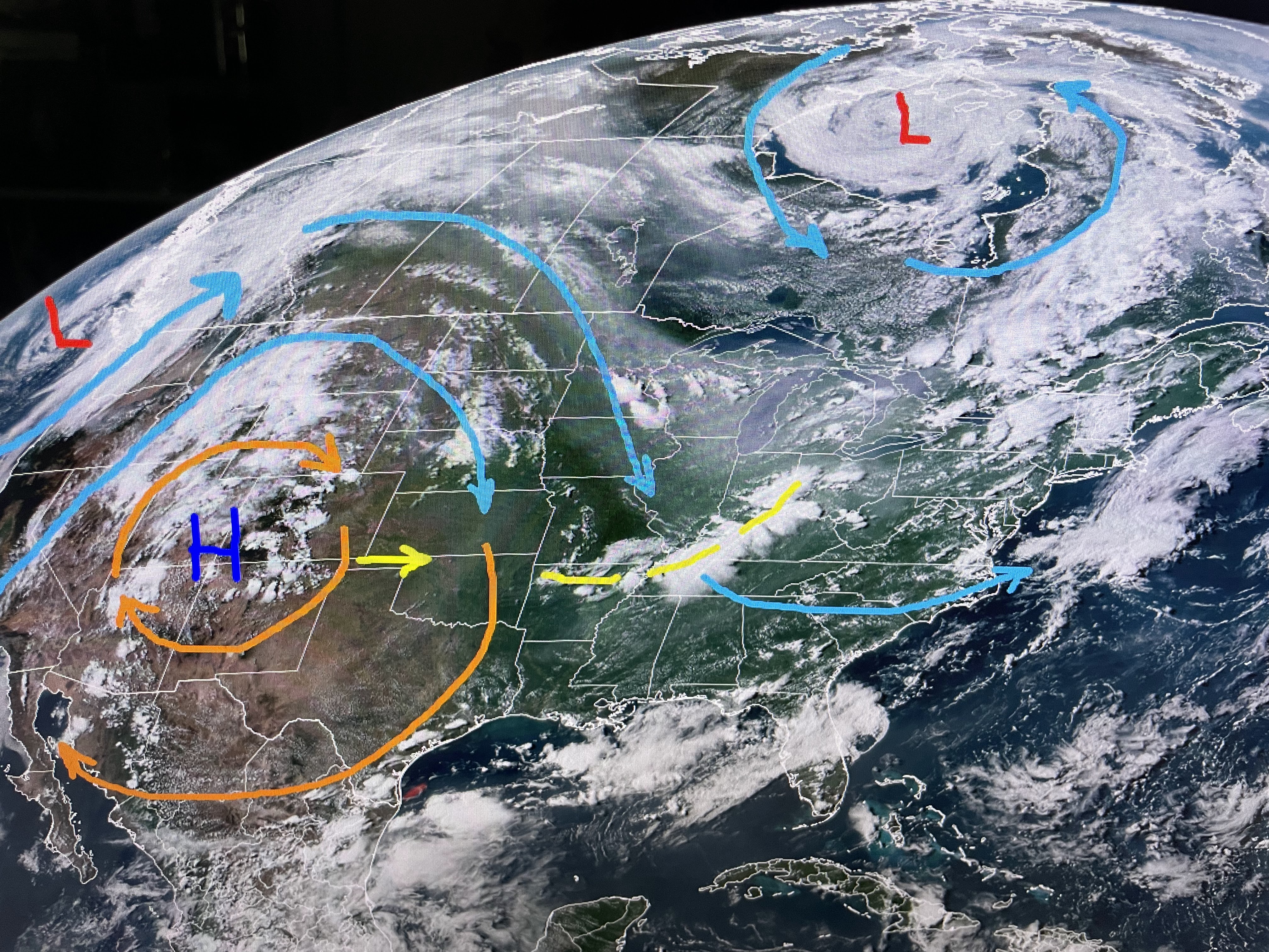

The upper heat dome/High pressure has expanded northward taking the 100 degree heat into Montana.
That dome is forecasted to shift eastward later this week bringing the very hot temps. back to us. Ugh!


That won't stop the International Grand Isle Tarpon Rodeo from having a great weekend. (July 27-29). Don't forget to register (www.tarponrodeo.org) for an opportunity to win the $10,000 Grand Prize. You don't have to come down to the island to fish to win. Just register for $55 and I could be calling your name out Saturday night as the winner of $10K! With 2-3,000 registrations, your odds at winning are way greater than the Lott or Powerball. What are you waiting for?!!!

Those that do fish will have to work around the heat like we do every late July.


You can see the heat across Texas, but in the words of James Carville, " It's the humidity, stupid"! As long as the dew points stay below 70, it won't feel like the heat of 2 weeks ago. You should feel the difference once the sun sets, especially north of Lake P. As for the Tropics,


NHC is highlighting 2 areas with a low chance for development. As we approach August, we expect activity to increase. Just not this weekend & not in the Gulf All Hail Grand Isle! Stay tuned!

No comments:
Post a Comment