


There is no activity in the area highlighted and I guess whatever forms must come from the upper (T.U.T.T.) low NE of the islands? The low off New England is a surface cold low(yellow arrow) so i guess the spin out over the Atlantic is the system NHC will follow.


Locally, our "extreme" heat wave has been broken by the return of the upper trough over the eastern states that allows daily storms to form.


Amazing how most of the country has highs in the 70s & 80s with the 'extreme" heat confined to the desert SW. What makes it feel warmer are the high dew points (75-80) from Texas to Florida.


I have no clue how MSY reached 94 today since their hourly reports only showed 91. We still have some strong storms around and more are likely during the next 3 days.


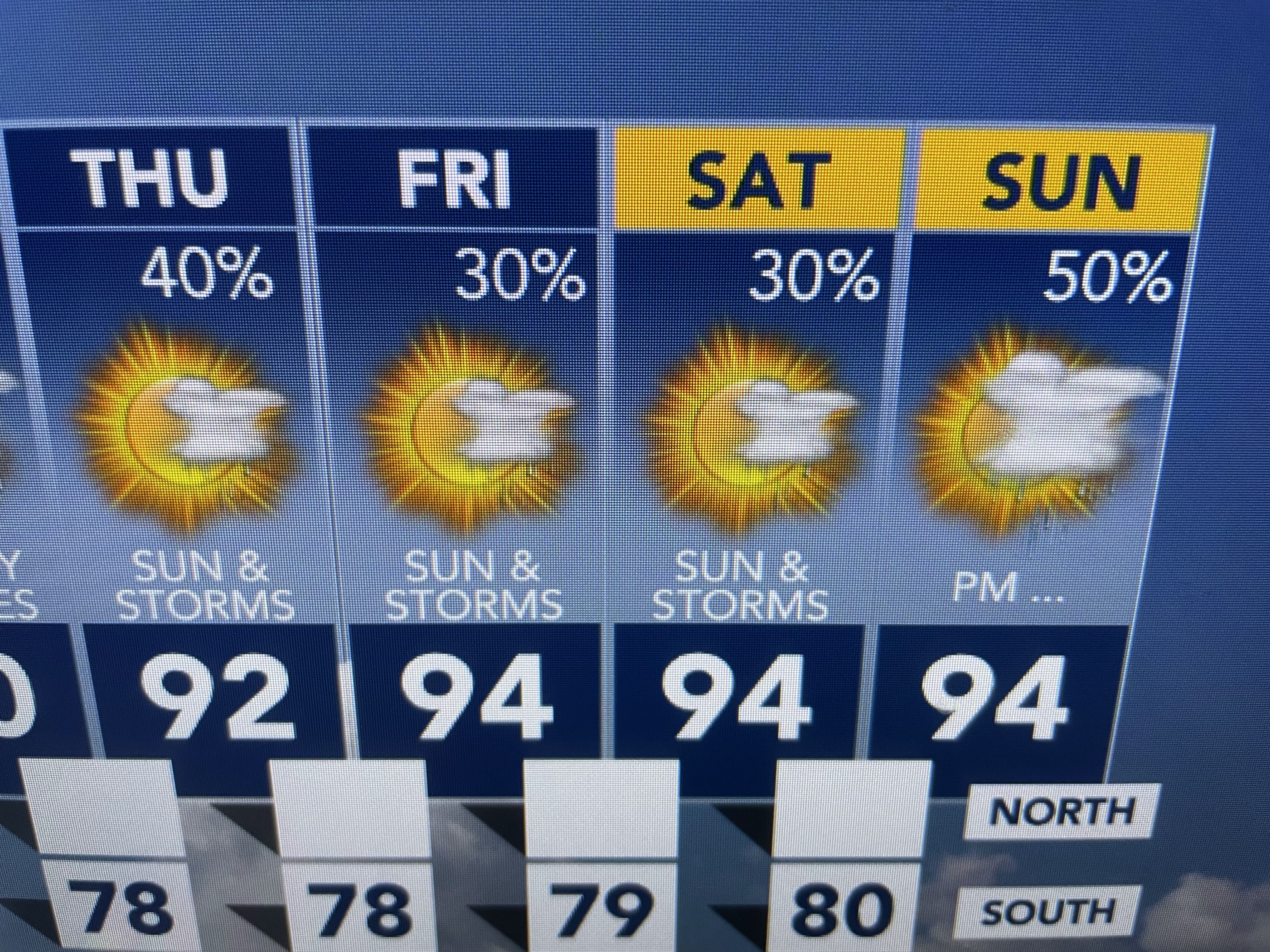
Keep daily rain chances and we stay "less hot". I'm gonna try & fish with Captain Hylton tomorrow & Tuesday. Enjoy the rains! Stay tuned!

No comments:
Post a Comment