Hurricane Calvin is predicted to become a Cat. 2 Hurricane before it crosses cooler water on his way towards Hawaii. There is a compact core of yellows & reds (T-Storms) around his center, but he's in the Pacific. Note the dust coming off of Africa.
The dust layer has shut down the MDR (Main Development Region), however, there is a broad swirl of spinning clouds well east of Bermuda (yellow arrow). NHC indicates some surface winds are gusting to 45-50 mph, but there appears no well defined center. The IR/color view appears to show some clustering of storms around the northern center. If that trend continues, expect NHC to name this system "Sub-tropical Storm Don with a motion to the north. That will keep all the issues out to seas. The other weather news to talk about is the Thursday release of the Drought Monitor.
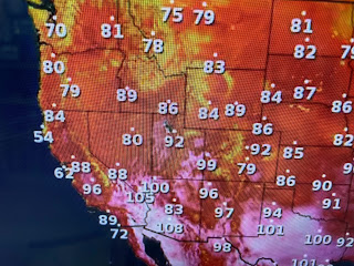
There is a region in the nation's bread basket (Nebraska, Kansas & Missouri) that really needs rain. But look at the West. All those storms that battered California into Colorado this past Winter clearly wiped out their drought. Satellite views reveal no smoke plumes with plenty of sunny skies with the typical desert heat over the Southwest.
The fires this year are up over Canada where it didn't snow much this past Winter. Look at the smoke plume that heads into Minnesota.
Does that mean there will be no fires out west? Nah, just means it will take longer for them to get going, but the Winter rains have created lots of lush vegetation that will provide fuel for the August/September fire season. Hopefully the El Nino brings an early start to the Fall rainy season out there.
Otherwise there is not much to talk about as the upper pattern remains stuck. The heat dome is to our west while the eastern upper trough creates a spreading out of the upper winds (Divergence) that enhance rising air at the surface. Two such clusters (green areas) are rotating around the ring of fire with most of the action today to our north and east.
Since we missed the rain, we're very hot again. The seven day holds on to that pattern through the weekend with a hint of the heat dome coming back for next week.
No models indicate any tropical activity coming during the next 10-14 days and that almost gets us into August. Finally...
We all see the daily hyping of extreme everything (tornadoes, floods, drought, heat etc) that the media seems to thrive on. Here's an example that both Bruce last night and Zack this morning highlighted on their broadcasts. Yesterday's high was reported as 98 by NWS, but what should jump out to you about the MSY reading? Everything around it was 3-4 degrees lower. Could it be the station siting near one of the runways & new terminal buildings makes the reading inaccurate? Hummm? Don't forget to go to www.tarponrodeo.org to register for the chance to win $10,000 at this year's Grand Isle Tarpon Rodeo July 27-29. You don't have to fish or attend. Just register for $45 and you're in on an opportunity to pay some bills! I'll be way from my computer for a few days unless something exciting happens. Stay tuned!


No comments:
Post a Comment