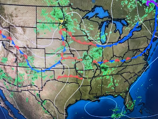
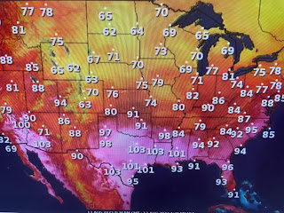
It appears today's high will stop short of 100, but more encouraging is the upper dip coming down across the northern Plains. Even at 4 PM, temps are only in the 60s & 70s. If you believe the models, that upper trough will drive a weak cool front down to us late Tuesday into Wednesday.
The main benefit from this front will be lower dew points, especially on the North Shore. That should result in cooler night time lows.
So the upper high will reform out over the western states for the first half of this week allowing for the potential for daytime heating storms to develop here. Don't get use to it as models bring the upper high back eastward later this week.
As much as we hate the brutal heat caused by the upper heat dome, it will keep us protected from any tropical activity as we head into late August. NHC has highlighted an area way out in the eastern Atlantic for possible development later this week.
There is still a huge plume of Saharan dust pouring out over the Atlantic, so that should hinder any development.
No rain around again today, but that stuff farther to our north will be sinking our way. Hopefully, late Monday ,but especially on Tuesday, we should see much better rain coverage & that should mean less hot. Stay tuned!


No comments:
Post a Comment