As you can see, temps. are mainly in the 80s with some 70s along the coast with nearby showers. The real chilly air remains along the West Coast & up in Canada and shows no signs of coming our way before late next week.
I've drawn the lazy upper flow on the satellite view, but you can see we have no fronts around except the old boundary across the northern Gulf.
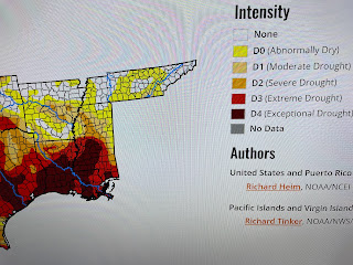
The same sorry story continues over the Ohio River & Upper Mississippi River Basins. Very little rainfall today except over Ohio & Pennsylvania. So looking ahead for the next week gives us little hope in ending our dry conditions.
The Gulf has lots of unorganized showers with many little swirls of low pressure. NHC isn't concerned about any development. Out over the Atlantic, we have another named storm (Rina) that will not threaten any land areas.
Rina is the eastern storm with Philippe being the western storm. Only shipping need worry about these storms. Models are hinting at our first REAL cold front coming for NEXT weekend. The GFS also tries to form a storm off the Louisiana coast at day 14. These will be two things to watch as we get into October. Stay tuned!


No comments:
Post a Comment