


The SL refers to short & long term impacts, and you can see how the bright reds & deep reds (Severe/exceptional) have overspread SE LA/MS. But before you join the herd and start clearing out the water from the grocery stores, a word of warning. I typically keep 4 cases of the 16 oz. bottles in my garage during the hurricane. However, my wife noticed a distinctive taste difference one day this summer, and I learned when water stored in PLASTIC bottles sits for weeks in high (85 + degrees) temperatures, there is a chemical reaction between the bottle & water, A fast rule of thumb. Keep only enough water you will use in a week (or two at most) or you risk water contamination with the plastic.


The salt wedge is not predicted to reach Orleans parish until Oct. 8th IF no rain falls upriver from us. That's 2 1/2 weeks from now. Only stock up on enough water for a week. That way no one will run out since it allows stores to keep restocking. The other big news is the Tropics.


Two systems will be named in the next 2 days. The disturbance off of Africa has a nice low level swirl, but it's so far out that we have 2 weeks to watch it. However, the developing disturbance off the U.S. east coast should be named Ophelia by Friday morning.


The Infrared (color) satellite view has no storms yet around the broad low level center, but as the system passes over the Gulf Stream tonight and on Friday, don't be surprised to see the rapid intensification like previous storms this hurricane season. PTC 16 will pass over the highest heat content on Friday.


NHC is calling this disturbance PTC (Potential Tropical Cyclone) # 16 as it allows them to begin the warning process for the coastal communities from N.C. to New Jersey. IF you have travel plans for the East Coast Saturday or Sunday, soon to be Ophelia will cause travel delays. Back over the U.S., we wait for the trough to dive over the eastern states.


We want a real cold front, but the upper trough remains over the West Coast where sweaters & jackets are needed. In addition, despite only a few wildfires out west, the circulation around the upper low is bringing the smoke plume back over California where air quality alerts are up.

Canada has many wildfires out of control, but the number of fires in the U.S. is way lower than last year.


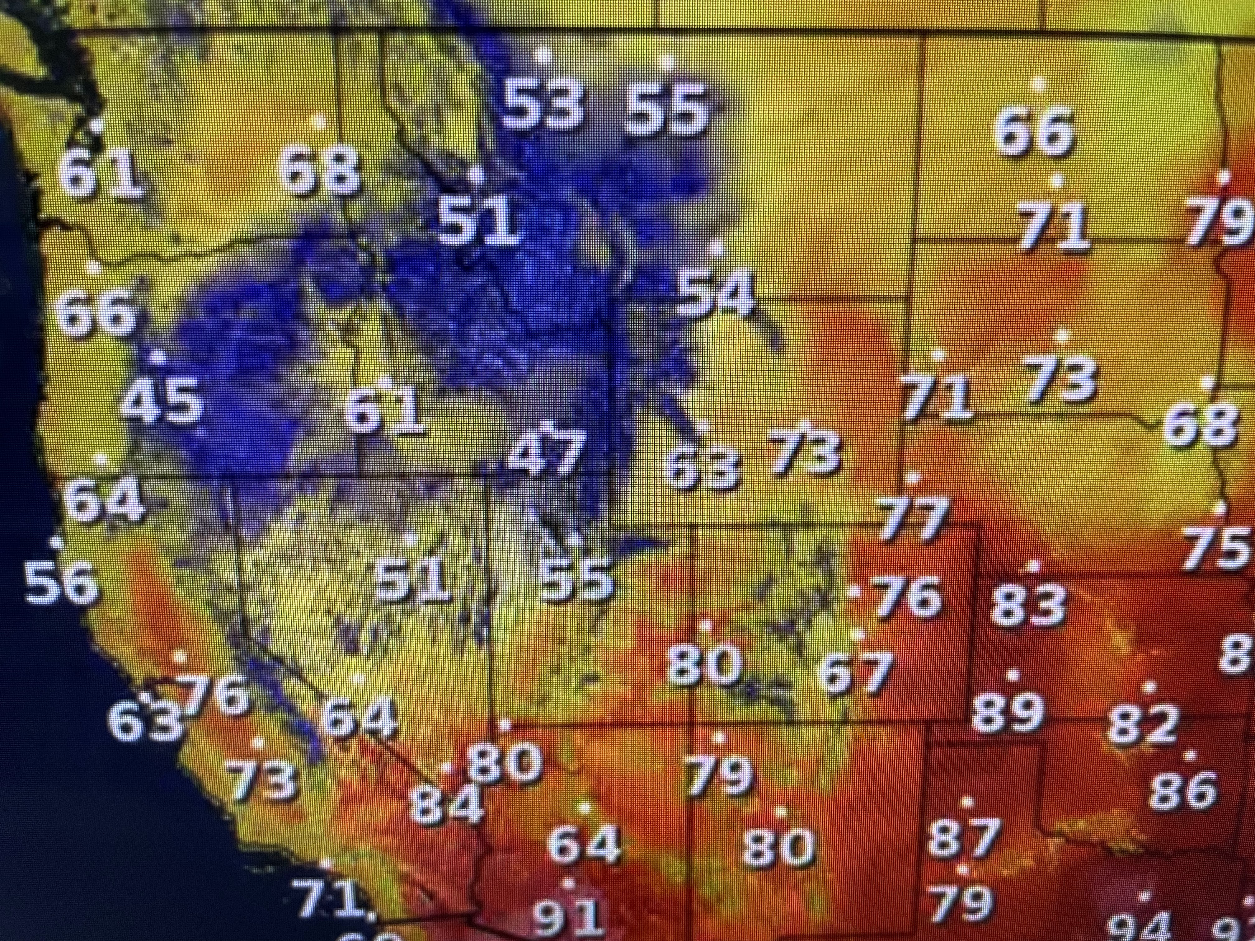
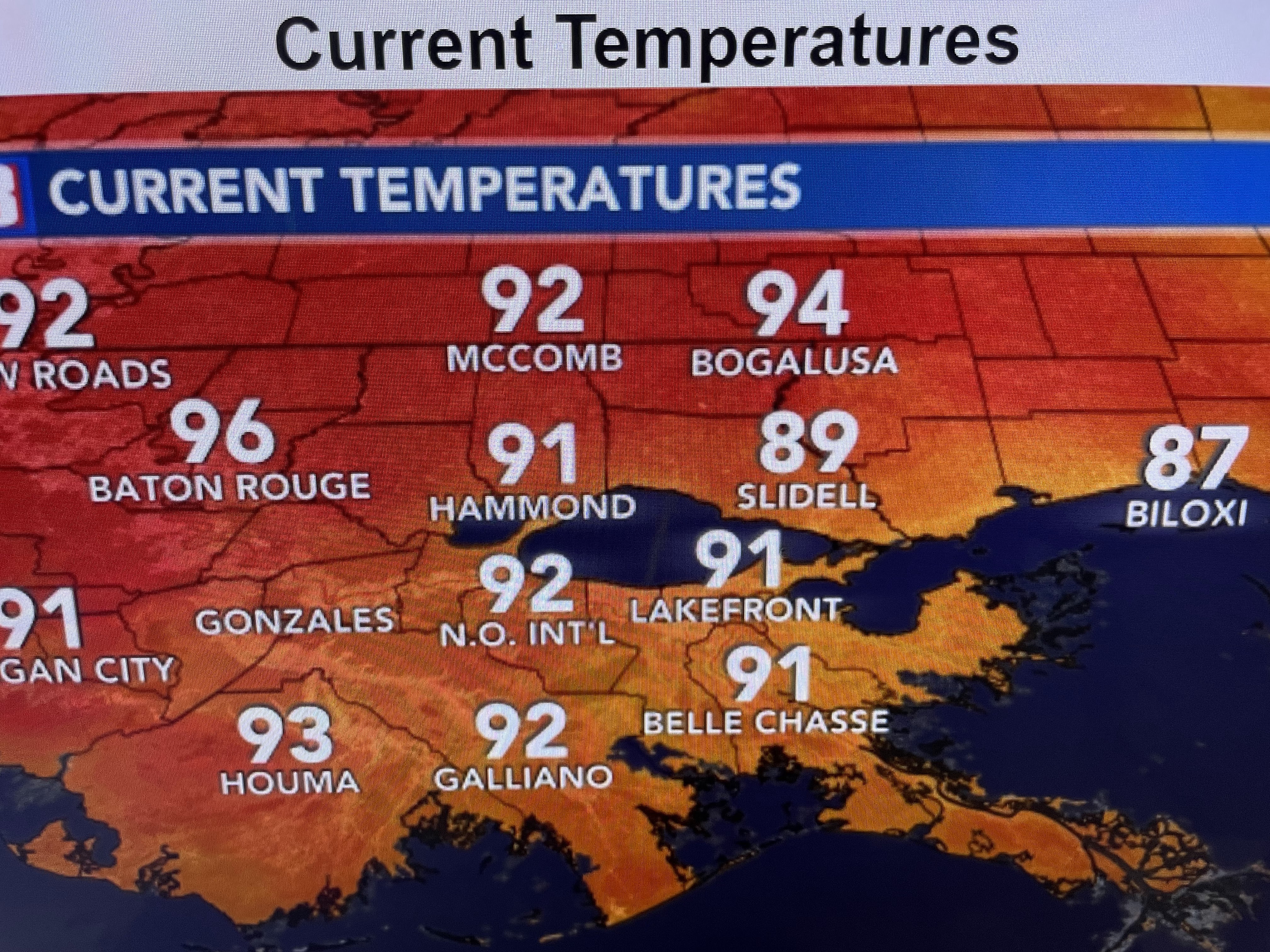
Some rain is falling over the Plains, but we need a lot more to help get the river levels up on the lower Mississippi. Dew points are back 70+ so the 90+ current temps feel really hot.


I wish I could offer some hope in the short term, but it appears the summer from hell will linger into October.


Fall officially begins at 1:50 AM on Saturday, but it won't feel like Fall for another 10-14 days. Ugh! Thankfully, none of the models have tropical development in the Caribbean or Gulf for the next 10-14 days. Stay tuned!

No comments:
Post a Comment