


Not sure, but I think today's high will be below 90. Yippee! The upper high has moved to our west and north as an upper low is drifting out of Louisiana and into east Texas. That places us in a stream of moisture coming out of the Gulf.

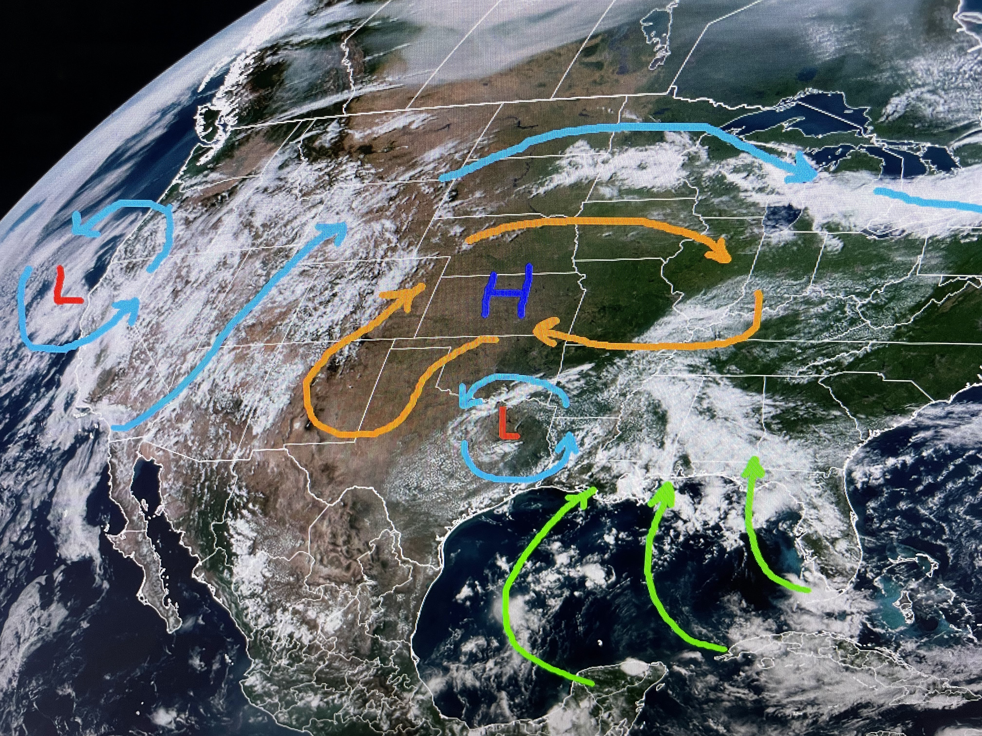


Look for that pattern to continue for another 2 days before drier air spa back in on Tuesday.

The Tropics have little activity as most of the action is in the mid-latitude areas of the Atlantic.

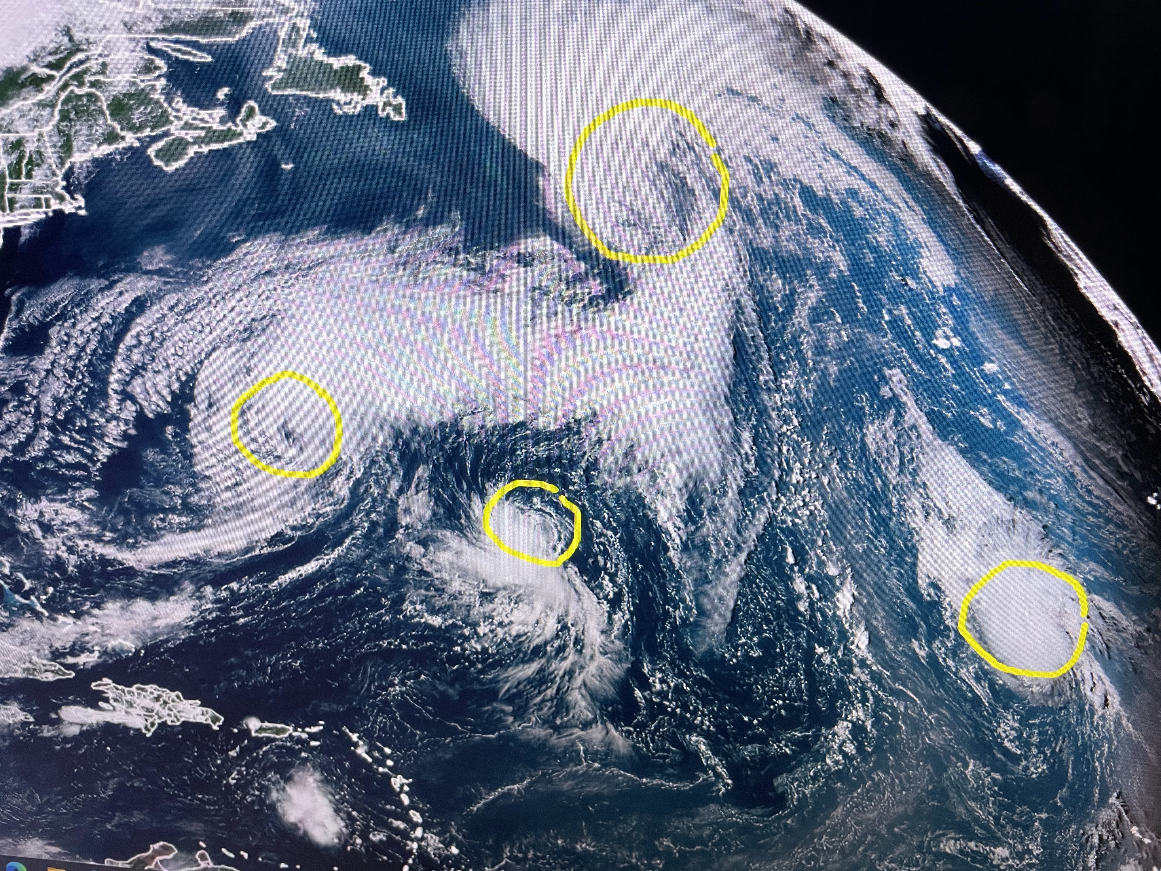


There is an area (Invest 85L) way out off of Africa that is likely to slowly develop as it heads towards the islands by late next week. We'll have plenty of time to watch it. As Bruce Katz said yesterday, " every week in September without a tropical threat is a win for us." How about for 2 weeks? Computer models indicate nothing in the Gulf through the 15th Better yet, they are hinting at a REAL cold front pushing into the Gulf around Sept. 20th. Bring it on! Finally...

Look at the smoke over Canada where the wild fires continues. They need rain in a big way this Fall, but so do we.


The Drought monitor for the past two weeks has the red (extreme) area growing from the South Shore to all of the North Shore into Mississippi. The top is last week with the bottom being for this week. Let's hope we get some god soakers during the next two das. Stay tuned!

No comments:
Post a Comment