


Those who left for the Florida beaches this weekend are not happy campers as hey have more clouds & storms. But at least we have no tropical activity around nor should we for the next 5-7 days.


All the action is far out over the Atlantic with the system coming off of Africa having the best chances of bein our next (Katia) named storm. Long time to watch it.


The good feel air we enjoyed as Idalia passed to our east is gone as the higher dew points (70+) are back.


A couple of storms has fired off giving some folks brief cooling relief.

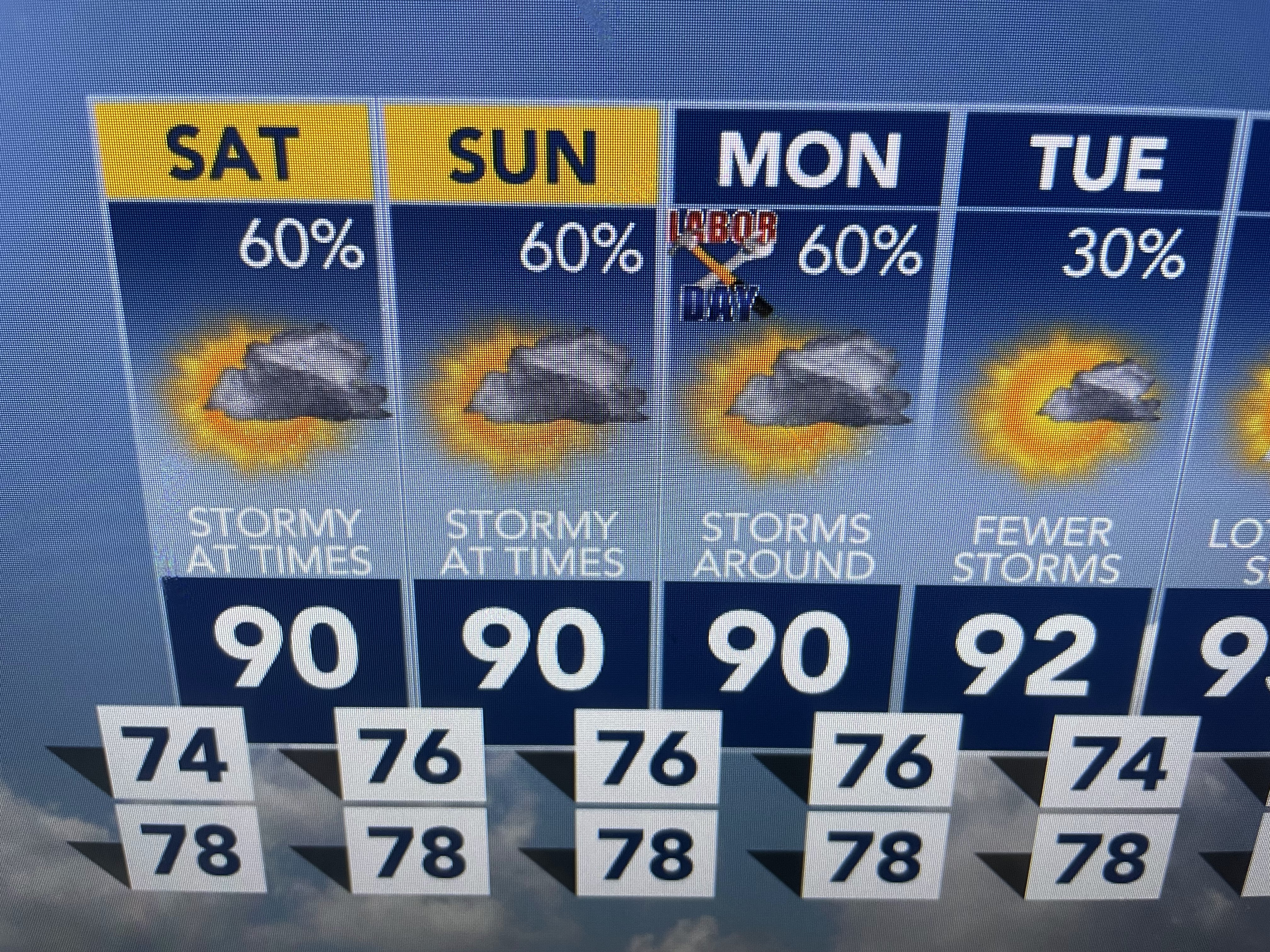

Until the upper low pulls away, expect pretty good chance (60%+) for the next 2-3 days. No real cold front is in sight. But there is hope up north.


Canada is getting colder and we'll start to see some real fronts head our way after the 15th of this month. Today is the beginning of "Meteorological Fall". Hurricane Idalia churned up some cooling water over the eastern Gulf. Now we just need those fronts to start coming! Enjoy your weekend and stay tuned!

No comments:
Post a Comment