Friday, October 13, 2023

Rains Are Falling To Our North, Sweater Weather Returning This Weekend

We have been told many times that it has to start raining over the Upper Mississippi & Ohio  River Valley for the flow down here on the Mississippi to increase enough to stop the salt water wedge from coming northward.  A potent surface low is moving across the upper Midwest triggering a wide spread rain shield that is much needed.


The top radar view is from 10 AM with the next view from 5 PM.  Note how chilly (40s & 50s)  the air is behind this system and it will be arriving later Saturday afternoon.


Our next push of cooler air is being driven by another dip in the East Coast upper trough.  You'll need sweaters & jackets by later Saturday afternoon and highs Sunday & Monday will struggle to top 70.


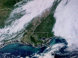
We were lucky to see the low cloud deck pull away from us allowing for the Sun to warm us back into the 80s.


It was not a pretty day once east of Biloxi.  Finally. storms are coming to the West Coast.


With an El Nino Winter coming, that usually means California gets wet & snowy along with the southern states and Northeast.  Could we see some snow?   I say bring it on!  Enjoy your dry & cooler weekend.  Stay tuned

No comments: