


Winter-like lows can have some of the same impacts of a Tropical Storm or Hurricane, but usually not as intense. Fortunately, they typically move much quicker & don't linger like the slow moving summer hurricanes. We need more of these winter-like lows to end the wide spread drought conditions across the heart of our nation.
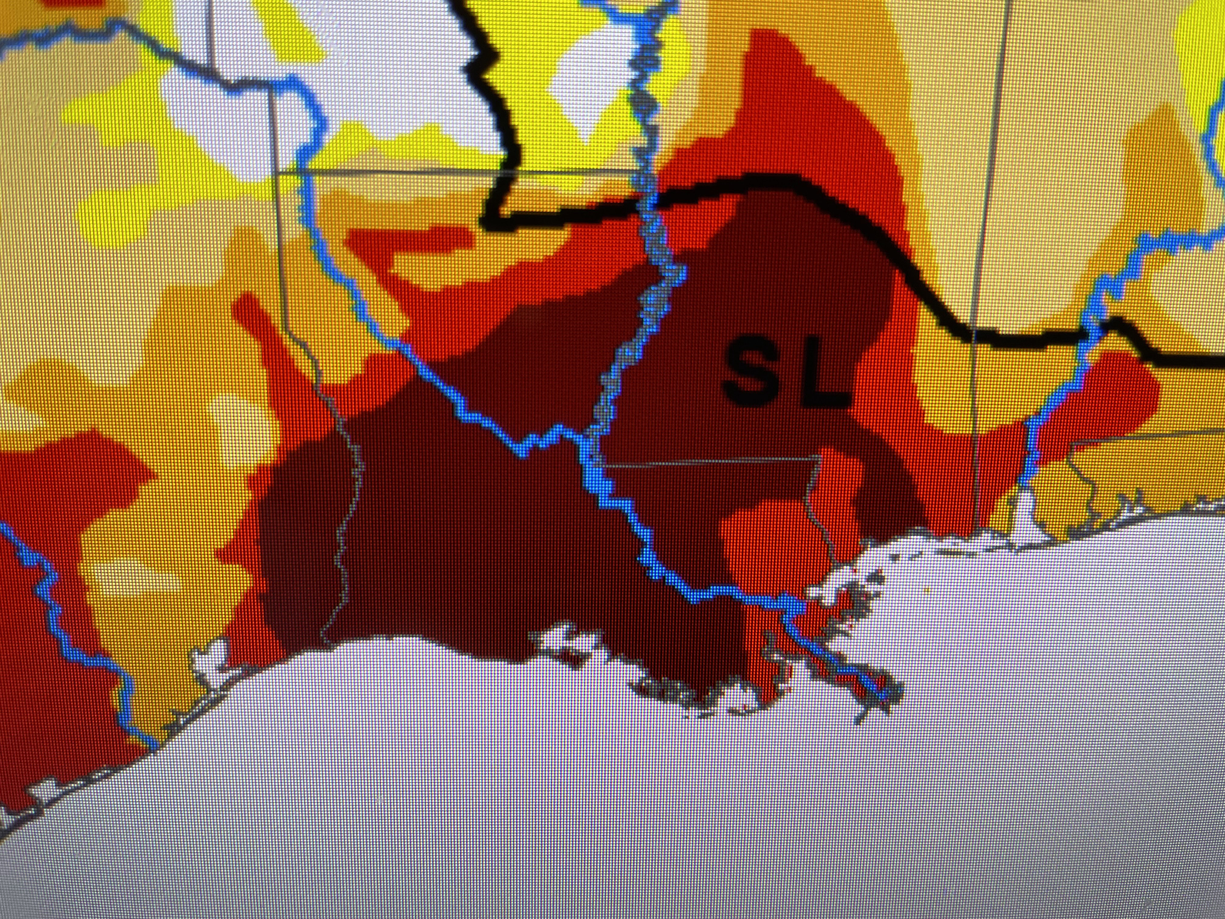


The new drought monitor does not include yesterday's 1-2" of rainfall. It did help some, but we need much more especially farther to the north. And one such storm is coming out of the Rockies.


This is a classic winter storm set up with warm air (70s & 80s) stream northward over running cooler air to the north with a large rain band stretching west to east. On the backside of this system, snow is falling over the Rockies as temps dip into the 30s.


As sunshine returns tomorrow, look for highs to soar back to 80+ ahead of the next cold front that arrives before dawn on Saturday. Although this front will bring storms farther to the north, it'll come through us mostly dry.


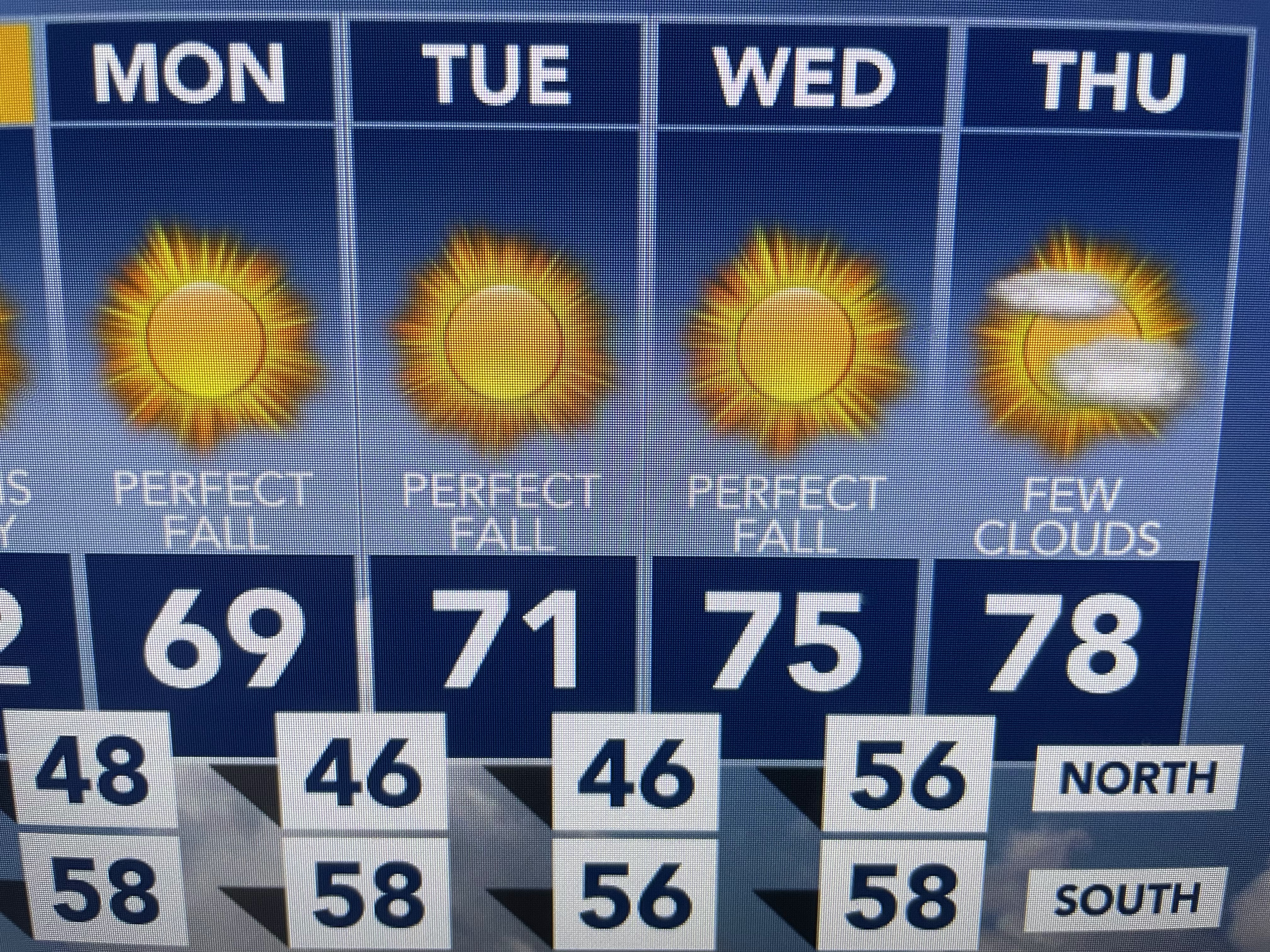
This next front will be a little stronger than the last as highs Sunday into Tuesday will struggle to get out of the 60s. Humidity will be much lower behind the front and you'll need sweaters & jackets especially after dark. It's the kind of weather we all knew was coming and, after June, July, August & much of September, is well deserved! Enjoy! Stay tuned!

No comments:
Post a Comment