We still have to get through 3 more days of 90+ before the cooling arrives as the upper ridge hangs tough over the eastern states.
So the next question is, will this front bring lots of rain? Yes, but not here.
The upper Texas coast is seeing some welcomed rains, but that cluster is not coming our way. Look at how warm it is under the upper ridge and how chilly it is under the trough over the Rockies.
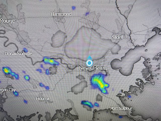
So nice to see some rain on radar. Don't look for widespread showers with this front with the better chances coming late Friday. There's still a smoke plume just to our east and we could see hazy skies the next few days.
There is only one weak storm out in the Atlantic.
Philippe is barely a Tropical Storm moving north of the Virgin Islands and no model develops anything in the next 7-10 days. Let's get ready to open our windows this weekend and enjoy the feel of Autumn. Stay tuned!


No comments:
Post a Comment