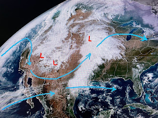
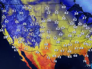
That split today is over Texas & Oklahoma, but will shift into Louisiana tomorrow. So why do we have no T-Storms breaking out yet? Blame it on lack of Gulf moisture as seen in the dew points.
But that will be changing as the return flow from the Gulf is rapidly increasing. You'll notice a different feel to the air on Monday.
This could turn out to be a powerful storm coming out of the Plains heading up the East Coast on Wednesday. That could really impact travel plans for Thanksgiving for many. here's the timing for us.
Hannah Gard showed the computer model bringing us strong storms after dark tomorrow. Most of the activity should be gone before daybreak on Tuesday. Make sure your FOX 8 Weather App is updated with all alerts on if warnings are issued. Check with Amber Wheeler tonight at 9 PM for the latest model update. It will turn much colder behind this front.
The weather question for Thanksgiving is, how far will the front get into the Gulf before stalling? We could see a cold rain shield spread northward over us making for a cold Turkey day. Stay tuned!


No comments:
Post a Comment