


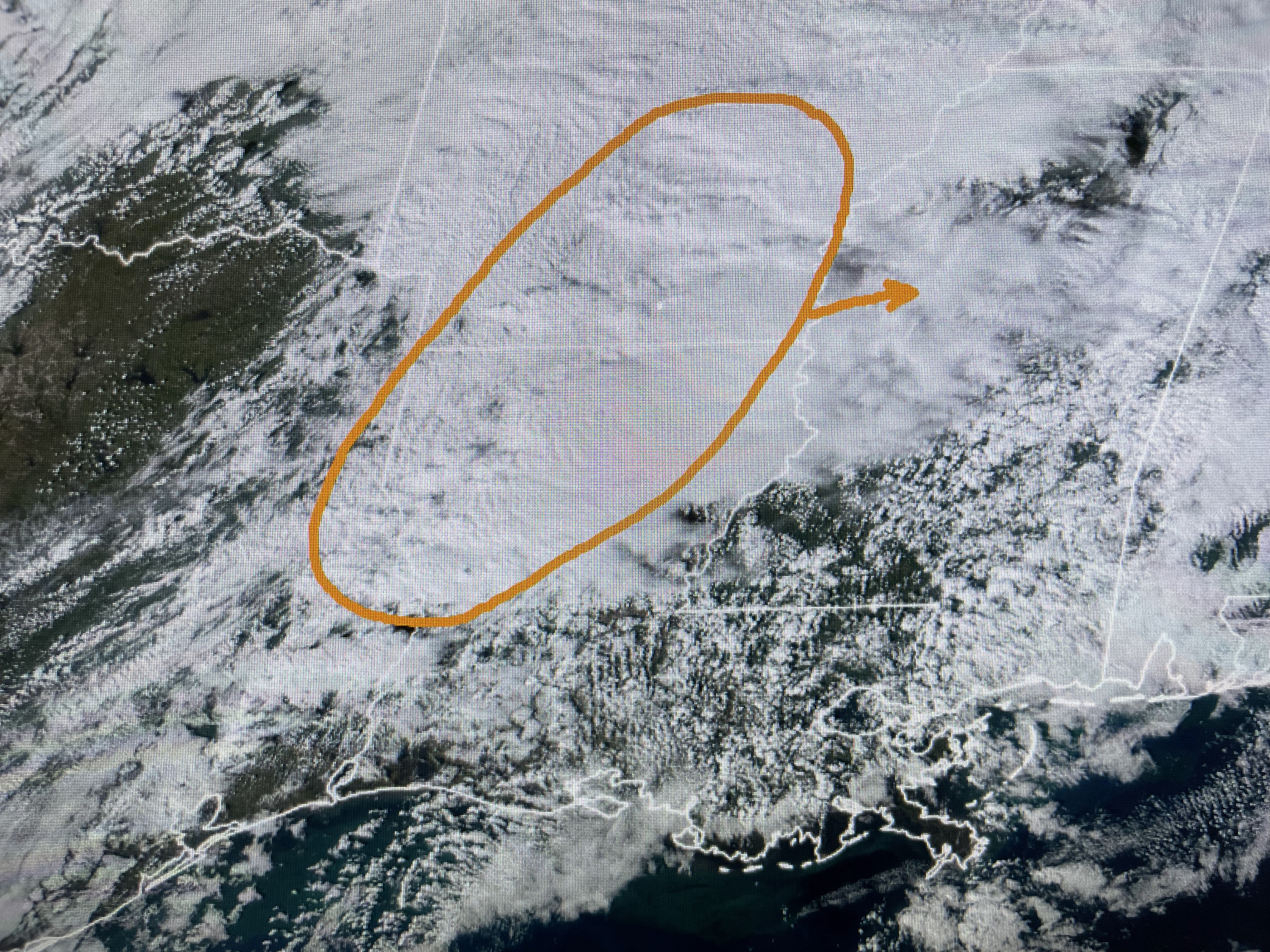


The orange circle is where I'm seeing the splitting of the upper winds. The radar returns are indicating the current storms over Louisiana will stay well north of Lake Pontchartrain and that is where SPC & The Weather Channel's TorCon (Tornado Conditions) index places it.


How ironic it is that today's greatest severe threat is right where November climatology (bottom map) says it should be. I'm hoping as the upper energy lifts farther to the NE, it'll take the strongest storms away from us. So what we want to be watching this evening is back to our west. Will we see a squall line develop? Not seeing it yet.


So here's the timing from the model Nicondra used at noon.


Of course, timing may change. but what I'm seeing is the greatest/best chance for severe weather will be between 11 PM & 4 AM. Since most of us will be sleeping, make sure your FOX 8 Weather App is all set up in case warnings come out. FOX 8 will stay on the air as long as the danger exists.


I do not cry wolf, but it has been a long time since we have had to deal with severe weather. Let's just pay attention after dark. Make sure you watch the early and especially the 9 PM news with Bruce Katz for the latest updates. The set up is classic with a deepening surface low, cold air to the north and a surge of Gulf warmth (80s) & moisture (dew points 70+) that shouts severe weather. My gut says it will stay well north of Lake Pontchartrain, but too close to say zero threat.

The cold front will stall out over the northern Gulf and we're likely to see a cold rain shield spread back over us for Thanksgiving. I will be with family/grandson this Thanksgiving so I might not post for several days. Stay alert this evening and let's hope we'll all be thankful for no damage as we celebrate the holiday. Stay tuned!

No comments:
Post a Comment