


We currently are the driest year since records began (1946) at MSY. That won't last as we'll get 1-2" tomorrow. The other record is top 10 wettest Decembers. We currently stand at 7.40". IF we get 2+" tomorrow, that'll vault us to # 7 wettest Decembers. Sure looks possible. Check out what's coming.


The top satellite view indicates we won't see any sunshine on Sunday. The radar view has a cluster of heavier showers along the lower Texas coast and they're moving to the NE. The next graphics are from Zack Fradella's morning program. NWS has us in a level 2 (slight) flood risk for Sunday. You can see the rain potential map hints at a heavier band of rainfall developing in a "training situation" across parts of NOLA. That's why there is a FOX 8 First Alert for the POTENTIAL for street flooding for Christmas Eve. Here's the timing.

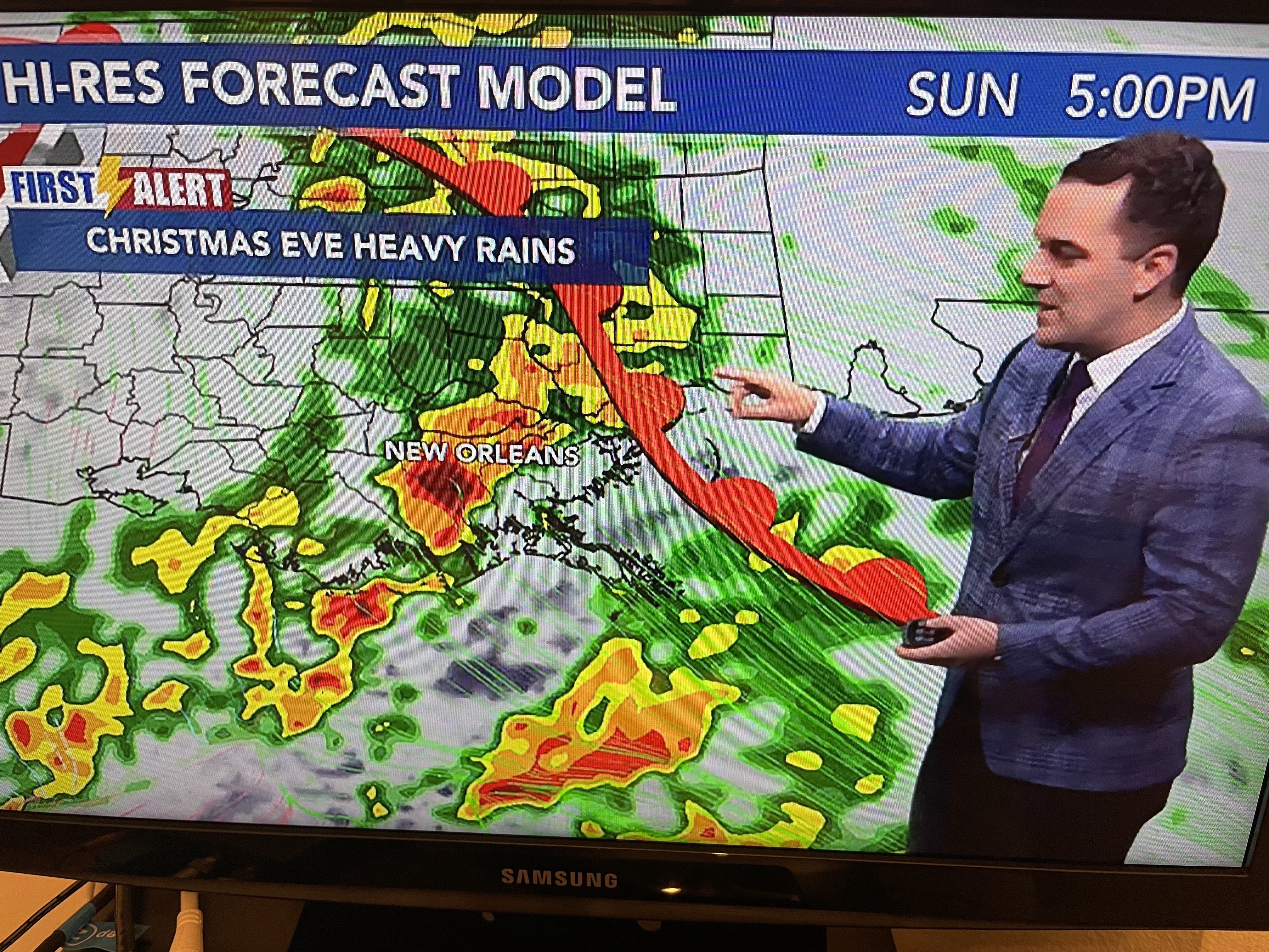


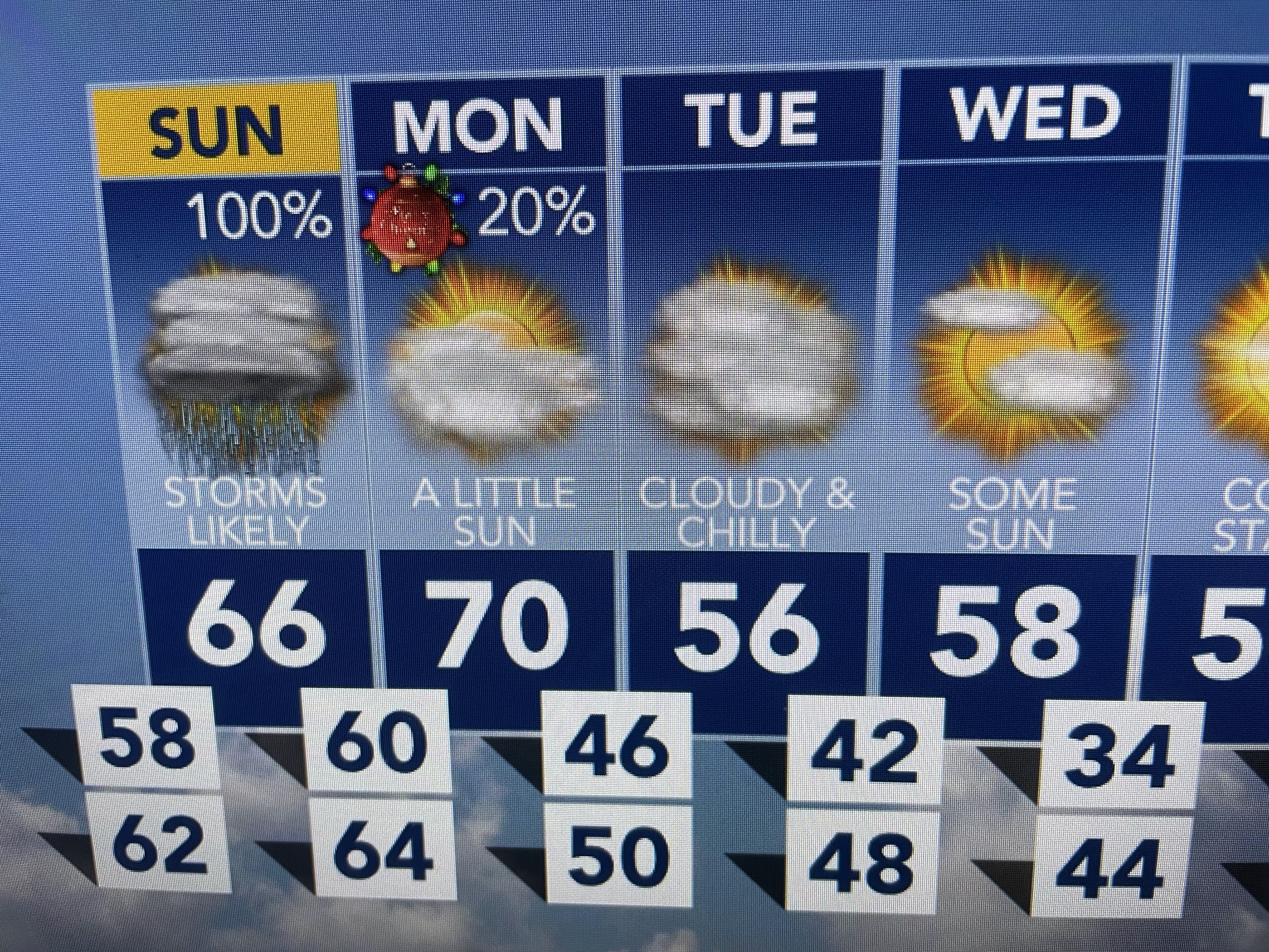
Based on this morning's model run, the heaviest rains will come through Sunday afternoon. IF the model is correct, all the rains will be gone before Monday daybreak. Christmas Day looks to see some sunshine with comfortable temperatures and lower humidity.


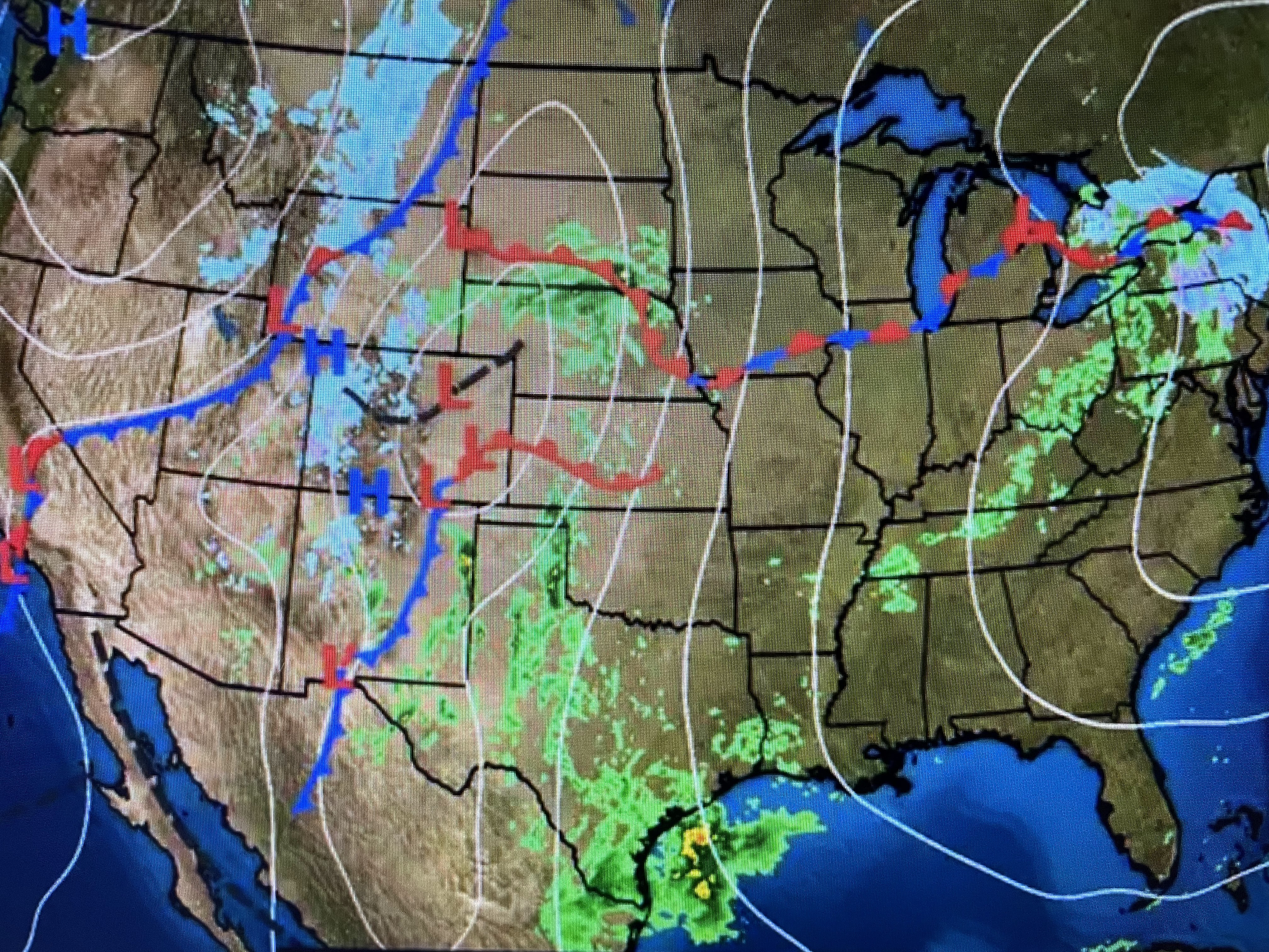


The disturbance that is triggering our approaching weather is the same one that drenched the West Coast on Friday/ Since the center of the surface low will form over the central Plains, there is little cold air to produce snow. However, as the low deepens, it'll tap the Canadian cold air producing snow on the backside of the storm. NWS has a graphic indicating blizzard conditions are possible. For us, tomorrow, we'll be in the warm air sector. Christmas Day will be drier but sunshine should get us back to 70+ before a much colder pattern develops for the end of next week into the first week in January.


Computer guidance may not be cold enough for next week. North Shore may have to deal with freezing temperatures, but we should be OK south of Lake P. Enjoy your weekend and stay tuned!

No comments:
Post a Comment