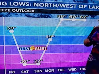
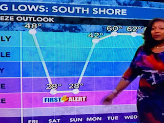
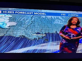
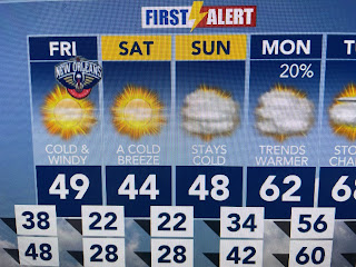
The bottom graphic is this afternoon's temperatures up in Canada. Unlike this past weekend, the air there is not as cold. In fact, most stations are only single digit below zero. Last week had 30-50 below zero readings. Still the coming cold has NWS issuing Freeze watches for Saturday & Sunday mornings.
I grabbed these graphics off of Nicondra's 4 PM program.
The front sweeps through near midnight with strong north winds bringing the cold feel back requiring heavy coats once again. Ahead of the front today, we enjoyed a Spring preview.
Highs across south Louisiana were 20-25 degrees warmer than yesterday. We have no freeze issues tonight. The hard freeze precautions will be needed tomorrow night & on Sunday morning, Look at the warm up for next week.
However, with the return of warmer air will come a heavy rain threat.


No comments:
Post a Comment