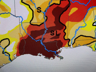
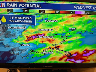
The middle graphic is from early February with the bottom the most recent. But look at the rainfall total forecast for the next 3 days. In the broad brush top view, the red & oranges indicate 2-4"+ amounts.
The next 2 views are more focused, but remember, we're still 2 days out. These graphics will change. Bottom line, we have 2 opportunities this week for more soaking, possibly flooding rains.
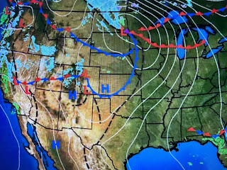
So what will cause us rain issues? Wish I could show you the disturbances on satellite views, but I can't. I've drawn the upper flow on top of the clouds and the southern stream (sub-tropical) remains right over us.
There is a weak disturbance off the Florida coast, but I can't see anything coming to our west.
What ground truth data does show is Springtime warmth (Chicago 70+!) surging out of the Gulf with mid to upper 60 dew points. That will provide the fuel for the rainfall & possibly severe storms.
As Hannah Gard showed us this morning, the SPC severe risk is only level one. Here's the computer timing from this morning.


No comments:
Post a Comment