


Notice another disturbance is firing off a new round of storms near Houston that will head our way after 10 PM tonight. So what is causing all this unsettled weather to linger through this holiday weekend? Blame it on a "cut off" upper low stalled over the Southwest. That is keeping a stream of disturbances tracking over the Gulf coastal states.


It appears we'll have to wait until Monday before we shift to a more WNW upper flow that will drive cooler & drier air back for next week.


It'll be back to sweaters & jackets next week, but the cool-down won't be extreme.


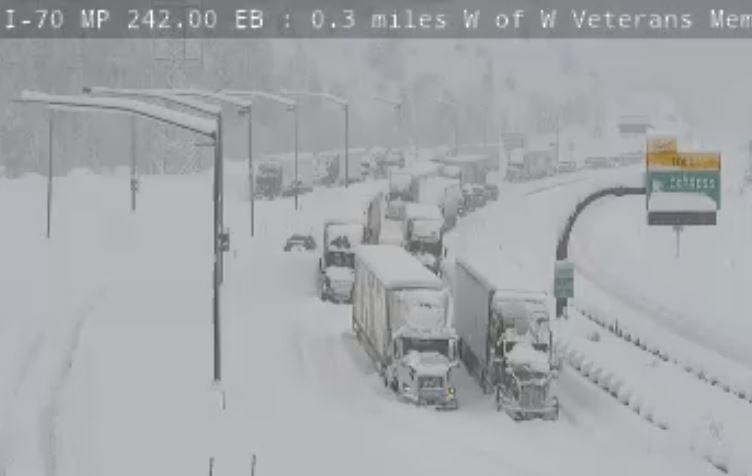
Night-time lows on the North Shore next week could dip into the 30s so if you've planted any tropical plants, you might need to cover them? South Shore will have no problems. Finally for you snow geeks, here are more pictures. We begin with I-70 which was closed at Silverthorne in BOTH directions! A trucker's nightmare!


There actually is outdoor furniture on the deck! Here are more views from Evergreen up at 7500' west of Denver.


I'm told that little dip in the snow is a small koi pond! Don't worry, the fish will be fine. But what views of a fresh snow cover. Here, we're dealing with more stormy periods coming this weekend. It won't rain all the time with many dry hours between storms. Just hate to see it rain on a big parade weekend. Hopefully, next weekend will be drier? Stay tuned!

No comments:
Post a Comment