


Last night's cold front has sagged into the Gulf and has fallen apart as a new boundary is trying to redevelop closer to us. That will be the key to the heavy rainfall. Will the boundary shift to our north putting the heaviest rains north of the Lake? Will it form right over the city? Those are the difficult problems. Here's what's causing the challenges.
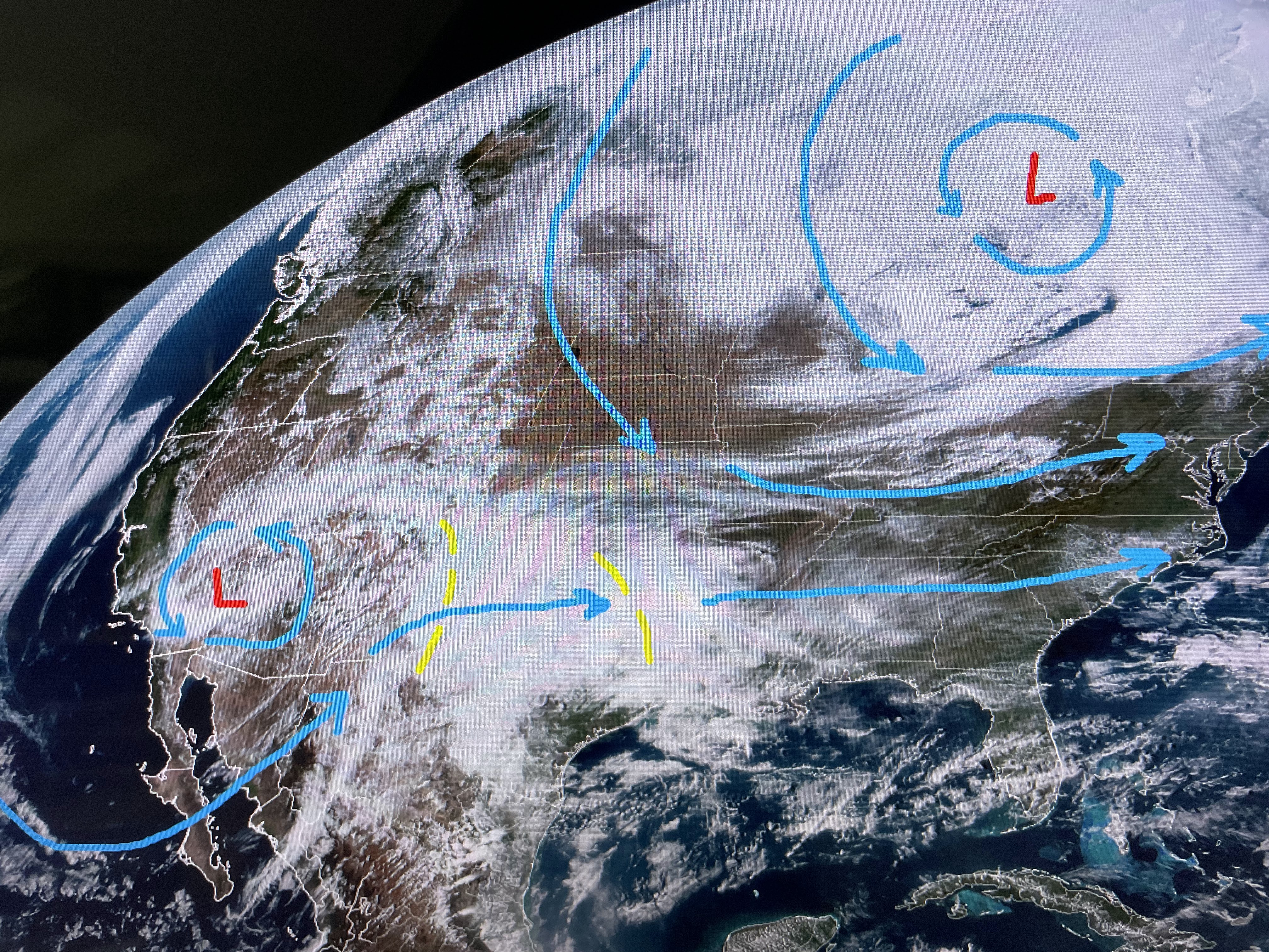


There is a stalled cut off upper low over the SW with a digging tough over the Great Lakes. That low will bring down some very chilly air out of Canada for next week. But before then, the stalled SW low will eject several disturbances for us on Sunday. It is a pay attention day. Cooler and drier air pours in for Sunday night into Tuesday.


Just looking at our current surface winds, I'm thinking the boundary will reform farther to our north on Sunday morning and sink back to the south Sunday PM.


Toda's sunshine will be replaced by a cloud cover tomorrow. Finally, we don't have to wait until April so see azaleas in bloom.


Wow, gotta love Spring! Try to stay dry tomorrow and get those sweaters and jackets ready for next week. Stay tuned!

No comments:
Post a Comment