
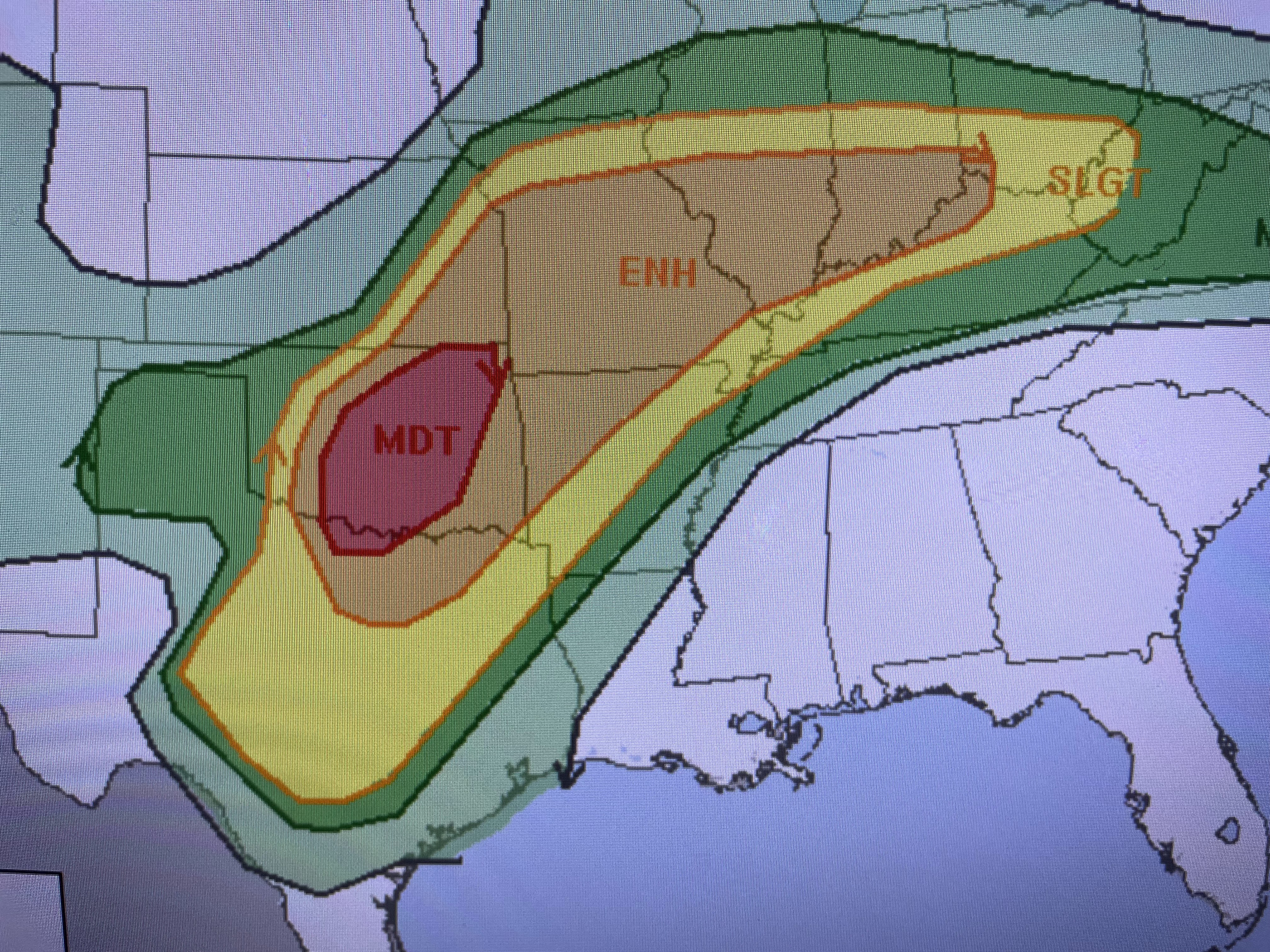


Tornado Watches (red boxes) & Severe T-Storm Watches (Blue boxes) indicates where the severe threat is now. The green circle shows where the jet streams are splitting enhancing low level lift. I've drawn the upper flow on top of the satellite view.


Look at how the computer takes the Rockies upper low and sinks it over the Ohio Valley by Thursday. This will allow some very chilly Canadian air to invade the northern states.


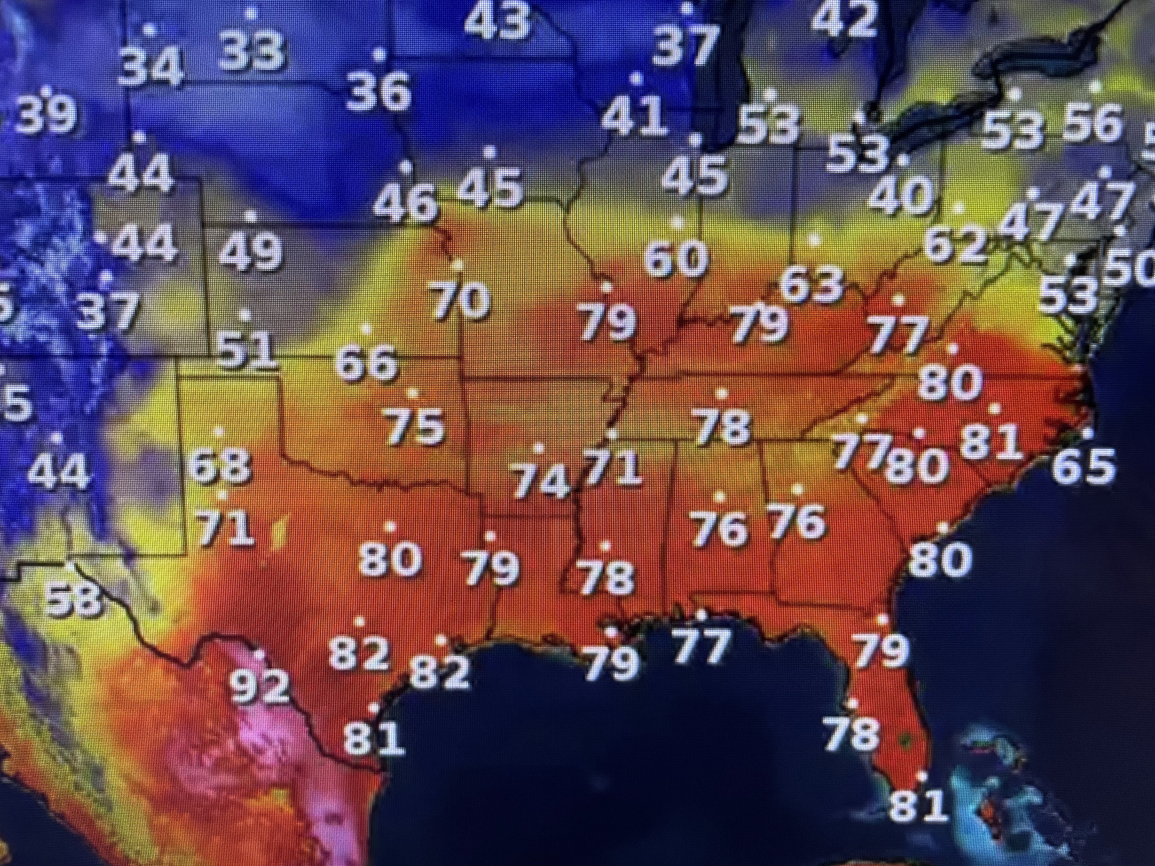

There is a large swatch of high(65-70+) dew points surging out of the Gulf. Nicondra show us the time line for the front arriving late tomorrow.


The heavier storms remain north of the Lake with rain amounts South Shore barely enough to wet the ground. Note the cool down behind the front.


Night time lows will dip into the 40s north with mainly 50s south. The lower humidity will make it feel really good. Looking deeper into April, I see more cold fronts coming so summer is not here yet. Stay tuned!

No comments:
Post a Comment