I've found 4 distinct upper swirls rotating around the upper trough that has lifted from the desert SW to over Canada and the central Rockies. Radar shows those swirls with a squall line approaching Des Moines.
The Weather Channel had the first video showing a badly damaged house, but more damage is expected as the tornado passed right over Greenfield, Iowa. All the ingredients are there for a major outbreak during the next few hours.
Des Moines' dew point is 71 indicating plenty of low level tropical moisture from the Gulf. Chicago &
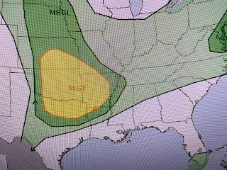
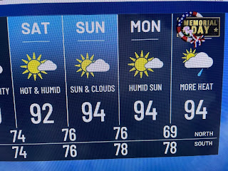
St. Louis are near 90 while it's in the 50s behind the front. Alas, that upper heat dome will not allow any fronts near us until next week. SPC's outlook keeps the severe threat way north & weakens it by Wednesday. The Weather Prediction Center's 7 day rain total follows SPC's idea.So I promised I wouldn't bore you focusing on the heat day after day, but let me add this Opinion. The mid 90s in late May could be tough to reach this weekend just because coastal water temps are still in the upper 70s.
Here are some more pictures just posted by TWC.
Iowa has many wind farms and the bottom pic shows one turbine knocked down. In fact, many turbines have been blown down.
Yikes! As you can see, there are many miles of farmland in Iowa. Let's pray that any tornadoes stay away from the cities. Finally, remember that little swirl east of Florida? It's still there, but there are no T-Storms around it.


No comments:
Post a Comment