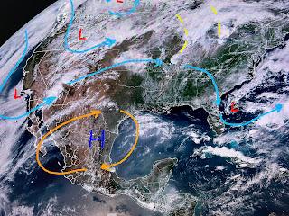
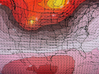
Does that dome move over us? Not according to the GFS model forecast. We begin with today with the second graphic valid on Thursday.
The third is valid for Sunday followed by Tuesday with the bottom for next Thursday. To me, the upper high doesn't keep building over us and next week the eastern trough returns forcing the upper ridge back into Mexico. That should bring down another front down to the Gulf coast keeping us less hot. But between now and Memorial Day, we'll stay hot & mostly dry.
With that upper high blocking any fronts from coming our way, the severe weather battle zone has shifted back over the northern Plains into the Great Lakes. The SPC's severe outlooks are below the satellite view.
The level 3 severe risk today over Colorado & Kansas shifts eastward tomorrow with a level 4 across Iowa into Illinois. That decreases some for Wednesday, but there should be a significant tornado outbreak Tomorrow. The bottom graphic is the 7 day rain totals with 4-7" possible, but nothing over us.
Notice more cities are reaching 90+. Finally...


No comments:
Post a Comment