
Received an e-mail from Joey G. asking me to explained why our current weather pattern is a bad one IF it lingers into the heart (Aug-Sept) of hurricane season. To begin with, our current pattern will NOT last even through this weekend. Let's set it up with some upper air graphics beginning with today where the upper heat dome remains over the west with a broad eastern trough.


The middle graphic is valid for next Monday and already we have the hunts of an upper high building over the Southeast. The bottom view is valid 2 weeks from today with a full fledge Heat Dome centered over the central plains with the upper trough along the East Coast. What that would mean is this...IF a storm/hurricane came into the Gulf, it would turn to our east as it couldn't go into the Heat Dome.

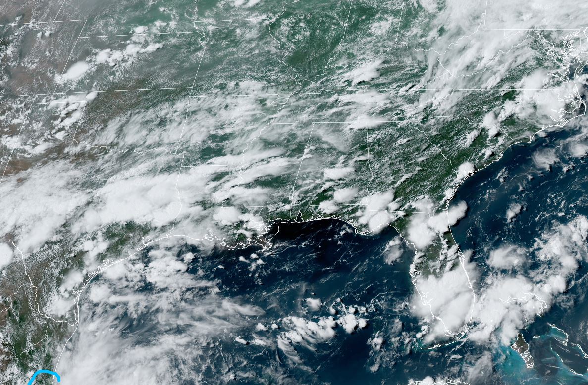
Fortunately we have no storms currently as the nose of the Atlantic Ridge/Bermuda High extends only into the eastern Gulf allowing moisture to stream over the western Gulf including us. But all models continue to show the Tropics staying dead into August. Here's how the Tropics look from space.


The dust is still coming off of Africa along with tropical waves. Dr. Knabb on TWC stated today "once we get to August, the switch flips", meaning we'll go from quiet to active. At least that's what history tells us. I have found a mid level swirl that is creating clusters of storms over the western Gulf.

That should keep moving into Mexico tomorrow. Otherwise, in the short term the pattern remains stalled with a ridge over the Rockies and a trough over the east resulting is storms from Texas across the Southeast.


The good feel air (dew points in 50s) has retreated and it's soupy over all of the Southeast into the Ohio River Valley.


The airport (MSY) finally got dumped on with greater coverage on the North Shore and fewer showers south & east. In fact, the bottom satellite view shows the drier air slowly working westward towards us.

FOX 8 is way higher on rain chances than I feel. IF the upper high begins to build over us, I see coverage dramatically lower by Thursday into the weekend with temperatures rebounding back into the mid to upper 90s. Drier air for the weekend is exactly what we need on Grand isle.


Go to www.tarponrodeo.org to register for an opportunity to win the Grand Prize. Rodeo begins at dawn on Thursday. Stay tuned!
No comments:
Post a Comment